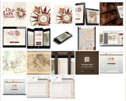
On Tuesday, July 21, a new version of OldMapsOnline.org has been launched with its bright new mobile application that, thanks to the device’s geolocation, can display the position of users on maps that might be hundreds of years old.
OldMapsOnline is a search engine for maps that allows visitors to explore and discover the beauty of historical maps depicting a past geographical place of their interest. It is a well-known project in the cultural heritage sector. From its first launch in 2012, the website has had over 1,500,000 visitors and it already indexes over 400,000 scanned maps from collections of The British Library, National Library of Scotland, David Rumsey, Harvard Library, Dutch National Archives, Charles University in Prague, New York Public Library and other institutions worldwide.
OldMapsOnline provides a single entry point for searching maps of the same geographical location without the need to know which library holds the actual map. This is a real benefit for researchers and students because it saves their time, effort and costs. The idea for the OldMapsOnline search engine was formed years back while its creator, Petr Pridal from Klokan Technologies GmbH, worked in a public library as a student intern. “As like many other people, I have been fascinated by the beauty of the historical maps — and especially excited in using the power of modern computer technology to breathe new life into these archived documents and help them reach a new audience,” said Pridal about his passion.
Thanks to funding from JISC, Pridal created OldMapsOnline in collaboration with The Great Britain Historical GIS Project based at The University of Portsmouth. He received a special award from the Royal Scottish Geographical Society, and experts from UK libraries included OldMapsOnline on a list of 100 websites important enough to preserve for future generations.
OldMapsOnline uses the MapRank® search system to retrieve maps from a large database of online maps housed in institutions all over the world.
The new application provides an easy-to-use, touch-optimized interface that allows users to discover and explore historical maps directly on mobile phones and tablets, while using the device geolocation.
“OldMapsOnline is a fantastic website. The whole interface, the look and feel is really new, really modern and it provides a really interesting and engaging way for our collections to be exposed to a wider audience,“ said Chris Fleet from the National Library of Scotland.
“There was no real online mapping search mechanism before,“ said Kimberly Kowal from the British Library at the conference in Edinburgh, one year after the launch of the OldMapsOnline website. “It is the best single place to go to find historical maps online.”
With the development of the mobile app it is now even easier to access the historical maps and to undertake a virtual journey back in time anywhere.
For more information visit www.oldmapsonline.org.
Contact information: OldMapsOnline Team, [email protected]