Gecatalogiseerde kaart
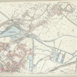
Warwickshire VIII.14 (includes: Birmingham) - 25 Inch Map

Instelling:National Library of Scotland
Volledige titel:Warwickshire VIII.14 (includes: Birmingham) - 25 Inch Map
Jaar illustratie:1886
Pubdatum:1890
Uitgever:Ordnance Survey
Schaal kaart:1:2 500