Project
Gemeenschap
Nieuws
Mijn app
Mijn kaarten
Cataloged map
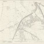
Derbyshire XXVI.16 (includes: Scarcliffe; Shirebrook; Warsop) - 25 Inch Map
Bekijk op externe website
Bekijk gedigitaliseerd
Full title:
Derbyshire XXVI.16 (includes: Scarcliffe; Shirebrook; Warsop) - 25 Inch Map
Depicted:
1938
Pubdate:
1941
Publisher:
Ordnance Survey
Map scale:
1:2 500
Catalogus
maps.nls.uk
Geschiedenis