ArcGIS, QGIS or web apps can simply use this map with web map services. WMTS, TileJSON or XYZ tiles are provided for quick access to processed maps.
Sign in to get links.
Sign in to download GeoTIFF.
Overlay & compare
iiif viewer, iiif info json
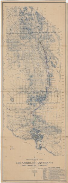
Topographic map of the Los Angeles Aqueduct and adjacent territory
21198_zz002c12qx
California
Relief shown by contours and hachures. Blue line print. Includes "Key to index system." Map Library copy annotated in colored pen.
1929
[California? : s.n.]
185 × 66 cm
1 : 1316800