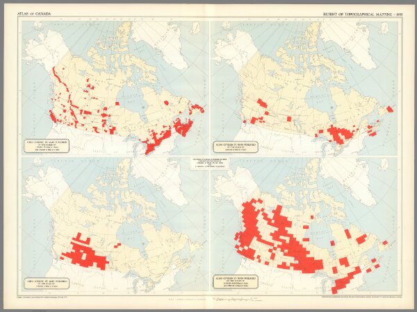
(5) Extent of topographical mapping, 1955 : Areas covered by maps published on the scales of 1:50,000 (.79 Miles to 1 Inch) and 1:63,360 (1 Mile to 1 Inch) -- Areas covered by maps published on the scale of 1:126,720 (2 Miles to 1 Inch) -- Areas covered by maps published on the scales of 1:190,080 (3 Miles to 1 Inch) -- Areas covered by maps published on the scales of 1:250:000 (3.946 Miles to 1 Inch) and 1:253,440 (4 Miles to 1 Inch). Compiled from information supplied by the Surveys and Mapping Branch (Canada) Department of Mines and Technical Surveys.
Depicted date
1955
Publication date
1958
Creator
Comtois, Paul
Publisher
Department of Mines and Technical Surveys, Geographical Branch