ArcGIS, QGIS or web apps can simply use this map with web map services. WMTS, TileJSON or XYZ tiles are provided for quick access to processed maps.
Sign in to get links.
Sign in to download GeoTIFF.
Overlay & compare
iiif viewer, iiif info json
Website
Original viewer
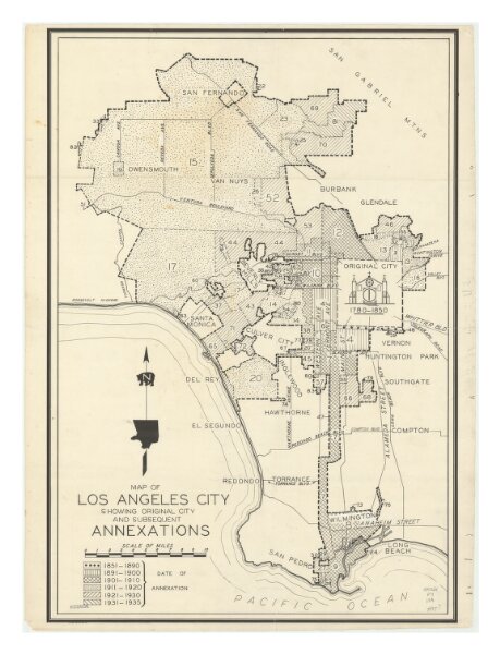
Map of Los Angeles City Showing Original City and Subsequent Annexations
21198_zz002c22gr
California
Shows areas annexed by Los Angeles from 1851-1935 by decade and in chronological order (no specific dates given).
1935
46 × 68 cm
1 : 120000