ArcGIS, QGIS or web apps can simply use this map with web map services. WMTS, TileJSON or XYZ tiles are provided for quick access to processed maps.
Sign in to get links.
Sign in to download GeoTIFF.
Overlay & compare
iiif viewer, iiif info json
Website
Original viewer
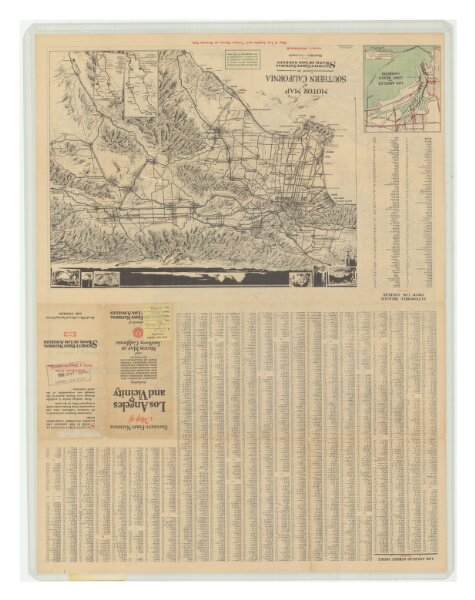
Map of Los Angeles and Vicinity
21198_zz002c23zgv_2
California
Relief shown by spot heights. Includes index. Printed in red, black, and green. On verso: 2 ancillary maps: Motor map of southern California -- Los Angeles and Long Beach harbors.
1929
Security-First National Bank of Los Angeles.
54 × 72 cm
1 : 56000