ArcGIS, QGIS or web apps can simply use this map with web map services. WMTS, TileJSON or XYZ tiles are provided for quick access to processed maps.
Sign in to get links.
Sign in to download GeoTIFF.
Overlay & compare
iiif viewer, iiif info json
Website
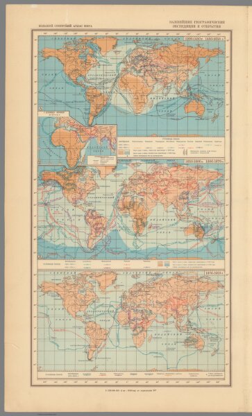
Karty vazhneyshkh geograficheskikh ekspeditsiy i otkrytii
11008.017
pilot5
Karty vazhneyshkh geograficheskikh ekspeditsiy i otkrytii. (to accompany) Bolshoi Sovietskii Atlas Mira. Moskva 1937.
1937
1939
Motylev, V.E.
Nauchno-izdatelskim Institutm Bolshogo
26 × 47 cm
1 : 150000000