Maps of Switzerland

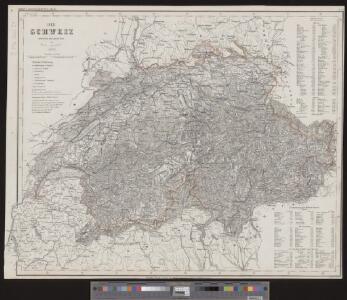
<<Die>> Schweiz
1 : 870000 1 Karte entworfen und gezeichnet vom Major C. Radefeld ; gest.: [Th.] Macht u. [W.] Feuerstein Bibliographisches Institut, Hildburghausen
Exactissima Helvetiae, Valesiae caeterorumq. confoederatorum ut et finitimorum populorum regionum tabula
1 Karte ex conatibus Nicolai Visscher ; A. Hogeboom sculp. Visscher, [Amsterdam]
Etappenkarte der Schweiz
1 : 500000 1 Karte bearb. vom Eidg. Generalstabsbureau = Carte des étapes de Suisse / dressée par le Bureau d'Etat-major général Eidg. Topogr. Bureau, Bern
<<La>> Suisse divisée en ses treze canton, ses alliéz et ses sujets
1 : 1250000 1 Karte [Homännische Erben?], [Nürnberg?]
<<Die>> Schweiz
1 : 600000 1 Karte [Jakob Melchior Ziegler] Wurster, Winterthur
<<Die>> Schweiz
1 : 870000 1 Karte gez. v. [Carl] Radefeld ; rev. v. L. Ravenstein Bibliographisches Institut, Hildburghausen
<<Die>> eidgenössische Volksabstimmung vom 4. November 1894 über die Zoll-Initiative
1 : 1200000 1 Karte [Kartogr.:] Lith. Gebr. Kümmerly, Bern Eidg. statist. Bureau, [Bern]
Umriss von der Schweiz zu einem geographischen Kartenspiel
1 Karte [Heinrich Körner?] [Verlag nicht ermittelbar], [Erscheinungsort nicht ermittelbar]
<<Die>> Schweiz
1 : 1200000 1 Karte F.A. Brockhaus, Leipzig
Carte de la Suisse à l'usage des écoles Suisses
1 : 850000 1 Karte dessinée et publiée par H. Keller = Charte der Schweiz für Schweizer Schulen / gezeichnet und herausgegeben von H. Keller H. Keller, Zürich
Nova Helvetiae tabula
1 : 780000 1 Karte ex officina Iudoci Hondij F., Amstelodami
Helvetiae, Rhaetiae et Valesiae nova tabula geographica
1 : 900000 1 Karte dedicabat Joh. Casparus Steiner [Verlag nicht ermittelbar], [Zug? oder Zürich?]
<<Die>> Schweiz
1 : 930000 1 Karte entw. u. gez. v. A. St. 1820 ; Situation gest. v. L. Thiel ; die Schrift von I.B. [Perthes], [Gotha]
Carte générale des trèze cantons de Suisse, Vallay, ligues Grise, Maison-Dieu & Valteline
1 : 725000 1 Karte [Nicolas Tassin] [chez Melchior Tavernier], [Paris]
Helvetia cum finitimis regionibus confoederatis
1 Karte [chez Iean Boisseau, en l'Isle du Palais sur le Quay qui regarde la mégisserie à la fontaine de Jouvence royalle], [Paris]
Switzerland
1 : 600000 1 Karte by G.H. Swanston, Edinburgh A. Fullarton & Co., Edinburgh
Carte des XIII cantons Suisses leurs alliés et leurs sujets
1 : 800000 1 Karte chez Bourgoin, rue de la Harpe vis à vis le passage des Jacobins à côté du caffé de Condé, Paris
<<Die>> gantz Eydgnoschafft
1 : 850000 1 Karte [Johannes Stumpf] [Froschauer], [Zürich]
<<La>> Suisse divisée en ses treze canton, ses alliéz et ses sujets
1 : 1250000 1 Karte [Homännische Erben?], [Nürnberg?]
<<Die>> gantz Eydgnoschafft
1 : 850000 1 Karte [Johannes Stumpf] [Froschauer], [Zürich]
Switzerland
1 : 700000 1 Karte by Sidney Hall Longman, London
<<Die>> Schweiz
1 : 815000 1 Karte in 2 Teilen auf 1 Bl. neue Bearbeitung von F. v. Stülpnagel 1844 ; gest. v. C. Metzeroth ; Schrift von Baumgarten [Perthes], [Gotha]
Switzerland
1 : 575000 1 Karte by J. Bartholomew George Philip & Son, London
Nova Helvetiae tabula geographica, illustrissimis et potentissimis tredecin cantonibus confoederatis et subjectis provinciis consistentis
1 Karte per Fr. Lotter [Lotter?], [Augsburg?]
<<Les>> cantons des Suisses et leurs alliéz et leurs sujets
1 : 1400000 1 Karte [Chamereau], [Amsterdam]
Carte physique, administrative et routière de la Suisse
1 : 450000 1 Karte dressée par Th. Duvotenay ; gravée par Ch. Dyonnet Lanée, Paris
Übersichtskarte des schweizerischen Pegel- und Witterungsstationennetzes
1 : 600000 1 Karte Wurster, Winterthur
Uebersichtskarte aller am "Arbeiter-Secretariat" interessirten Vereine
1 : 500000 1 Karte gezeichnet und zu beziehen von G.M. Bay R. Müller-Tobler, Zürich
Carte physique, administrative et routière de la Suisse
1 : 450000 1 Karte auf 32 Blättern auf 1 Leinwand aufgezogen dressée par Th. Duvotenay, Géographe au Dépot de la Guerre; gravée par Ch. Dyonnet chez Longuet Succ.eur de Simonneau Graveur Géographe-Editeur, Paris