Maps of Schwyz

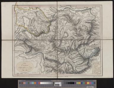
<<Die>> Cantone Schwyz und Zug
1 : 180000 1 Karte gest. von J. Scheurmann Orell, Füssli & Cp., Zürich
<<Die>> Cantone Schwyz und Zug
1 : 180000 1 Karte gest. von J. Scheurmann Orell, Füssli & Cp., Zürich
<<Die>> Cantone Schwyz und Zug
1 : 180000 1 Karte gest. von J. Scheurmann Orell Füssli & Cp., Zürich
Atlas der Schweiz
1 : 450000 1 Atlas (18 Bl.) gez. u. gest. v. J. Scheurmann Orell Fussli, Zurich
Atlas novus Reipublicae Helveticae
1 Atlas ([40] Bl., 97 S.) bey Orell, Gessner und Compagnie, Zürich
<<Die>> Cantone Schwyz und Zug
1 : 180000 1 Karte gest. von J. Scheurmann Orell, Füssli & Cp., Zürich
Atlas de la Suisse
1 : 450000 1 Atlas (19 Bl.) dessiné par MM. H. Keller, Scheurmann, Pfyffer d'Altishofen, Osterwald, etc. ; gravé par M. Scheurmann Orell Füssli & Co., Zürich
<<Die>> Cantone Schwyz und Zug
1 : 180000 1 Karte gest. von J. Scheurmann Orell Füssli & Cp., Zürich
Partie du canton de Lucerne, d'Unterwalden, d'Uri et Zurich, le canton Glarus Schweiz et Zug
1 : 122000 Curych (Švýcarsko : kanton) Weiss, J. H. Eichler, M. G.
<<Die>> Cantone Schwyz und Zug
1 : 180000 1 Karte gest. von J. Scheurman Orell Füssli & Cp., Zürich
<<Die>> Cantone Schweiz und Zug
1 : 180000 1 Karte gest. v. J. Scheurman [Orell Füssli & Comp.], [Zürich]
Karte der Kantone Schwyz und Zug
1 : 250000 1 Karte J. Wurster u. Comp., Winterthur
Atlas der alten Eidgenossenschaft in 20 Karten: Kanton Schwyz
Originaltitel: Canton Schweiz sive Pagus Helvetiae suitensis cum confinibus. Mit Erklärung der Zeichen sowie Zeichnung des Klosters Einsiedeln. Zeichnung: Walser, Gabriel (1695-1776), reformierter Pfarrer, von Teufen AR Herausgeber: Homännische Erben
Karte der centralen Schweiz
1 : 200000 Leuzinger, Rudolf ; Steiner, P. bei Heinrich Fuessli u. Comp.

Canton Zug sive pagus Helvetiae Tugiensis cum confinibus
1 : 68300 Zug (Švýcarsko : kanton) Walser, Gabriel Homann. Hered.
Canton Schweiz sive Pagus Helvetiae Suitensis cum confinibus recenter delineatus
1 : 95000 Mollova mapová sbírka Walser, Gabriel Homann, Johann Baptista - dědici
Pagus Helvetiae Suitensis
1 : 90000 Mollova mapová sbírka Seutter, Matthäus Lotter, Tobias Conrad Seutter, Matthäus
Taschen-Atlas der Schweiz
1 Atlas (25 S., 20 Taf.) gezeichnet und gestochen von Emil Wagner = Atlas de poche de la Suisse : 26 cartes en couleurs / dessinées et gravées par Émile Wagner Eggimann, Genf
Canton Schweiz sive pagus Helvetiæ Suitensis cum confinibus
1 Karte : Kupferdruck ; 22 x 26 cm Walser Homännische Erben
Die Cantone Schweiz und Zug
1 : 161000 Schwyz (Švýcarsko : kanton) Scheurmann, J.
Plan des Waldstädter Kriegs im Jahr 1798
1 : 120000 1 Karte gezeichnet und graviert von J. Sam. Weibel 1801 [H. Gessnersche Buchhandlung], [Zürich]
Übersichtskarte der Zürichsee-Gotthardbahn
1 : 100000 1 Karte [Verlag nicht ermittelbar], [Erscheinungsort nicht ermittelbar]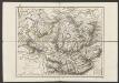
Cantone Schwyz und Zug
1 : 180000 Scheuermann, Johann Jakob Orell, Füssli & Cp.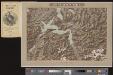
Vierwaldstättersee
1 Vogelschaukarte Orell Füssli, Zürich
Generalkarte der Gotthardbahn
1 : 100000 Nordblatt im Verlag von Orell Füssli & Co.
Geographische oder grund-richtige Verzeichnus der schönen Situation der Statt Zürich, ihres Sees und derselbigen Landschafft so um und an dem See gelägen
1 : 150000 1 Karte ex. Joh. Conr. Gygeri pm. tabula ; delineavit Joh. Jac. Gÿgerus nepos ; Johannes Meierus sculpsit
Uebersichtskarte vom Vierwaldstättersee & Umgebung / E. Wagner Kartogr.
1 : 187500 Wagner, E. [Luzern : Dampfschiffgesellschaft des Vierwaldstättersees]
Relief pittoresque du sol classique de la Suisse
9 Karten dessiné d'après nature et gravé à l'eau forte par Frédéric Guillaume Delkeskamp ; terminé à l'aqua tinta par François Hegi et J.J. Sperli à Zuric = Malerisches Relief des klassischen Bodens der Schweiz / Nach der Natur gezeichnet und radirt von Friedrich Wilhelm Delkeskamp ; in Aqua tinta vollendet von Franz Hegi und J.J. Sperli in Zürich Friedrich Wilhelm Delkeskamp, Frankfurt a/M.