Maps of Trento

Trient
1 : 200000 1 Karte entworfen und bearbeitet von Woerl ; in Stein gestochen unter seiner Leitung ; Lithographie von B. Herder Herder, Freiburg im Breisgau
Tyrolis pars meridionalis
1 : 218000 Trident (Itálie : provincie) Spergs, Ioseph de Homannianis Hered.
Carte de la Suisse avec les plans des cheflieux des 22 cantons
1 : 200000 1 Karte auf 8 Bl. dessinée et publié par Henri Keller ; Lithogr. von J. Schweizer = Charte der Schweiz mit den Grundrissen der Hauptorte der 22 Cantone Keller, Zürich
Distanzenkarte von der Schweiz
1 : 200000 1 Karte in 8 Teilen nach den besten Hülfsquellen bearb. von R. Huber Wagner, Bern
Wandkarte der Schweiz
1 : 200000 1 Karte auf 8 Blättern J.M. Ziegler Wurster, Winterthur
Touristen-Karte der ostrhätischen Kurorte
1 : 200000 1 Karte Topogr. Anstalt v. Wurster, Randegger & Co. In Commission bei Wurster, Randegger & Co., Winterthur
Carte du Tyrol
1 : 150000 Südwest-Blatt Anich, Peter par le Dépôt Général de la Guerre
Carta geologica delle provinicie Lombarde
1 : 172800 Ostblatt Curioni, G. Hoepli

Süd. Oetzthaler- und Ortler Alpen, Presanella Gruppe
1 : 130000 Ortles (Itálie : pohoří) Maschek, Rudolf Meurer, Julius Artaria
Schulwandkarte zur Geschichte der Schweiz
1 : 180000 Südost-Blatt Oechsli, Wilhelm ; Baldamus, Alfred Kartograph. Verlagsanstalt von Georg Lang
Carte du Tyrol
1 : 150000 West-Blatt Anich, Peter par le Dépôt Général de la Guerre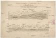
Heerstrasse über das Stilfser Joch oder die Wormses Strasse
Inst. Bibl.

Schulwandkarte zur Geschichte der Schweiz
1 : 180000 1 Karte auf 6 Bl. bearbeitet v. W. Oechsli u. A. Baldamus ; gezeichnet von Ed. Gaebler Kartograph. Verlagsanstalt von Georg Lang, Leipzig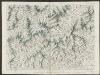
Partie des Grisons et de la Valteline
1 : 108000 Weiss, Johann Heinrich ; Meyer, Johann Rudolf J. R. Meyer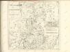
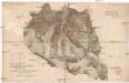
Originalkarte der westlichen Ortleralpen
1 : 36000 Alpy Payer, Julius Justus Perthes
Ober Engadin
1 Vogelschaukarte Orell Füssli, Zürich
Karte der Adamello- und Presanella-Gruppe
1 : 50000 Alpy italské (pohoří) Deutscher u. Oesterreichischer Alpen Verein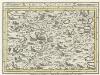
Trient mit der Gegend auf 2 Stund
Mollova mapová sbírka Bodenehr, Gabriel Bodenehr, Gabriel
Territoriumi Tridentinum
1 : 366000 Mollova mapová sbírka Schenk, Pieter Schenk, Peter
Territorio di Trento
1 : 390000 Mollova mapová sbírka Blaeu, Willem Janszoon Bleau, Willem Janszon
Territtorium Tridentinum
1 : 366000 Mollova mapová sbírka Janssonius, Johannes Janssonius, Jodocus
Territorio di Trento
1 : 400000 Mollova mapová sbírka Magini, Giovanni Antonio Bleau, Willem Janszon
Tione und M.Adamello.
from Spezialkarte der osterreichisch-ungarischen Monarchie.
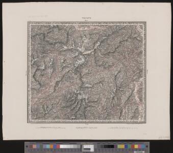
Trient.
from Spezialkarte der osterreichisch-ungarischen Monarchie.
Meran.
from Spezialkarte der osterreichisch-ungarischen Monarchie.
Glurns und Ortler.
from Spezialkarte der osterreichisch-ungarischen Monarchie.