Maps of Savoy

Nova Rhaetiae atque totius Helvetiae descriptio
1 : 350000 1 Karte auf 10 Bl. per Aegidium Tschudum Glaronensem Hofer & Burger, Zürich

Nouvelle carte géographique de la Suisse
1 : 600000 1 Karte auf 4 Bl. dressé par Jacq. Scheuchzer chez R. & J. Wetstein et Guil. Smith, Amsterdam
Karte von dem Herzogthume Savoyen und den Grafschaften Nizza, Tenda und Borgio, oder den Ländern welche der König von Sardinien in dem Frieden zu Paris den 15. May 1796 der französischen Republik abtrat
1 : 570000 Nice (Francie)
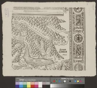
Sabaudia Ducatus. Savoye [Karte], in: Novus atlas absolutissimus, Bd. 4, S. 233.
1 Karte aus Atlas Janssonius Offizin
Sabaudia Ducatus. Savoye [Karte], in: Novus Atlas, das ist, Weltbeschreibung, Bd. 2, S. 162.
1 Karte aus Atlas Blaeu, Joan Blaeu, Willem Janszoon
Sabaudia Ducatus. Savoye [Karte], in: Theatrum orbis terrarum, sive, Atlas novus, Bd. 2, S. 163.
1 Karte aus Atlas Blaeu, Joan Blaeu, Willem Janszoon
Sabaudia Ducatus La Savoié [Karte], in: Gerardi Mercatoris et I. Hondii Newer Atlas, oder, Grosses Weltbuch, Bd. 2, S. 146.
1 Karte aus Atlas Mercator, Gerhard und Hondius, Jodocus Jansson, Jan
Sabaudia Ducatus. Savoye [Karte], in: Le théâtre du monde, ou, Nouvel atlas contenant les chartes et descriptions de tous les païs de la terre, Bd. 2, S. 161.
1 Karte aus Atlas Blaeu, Willem Janszoon und Blaeu, Joan Blaeu, Willem Janszoon
SABAVDIA | DVCATVS. | SAVOYE
Amsterdami | Apud Guiljelmum Blaeuw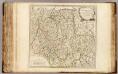
Duche de Savoye.
1 : 325000 Robert de Vaugondy, Gilles, 1688-1766
Géographie. croquis n26, Suisse et Jura français
1 : 400000 Messain, Capitaine 18..-.... [Paris] : Service Géographique de l'Armée
Nova Helvetiae tabula geographica
1 : 1000000 Südwest-Blatt Scheuchzer, Johann Jakob ; Schenck, Peter ex officina Petri Schenckii
Sabaudia ducatus
1 : 440000 Savojsko Hondius, Jodocus Judocus Hondius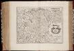
Sabavdia dvcatvs = Savoye
1 : 520000 titelvariant: Savoye; Annotatie: Origineel is Blad 153 in atlas factice; Annotatie geografische gegevens: Schaalstokken op kaart: 6 Milliaria Gallica (= 6,3 cm), en: 20 Milliaria Italica (= 7 cm) Amsterdami : apud Joan: Janssonium
Tabvla generalis Sabavdiæ
1 Karte : Kupferdruck ; 49 x 58 cm Blaeu; Borgonio; Broen Ottens ...hos
Tabvla generalis Sabavdiæ
1 Karte : Kupferdruck ; 49 x 58 cm Blaeu; Borgonio; Broen Joannes Blaeu excudit

Nova Helvetiae tabula geographica illustrissimis et potentissimis cantonibus et rebuspublicis reformatae religionis Tigurinae, Bernensi, Glaronensi, Basiliensi, Scaphusianae, Abbatis Cellanae
1 : 230000 1 Karte auf 4 Bl. dominis suis clementissimis humillime dicata a Ioh. Iacobo Scheuchzero Tigurino ; Ioh. Melch. Füsslin ornamenta pinx. ; Ioh. Henr. Huber et Eman. Schalch sculps. [Hofmeister], [Zürich]
[Keller's Reisekarte der Schweiz]
1 : 500000 1 Karte auf 6 Bl. gezeichnet v. H. Keller ; gest. v. J.J. Scheurmann [Keller], Zürich
Carte géologique de la Suisse
1 : 380000 1 Karte auf 4 Bl. par B. Studer et A. Escher de la Linth d'après leurs propres observations et les communications de leurs amis propriété de l'Etablissement topographique de J. Wurster & Comp., Winterthur
Hypsometrische Karte der Schweiz
1 : 380000 1 Karte auf 4 Blättern von J.M. Ziegler = Carte hypsométrique de la Suisse / par J.M. Ziegler Verlag von Joh. Wurster u. Comp., Winterthur
Postkarte der schweizerischen Eidgenossenschaft
1 : 300000 1 Karte in 4 Teilen unter Aufsicht des General Dufour nach den gegenwürtig vorhandenen Materialien des eidgenössischen Atlasses und den besten Karten gezeichnet von J.R. Stengel u. E. Mohr Wurster, Winterthur
STATVVM ITALIAE SVPERIORIS vulgo olim LOMBARDIA dictorum geographica Delineatio
Lombardie (Itálie) Mayer, Tobias edentibus Homannianis Heredibus
[Reisekarte der Schweiz]
1 : 500000 1 Karte auf 6 Bl. gezeichnet v. H. Keller ; gest. v. J.J. Scheurmann [Füssli & Comp.], [Zürich]
Neue Schweizerkarte von 1847
1 : 300000 1 Karte auf 4 Bl. als Wand- und Reliefkarte topisch und politisch dargestellt von Eduard Winckelmann Tobias Dannheimer, Kempten
<<Les>> Suisses, leurs alliés et leurs sujets
1 : 230000 1 Karte auf 4 Bl. par Iaillot chez l'auteur joignant les Grands Augustins aux deux Globes, Paris
Carte du phénomène erratique et des anciens glaciers du versant nord des Alpes suisses et de la chaîns du Mont-Blanc
1 : 250000 1 Karte auf 4 Blättern par Alphonse Favre ; publ. par la Commission géologique de la Société Helvétique des Sciences Naturelles [Verlag nicht ermittelbar], [Erscheinungsort nicht ermittelbar]
Karte der Schweiz in IV Blättern
1 : 250000 4 Karten nach dem topographischen Atlasse des eidgenössischen Generalstabes reduziert unter der Direction des Herrn Generals G.H. Dufour ; gest. von H. Müllhaupt Eidg. Stabsbureau, [Bern]