Maps of Switzerland

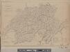
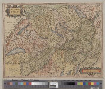
Helvetia cum finitimis regionibus confoederatis
1 : 800000 1 Karte per Gerardum Mercatorem [Mercator], [Duisburg]
Original von Keller's erster Reisekarte der Schweiz
1 : 500000 1 Karte Heinrich Keller, Zürich
Helvetiae conterminarumque terrarum antiqua descriptio
1 : 1200000 1 Karte auctore Phil. Clüverio [Verlag nicht ermittelbar], [Wolfenbüttel]
Karte der Schweiz
1 : 525208 1 Karte [Karl Joseph Kipferling?] ; Lith. und zu haben bey Joseph Franz Kaiser bey Franz Joseph Kaiser, in Gratz
Nouvelle carte physique & routière de la Suisse
1 : 800000 1 Karte par Keller H. Langlois Fils, Paris
Carte des chemins de fer de la Suisse
1 : 300000 1 Karte par F. Müllhaupt ; avec la collab. de J. Ammann = Eisenbahn-Karte der Schweiz = Railway map of Switzerland = Carta delle strade-ferrate della Svizzera Müllhaupt, Bern
Original von Keller's erster Reisekarte der Schweiz
1 : 500000 1 Karte Heinrich Keller, Zürich
Karte der Schweiz
1 : 450000 1 Karte von Rudolf Gross ; gravirt: Terrain v. [Josef] Graf, Schrift v. C. Spengler Ch. Beyel, Zürich
Carte industrielle de la Suisse pour l'année 1882
1 : 500000 1 Karte élaborée sur la demande du Comité Central de l'Exposition Nationale à Zurich par Hermann Schlatter = Industrie-Karte der Schweiz für das Jahr 1882 / im Auftrage des Central-Comite der schweiz. Landesausstellung in Zürich bearb. von Hermann Schlatter Wurster, Randegger & Co., Winterthur
Roadmap of Switzerland
1 : 400000 1 Karte dressée et gravée par Mullhaupt ; écrit par Bressanini ; publiée par H.F. Leuthold H.F. Leuthold, Zürich
Carte industrielle de la Suisse pour l'année 1882
1 : 500000 1 Karte élaborée sur la demande du Comité Central de l'Exposition Nationale à Zurich par Hermann Schlatter = Industrie-Karte der Schweiz für das Jahr 1882 / im Auftrage des Central-Comite der schweiz. Landesausstellung in Zürich bearb. von Hermann Schlatter Wurster, Randegger & Co., Winterthur
<<Die>> Schweiz
1 : 600000 1 Karte [Jakob Melchior Ziegler] Wurster, Winterthur
Eisenbahnkarte der Schweiz
1 : 500000 1 Karte gezeichnet von Rudolf Gross Verlag von Caesar Schmidt, Zürich
Roadmap of Switzerland
1 : 400000 1 Karte dressée et gravée par Mullhaupt ; écrit par Bressanini ; publiée par H.F. Leuthold H.F. Leuthold, Zürich
Karte der Schweiz
1 : 450000 1 Karte nach den neuesten Materialien entworfen und gezeichnet von Rudolf Gross ; gravirt: Terrain v. J. Graf, Schrift v. C. Spengler u. Rixinger Ch. Beyel, Frauenfeld
[Keller's Reisekarte der Schweiz]
1 : 500000 1 Karte [Heinrich Keller] [Keller?], [Zürich]
Physikalische Karte der Schweiz
1 : 800000 1 Karte R. Leuzinger J. Dalp (C. Schmid), Bern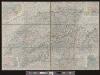
Roadmap of Switzerland
1 : 400000 1 Karte dressée et gravée par Mullhaupt ; écrit par Bressanini ; publiée par H.F. Leuthold H.F. Leuthold, Zürich
Relief-Karte der Schweiz
1 : 530000 1 Karte von R. Leuzinger ; [Kartogr.:] Topogr. Anstalt v. Wurster, Randegger & Co. in Winterthur J. Wurster & Co., Zürich
Carte de la république des Suisses, leurs sujets et alliées
1 Karte par J.E. Hauman chez Mondhare, Rue S.Jacques, Paris
Roadmap of Switzerland
1 : 400000 1 Karte dressée et gravée par Mullhaupt ; écrit par Bressanini ; publiée par H.F. Leuthold H.F. Leuthold, Zürich
Reisekarte der Schweiz
1 : 355000 1 Karte dressée et gravée par Mullhaupt ; écrit par Bressanini Leuthold, Zürich
Roadmap of Switzerland
1 : 400000 1 Karte dressée et gravée par Mullhaupt ; écrit par Bressanini ; publiée par H.F. Leuthold H.F. Leuthold, Zürich
Carte industrielle de la Suisse pour l'année 1882
1 : 500000 1 Karte élaborée sur la demande du Comité Central de l'Exposition Nationale à Zurich par Hermann Schlatter = Industrie-Karte der Schweiz für das Jahr 1882 / im Auftrage des Central-Comite der schweiz. Landesausstellung in Zürich bearb. von Hermann Schlatter Wurster, Randegger & Co., Winterthur
Helvetia cum finitimis regionibus confoederatis
1 : 800000 1 Karte per Gerardum Mercatorem [Mercator], [Duisburg]
<<Les>> Suisses, leurs sujets et leurs alliéz
1 Karte corrigée et augmentée d'après les nouvelles observations de Ms. de l'Académie Royale des Sciences ; P. Starckman sculpsit chez Desnos, Rue St. Jacques au Globe, Paris
Original von Keller's erster Reisekarte der Schweiz
1 : 500000 1 Karte Heinrich Keller, Zürich
Schweiz
1 : 600000 1 Karte Wurster, Winterthur
Roadmap of Switzerland
1 : 400000 1 Karte dressée et gravée par Mullhaupt ; écrit par Bressanini ; publiée par H.F. Leuthold H.F. Leuthold, Zürich