Maps of Rendsburg-Eckernförde

Maps of Rendsburg-Eckernförde

$title$

Dithmarsia, Rendesburgum, Kiel et Bordesholm, in Occidentali parte Holsatiae. [Karte], in: Novus atlas absolutissimus, Bd. 1, S. 146.
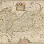
1 Karte aus Atlas Janssonius Offizin
$title$

$title$

Dithmarsia Rendesburgum Kiel et Bordesholm in Occidentali parte Holsatiae

1 : 210000 Mollova mapová sbírka Schenk, Pieter Schenk, Peter I
$title$

Tabvla Generalis Holsatiae complectens Holsatiae Dithmarsiae Stormariae et Vagriae Dvcatvs

1 : 310000 Mollova mapová sbírka Homann, Johann Baptist Homann, Johann Baptista
$title$

Tabvla Generalis Holsatiae complectens Holsatiae Dithmarsiae Stormariae et Vagriae Dvcatvs

1 : 310000 Mollova mapová sbírka Homann, Johann Baptist Homann, Johann Baptista
$title$

$title$

$title$

$title$

Schleswig-Holstein

1 : 50000 Šlesvicko-Holštýnsko (Německo) Reichs-Marine-Amt
$title$

RENDSBVRGVM, | CHILONVM et BORDESHOLMA, | sive | HOLSATIA PROPRIA.

Christian Lorensen | Rodtgiesser Husum | sculpsit [Amsterdam : Joan Blaeu]
$title$

23. Kiel, uit: Topographische Uebersichtskarte des Deutschen Reiches / herausgegeben v. d. Kartogr. Abt. d. Königl. Preuß. Landesaufnahme

1 : 200000 titelvariant: Topogr. Übersichtskarte des Deutschen Reiches; Annotatie: Titel boven bladen ook: Topogr. Übersichtskarte des Deutschen Reiches; Annotatie geografische gegevens: Op elk blad twee maatstokken: 10 Kilometer = 5,5 cm; 1 geogr. Meile = 3,6 cm; Legenda onder op elk blad Königlich Preußische Landesaufnahme. Kartographische Abtheilung [S.l : Königlich Preußische Landesaufnahme, Kartographische Abtheilung]
$title$

Das oestliche Holstein

$title$

[left] DITHMARSIÆ | TABVLA; [right] DITHMARSIÆ | TABVLA

Auctore Joh: Meyer Husumensi | Anno 1559 Matthias & Nicolaus Peters | Goldtschmide gebr. Hus. sculps. [Amsterdam : Joan Blaeu]
$title$

Kiel 21, uit: Special-Karte von Mittel-Europa / nach amtlichen Quellen bearbeitet von W. Liebenow

1 : 300000 titelvariant: W. Liebenow's Mittel-Europa; Annotatie: Titel boven de bladen: W. Liebenow's Mittel-Europa Johannes Wilhelm Liebenow 1822-1897 Frankfurt a. M. : Ludwig Ravenstein
$title$

Kiel 21, uit: [W. Liebenow's Special-Karte von Mittel-Europa]

1 : 300000 titelvariant: W. Liebenow's Mittel-Europa; Annotatie: Titel boven de bladen: W. Liebenow's Mittel-Europa Johannes Wilhelm Liebenow 1822-1897 Hannover : Hermann Oppermann
$title$

Special-Karte von Süd-Schleswig

1 : 150000 Šlesvicko Petermann, August Justus Perthes
$title$

Special-Karte von Süd-Schleswig

1 : 150000 Šlesvicko Petermann, August Friedrich Ehrlich
$title$

Special-Karte von Süd-Schleswig

1 : 150000 Šlesvicko Petermann, August Justus Perthes
$title$

Landtcarte Uom Süderntheil des Wagerland's

1 : 130000 Mollova mapová sbírka Mejer, Johannes Rothgiesser, Andreas Lorenzen
$title$

Nobilis Fluvius Albis maximâ curâ, ex variis famosisque Autoribus collectus, et in lucem editus. [Karte, Teil 2], in: Novus atlas absolutissimus, Bd. 2, S. 33.

1 Karte aus Atlas Janssonius Offizin
$title$

Nobilis Fluvius Albis maximâ curâ, ex variis, famosisque Autoribus collectus, et in lucem editus. [Karte, Teil 2], in: Gerardi Mercatoris et I. Hondii Newer Atlas, oder, Grosses Weltbuch, Bd. 1, S. 277.

1 Karte aus Atlas Mercator, Gerhard und Hondius, Jodocus Jansson, Jan
$title$

Hamburg mit dero Gegend Westwerts, die Elbe hinunter zu fahren Bis Gluckstadt.

1 : 320000 Mollova mapová sbírka Bodenehr, Gabriel Bodenehr, Gabriel
$title$

Thietmarsiae, Holsaticae Regionis Partis Typus. [Karte], in: Theatrum orbis terrarum, S. 58.

1 Karte aus Atlas Ortelius, Abraham
$title$

Dithmarsiae Tabvla

1 : 150000 Mollova mapová sbírka Mejer, Johannes Peters, Matthias Blaeu, Joan I.
$title$

Thietmarsiae, Holsaticae Regionis Partis Typus. [Karte] , in: Theatrum orbis terrarum, S. 212.

1 Karte aus Atlas Ortelius, Abraham Vrients, Jan Baptista
$title$

PRÆFECTVRÆ | GOTTORPIENSIS | PARS AVSTRALIS.

Matthias und Clauss Peters. | Goldtschmide und gbr. sculp. Husumens. [Amsterdam : Joan Blaeu]
$title$

Composite: 111. Otterndorf. (Germany)

1 : 100000 Reichsamt fur Landesaufnahme
$title$

DITHMARSIÆ | PARS SEPTENTRIONALIS [...]

author Iohannes Mejer Husum. | Regæ. Majis. Mathematicus Matthis Pet. v Clauß Peterss Goldtschmide unt gb. Hus. Cimbr. sculp. [Amsterdam : Joan Blaeu]
$title$

Dithmarsiae Tabvla

1 : 150000 Mollova mapová sbírka Mejer, Johannes Peters, Matthias Blaeu, Joan I.
$title$

Thietmarsiae, Hosaticae Regionis Partis Typvs

1 : 200000 Mollova mapová sbírka Boekel, Peter
© MapTiler © OpenStreetMap contributors
How does it work?
These instructions will show you how to find historical maps online.
Getting started
Type the place name in the search box to find the exact location. You can further adjust the search by zooming in and out.
Zoom
Zoom in and out with the buttons or use your mouse or touchpad natively.
Exact Area tool
Click here and draw a rectangle over the map to precisely define the search area.
Set filters
Narrow your search with advanced settings, such as Years (from/to), Fulltext, Publisher, etc.
Results
See the results of your search on the right side. You can scroll down to find more maps of this location.
?

Download OldMapsOnline Mobile