Maps of Uri

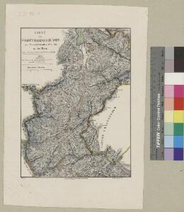
Carte der St. Gotthards-Strasse vom Vierwaldstädter See bis an den Tessin
1 : 150000 1 Karte A. Hartmann fec. ; J.J.G. [i.e. Johann Jakob Goll] del. ; Lith. Brupbacher in Wädenschweil bei Heinrich Füssli und Comp., Zürich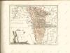

Atlas de la Suisse
1 : 450000 1 Atlas (19 Bl.) dessiné par MM. H. Keller, Scheurmann, Pfyffer d'Altishofen, Osterwald, etc. ; gravé par M. Scheurmann Orell Füssli & Co., Zürich
<<Die>> Cantone Uri und Unterwalden
1 : 260000 1 Karte gestochen von J. Scheurmann Orell, Füssli & Cp., Zürich
<<Die>> Cantone Uri und Unterwalden
1 : 260000 1 Karte gestochen von J. Scheurmann Orell Füssli & Cp., Zürich
Atlas der alten Eidgenossenschaft in 20 Karten: Kanton Uri
Originaltitel: Canton Uri sive Pagus Helvetiae Uriensis cum Subditis suis in Valle Lepontina. Mit Erklärung der Zeichen sowie Nebenkarte vom Livinental und Zeichnung des Wasserfalles im Schächental. Zeichnung: Walser, Gabriel (1695-1776), reformierter Pfarrer, von Teufen AR Herausgeber: Homännische Erben
Atlas der Schweiz
1 : 450000 1 Atlas (18 Bl.) gez. u. gest. v. J. Scheurmann Orell Fussli, Zurich
Canton Uri
1 : 100000 Müllhaupt, Hans Heinrich Eidg. Stabsbureau
Verbreitung d. Cretinismus, d. Blödsinns und d. Taubstummheit, 1841
1 : 260000 1 Karte [Orell, Füssli & Cp.], [Zürich]
<<Die>> Cantone Uri und Unterwalden
1 : 260000 1 Karte gestochen von J. Scheurmann [Orell Füssli & Comp.], [Zürich]
<<Die>> Cantone Uri und Unterwalden
1 : 260000 1 Karte gestochen von J. Scheurmann Orell Füssli & Cp., Zürich
Taschen-Atlas der Schweiz
1 Atlas (25 S., 20 Taf.) gezeichnet und gestochen von Emil Wagner = Atlas de poche de la Suisse : 26 cartes en couleurs / dessinées et gravées par Émile Wagner Eggimann, Genf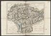
Cantone Uri und Unterwalden
1 : 260000 Scheuermann, Johann Jakob Orell, Füssli & Cp.
Canton Uri sive pagus Helvetiae Uriensis cum subditis suis in Valle Lepontina
1 Karte : Kupferdruck ; 45 x 54 cm Walser; Dorn edentibus Homannianis Heredibus
Canton Uri sive pagus Helvetiae Uriensis cum subditis suis in Valle Lepontina
1 Karte : Kupferdruck ; 45 x 54 cm Walser; Dorn edentibus Homannianis Heredibus
Die Cantone Uri und Unterwalden
1 : 22800 Scheurmann, J.
Die Canton Uri und Unterwalden
1 : 222000 Švýcarsko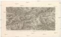
St. Gotthard Gebirge, Theil des Berner Oberlandes und das obere Rhone Thal
Rýn, řeka-tok horní Delkeskamp, F. W. Dauch, J. Ph.
St. Gotthard
1 Vogelschaukarte Art. Institut Orell Füssli, Zürich
Karte der Terrassen u. Thalstufen des Reussgebietes
1 : 100000 1 Karte von Albert Heim ; [Kartogr.:] Topogr. Anstalt v. Wurster, Randegger & Co. [Verlag der Expedition des Jahrbuches des S.A.C.], [Bern]
Pagus Helvetiae Uriensis cum subditis suis in valle Lepontina accuratissima delineatio
1 : 116800 Seutter, Matthäus Lotter, Tobias Conrad sumptibus Matthaei Seutteri
Rheni, Rhodani, Ticini, Ursae, prima stamina in sumis [i.e. summis] alpibus helveticis
1 : 115000 1 Karte delineata a Johanne Jacobo Scheuchzero M.D. excudit Petrus van der Aa, Lugd. Bat.
Gotthard Gebirge
Geologischer Atlas zur Naturgeschichte der Erde Leonhard, Carl Cäsar von E. Schweizerbart'sche Verlagsbuchhandlung
Relief pittoresque du sol classique de la Suisse
9 Karten dessiné d'après nature et gravé à l'eau forte par Frédéric Guillaume Delkeskamp ; terminé à l'aqua tinta par François Hegi et J.J. Sperli à Zuric = Malerisches Relief des klassischen Bodens der Schweiz / Nach der Natur gezeichnet und radirt von Friedrich Wilhelm Delkeskamp ; in Aqua tinta vollendet von Franz Hegi und J.J. Sperli in Zürich Friedrich Wilhelm Delkeskamp, Frankfurt a/M.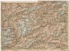
[Andermatt und Umgebung]
1 : 250000 Alpy švýcarské (pohoří) Wagner & Debes
Canton Unterwalden sive pagus Helvetiae Subsilvanus cum adjacentibus terrarum tractibus
1 Karte : Kupferdruck ; 23 x 25 cm Walser Homännische Erben
Pagus helvetiæ Uriensis cum subditis suis in Valle Lepontina accuratissima delineatio
1 Karte : Kupferdruck ; 56 x 48 cm Walser; Seutter; Lotter Matthäus Seutter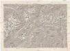
Gotthard
1 : 100000 Eidgenössische Landestopographie
Canton Uri sive Pagus Helvetiae Uriensis cum subditis suis in Valle Lepontina recenter delineatus
1 : 60000 Mollova mapová sbírka Walser, Gabriel Dorn, Sebastian Homann, Johann Baptista - dědici