Maps of Vercelli

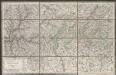
[Exactissima Helvetiae, Rhaetiae, Valesiae ... tabula]
1 : 850000 9 Karten [Kopie von Adrian Braakman] [chez Pierre Schenk et Adrian Braakman], [Amsterdam]
Viaggio della Francia in Italia
1 : 1230000 Milán (Itálie)
Descrittione di parte del Stato di Milano
Mollova mapová sbírka Cotta, Giacomo Cotta, Giacomo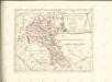

Nova Rhaetiae atque totius Helvetiae descriptio
1 : 350000 1 Karte auf 10 Bl. per Aegidium Tschudum Glaronensem Hofer & Burger, Zürich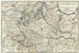
Les Estats Du Duché De Milan
1 : 840000 Mollova mapová sbírka Fer, Nicolas de Loon, Herman van Fer, Nicolas de
Biella
1 : 200000 1 Karte entworfen und bearbeitet von Woerl ; in Stein gestochen unter seiner Leitung 1835 ; Lithographie von B. Herder Herder, Freiburg im Breisgau

Piemonte Et Monferrato [Karte], in: Novus Atlas, das ist, Weltbeschreibung, Bd. 3, S. 41.
1 Karte aus Atlas Blaeu, Joan Blaeu, Willem Janszoon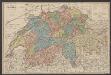
Piemonte Et Monferrato [Karte], in: Le théâtre du monde, ou, Nouvel atlas contenant les chartes et descriptions de tous les païs de la terre, Bd. 3, S. 29.
1 Karte aus Atlas Blaeu, Willem Janszoon und Blaeu, Joan Blaeu, Willem Janszoon
Piemonte Et Monferrato [Karte], in: Theatrum orbis terrarum, sive, Atlas novus, Bd. 3, S. 35.
1 Karte aus Atlas Blaeu, Joan Blaeu, Willem Janszoon
Belli Typvs in Italia
1 : 520000 Mollova mapová sbírka Homann, Johann Baptist Homann, Johann Baptista
Belli Typvs in Italia
1 : 520000 Mollova mapová sbírka Homann, Johann Baptist Homann, Johann Baptista
Ducatus Mediolanensis Placentini et Permensis nova Tabula
1 : 750000 Mollova mapová sbírka Kauffer, Michael
Piemonte Et Monferrato [Karte], in: Novus atlas absolutissimus, Bd. 5, S. 86.
1 Karte aus Atlas Janssonius Offizin
PIEMONTE | ET | MONFERRATO
[Amsterdam : Joan Blaeu]
Signoria di Vercelli [Karte], in: Le théâtre du monde, ou, Nouvel atlas contenant les chartes et descriptions de tous les païs de la terre, Bd. 3, S. 42.
1 Karte aus Atlas Blaeu, Willem Janszoon und Blaeu, Joan Blaeu, Willem Janszoon
Signoria Di Vercelli [Karte], in: Gerardi Mercatoris et I. Hondii Newer Atlas, oder, Grosses Weltbuch, Bd. 2, S. 273.
1 Karte aus Atlas Mercator, Gerhard und Hondius, Jodocus Jansson, Jan
Signoria di Vercelli [Karte], in: Theatrum orbis terrarum, sive, Atlas novus, Bd. 3, S. 43.
1 Karte aus Atlas Blaeu, Joan Blaeu, Willem Janszoon
Signoria Di Vercelli [Karte], in: Novus atlas absolutissimus, Bd. 5, S. 93.
1 Karte aus Atlas Janssonius Offizin
Signoria di Vercelli [Karte], in: Novus Atlas, das ist, Weltbeschreibung, Bd. 3, S. 51.
1 Karte aus Atlas Blaeu, Joan Blaeu, Willem Janszoon
Parte Alpestre Dello Stato Di Milano, Con il Lago Maggiore Di Lugano, É Di Como [Karte], in: Le théâtre du monde, ou, Nouvel atlas contenant les chartes et descriptions de tous les païs de la terre, Bd. 3, S. 63.
1 Karte aus Atlas Blaeu, Willem Janszoon und Blaeu, Joan Blaeu, Willem Janszoon
Sardinië
1 : 450000 lith. v. M. Miechielsen, Rott.m. Rotterdam : O. Petri
Parte Alpestre Dello Stato Di Milano, Con il Lago Maggiore Di Lugano, È Di Como [Karte], in: Novus Atlas, das ist, Weltbeschreibung, Bd. 3, S. 73.
1 Karte aus Atlas Blaeu, Joan Blaeu, Willem Janszoon
Parte Alpestre Dello Stato Di Milano Con il Lago Maggiore Di Lugano, È Di Como [Karte], in: Novus atlas absolutissimus, Bd. 5, S. 71.
1 Karte aus Atlas Janssonius Offizin
PARTE ALPESTRE | DELLO STATO DI | MILANO, | Con il LAGO MAGGIORE | DI LUGANO, É DI COMO
[Amsterdam : Joan Blaeu]
Parte Alpestre Dello Stato Di Milano, Con il Lago Maggiore Di Lugano, É Di Como [Karte], in: Theatrum orbis terrarum, sive, Atlas novus, Bd. 3, S. 61.
1 Karte aus Atlas Blaeu, Joan Blaeu, Willem Janszoon
SIGNORIA | di | VERCELLI.
[Amsterdam : Joan Blaeu]
![[Exactissima Helvetiae, Rhaetiae, Valesiae ... tabula]](https://images-2.georeferencer.com/images/iiif/037371613912/full/,300/0/native.jpg)

