Maps of Zurich

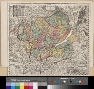
Delineatio aller Quartieren der Statt und Landschaft Zürich
1 : 190000 1 Karte von Joh. Heinr. Freytag
Karte des Kantons Zürich
1 : 250000 1 Karte
Delineatio aller Quartieren der Statt und Landschaft Zürich
1 : 190000 1 Karte von Joh. Heinr. Freytag
Karte des Zürcher Gebiets von 1685
1 : 96000 Neudruck der von Hans Georg Gyger (1627-1687), Maler und Amtmann des Klosteramts Küsnacht, von Zürich, herausgegebenen Originalkarte. Mit vereinzelten - wohl nachträglich angebrachten - Kolorierungen. Ohne Datumsangabe. Druck und Verlag: Hiltensperger, Johann Jost (1711-1792), Kupferstecher und Formschneider, in Zug
Kleiner historischer Atlas des Kantons Zürich
1 : 200000 1 Atlas (6 Bl.) von F. Beust
Kleiner historischer Atlas des Kantons Zürich
1 : 200000 1 Atlas (6 Bl.) von F. Beust
Kleiner historischer Atlas des Kantons Zürich
1 : 200000 1 Atlas (6 Bl.) von F. Beust
Nova descriptio ditionis Tigurinae regionumque finitimarum
1 : 95000 1 Karte Joh. Conradus Gygerus, P. delineavit ; Joh. Georgius Gygerus, F. in aes incidi ; curavit per Johannem Meyerum Ao. 1685
Kleiner historischer Atlas des Kantons Zürich
1 : 200000 1 Atlas (6 Bl.) von F. Beust
Karte des Zürcher Gebiets
1 : 96000 Originaltitel: Nova descriptio ditionis Tigurinae, Regionumque finitimarum, Neüe beschreibung der Landschafft Zürich. Im Kupferdruck veröffentlichte verkleinerte und inhaltlich vereinfachte, auf sechs Blätter aufgeteilte Kopie der Grossen Landtafel des Zürcher Gebiets (Gyger-Karte) von 1667. Enthält Nebenkarte der Freiherrschaft Sax-Forstegg sowie bildliche Darstellung der einzelnen Vogteischlösser, der Wappen der Inneren Vogteien, ferner der Stadt Zürich sowie der damaligen männlichen und weiblichen Bekleidung. Herausgeber: Gyger, Hans Georg (1627-1687), Maler und Amtmann des Klosteramts Küsnacht, von Zürich Zeichnung: Gyger, Hans Conrad, andere Schreibweisen: Geiger, Geyger, (1599-1674), Kartograf, Ingenieur und Amtmann des Amts Kappelerhof, von Zürich Stich: Meyer, Johannes (1655-1712), Kupferstecher, von Zürich
Grosse Landtafel des Zürcher Gebiets: Esquelette der Zürcher Kantonskarte in 56 Blättern
Später eingefügte Blattübersicht von Johannes Müller. Müller, Johannes (1733-1816), obrigkeitlicher Ingenieur des Zürcher Stadtstaats, von Zürich
Darstellung von Stadt und Landschaft Zürich nach Vogteien
1 : 250000 Originaltitel: Nova et accurata Agri Tigurini cum confiniis tabula geographica. Beruht auf der Gyger-Karte von 1667. Mit farbigen Wappen der innern und äussern Vogteien, einer Nebenkarte der Herrschaft Sax-Forstegg, ferner Legende. Ohne Datumsangabe (Datierung gemäss Angabe der Zentralbibliothek Zürich). Freytag, Johann Heinrich, Kupferstecher
Eigentliche Verzeichnung der Städten, und Graffschaften, und Herrschaften, welche in der Stadt Zürich Gebiet und Landschaft gehörig sind
1 : 56000 1 Karte auf 16 Bl. gerissen durch Josen Murer
Karte des Zürcher Gebiets (Murer-Karte) von 1566
1 : 56000 Originaltitel: Eigentliche Verzeichnuss der Städten, und Graffschaften und Herrschaften, welche in der Stadt Zürich Gebiet und Landschaft gehörig sind. Neudruck (6. Auflage) der von Jos Murer verfertigten Originalkarte, der ältesten gedruckten Karte des Kantons Zürich. Mit Legenden. Ohne Datumsangabe (Datierung gemäss Angabe Arthur Dürsts in seinem Aufsatz in Vermessung, Photogrammetrie, Kulturtechnik, Bd. 73 (1975): Das älteste bekannte Exemplar der Holzschnittkarte des Zürcher Gebiets 1566 von Jos Murer und deren spätere Auflagen, S. 8-12). Druck vermutlich: Orell, Gessner und Cie., in Zürich Verlag: Hofmeister, Johannes, Buchbinder, in Zürich
Eigentliche Verzeichnuss der Städten, und Graffschaften und Herrschaften, welche in der Stadt Zürich-Gebiet und Landschaft gehörig sind
1 : 56000 1 Karte auf 16 Bl. gerissen durch Josen Murern
Kleiner historischer Atlas des Kantons Zürich
1 : 200000 1 Atlas (6 Bl.) von F. Beust
Kleiner historischer Atlas des Kantons Zürich
1 : 200000 1 Atlas (6 Bl.) von F. Beust
Nova et accurata Agri Tigurini cum confiniis tabula geographica
1 : 200000 1 Karte ex cel. Scheuchzeri et Gygeri observationibus ; constructa a J. Heinrich Freytag
Nova et accurata Agri Tigurini cum confiniis tabula geographica
1 : 190000 1 Karte ex cel. Scheuchzeri et Gygeri observationibus ; constructa a J. Heinrich Freytag
Delineatio aller Quartieren der Statt und Landschaft Zürich
1 : 200000 1 Karte von Joh. Heinr. Freytag
Nova et accurata Agri Tigurini cum confiniis tabula geographica
1 : 200000 1 Karte ex cel. Scheuchzeri et Gygeri observationibus ; [gezeichnet von Joh. Balthasar Bullinger] ; constructa a J. Heinrich Freytag, Chalcographo
[Eigentliche Verzeichnuss der Städten, Graffschafften und Herrschafften, welche in der Stadt Zürich-Gebiet und Landschafft gehörig sind]
1 : 56000 1 Karte auf 16 Bl. [gerissen durch Josen Murern]
Karte des Zürcher Gebiets (Murer-Karte) von 1566
1 : 56000 Originaltitel: Eigentliche Verzeichnung der Städten, und Graffschaften, und Herrschaften, welche in der Stadt Zürich Gebiet und Landschaft gehörig sind. Neudruck (vermutlich 8. Auflage) der von Jos Murer verfertigten Originalkarte. Mit Legenden. Druck und Verlag: Orell, Füssli und Cie., in Zürich
Nova et accurata Agri Tigurini cum confiniis tabula geographica
1 : 200000 1 Karte ex cel. Scheuchzeri et Gygeri observationibus ; [gezeichnet von Joh. Balthasar Bullinger] ; constructa a J. Heinrich Freytag, Chalcographo
Darstellung von Stadt und Landschaft Zürich nach Quartieren
1 : 250000 Originaltitel: Delineatio aller Quartieren der Statt und Landschaft Zürich. Mit farbigen Wappen der innern und äussern Vogteien, einer Nebenkarte der Herrschaft Sax-Forstegg, ferner Legende. Ohne Datumsangabe (Datierung gemäss Angabe der Zentralbibliothek Zürich). Freytag, Johann Heinrich, Kupferstecher
Delineatio aller Quartieren der Statt und Landschaft Zürich
1 : 200000 1 Karte von Joh. Heinr. Freytag
Delineatio Pagi Tigurini ex observationibus recentissimis et accuratissimis
1 : 150000 1 Karte sculpsit et excudit Matth. Seutter ; Tob. Conr. Lotter sculps.
Zürich Gebiet
1 : 250000 1 Karte J.H. Streulinus inv. ; J.G. Seiller sculpsit
Karte des Kantons Zürich
1 : 200000 1 Karte [gez. v. Beust]