Maps of Zurich

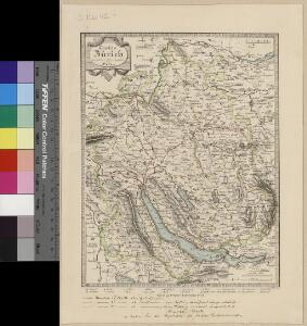
Canton Zürich
1 : 230000 1 Karte gezeichnet und herausgegeben von Hch. Keller ; gest. v. J. Scheurmann
Atlas de la Suisse
1 : 450000 1 Atlas (19 Bl.) dessiné par MM. H. Keller, Scheurmann, Pfyffer d'Altishofen, Osterwald, etc. ; gravé par M. Scheurmann Orell Füssli & Co., Zürich
[Nova descriptio ditionis Tigurinae regionumque finitimarum]
1 : 95000 1 Karte Joh. Conradus Gygerus, P. delineavit ; Joh. Georgius Gygerus, F. in aes incidi ; curavit per Johannem Meyerum Ao. 1685
Darstellung von Stadt und Landschaft Zürich nach Vogteien
1 : 250000 Originaltitel: Nova et accurata Agri Tigurini cum confiniis tabula geographica. Beruht auf der Gyger-Karte von 1667. Mit Wappen der innern und äussern Vogteien, einer Nebenkarte der Herrschaft Sax-Forstegg, ferner Legende. Ohne Datumsangabe (Datierung gemäss Angabe der Zentralbibliothek Zürich). Freytag, Johann Heinrich, Kupferstecher
Atlas der Schweiz
1 : 450000 1 Atlas (18 Bl.) gez. u. gest. v. J. Scheurmann Orell Fussli, Zurich
Karte des Zürcher Gebiets (Murer-Karte) von 1566
1 : 56000 Originaltitel: Eigentliche Verzeichnuss der Städten, und Graffschaften und Herrschaften, welche in der Stadt Zürich Gebiet und Landschaft gehörig sind. Neudruck (6. Auflage) der von Jos Murer verfertigten Originalkarte, der ältesten gedruckten Karte des Kantons Zürich. Mit Legenden. Ohne Datumsangabe (Datierung gemäss Angabe Arthur Dürsts in seinem Aufsatz in Vermessung, Photogrammetrie, Kulturtechnik, Bd. 73 (1975): Das älteste bekannte Exemplar der Holzschnittkarte des Zürcher Gebiets 1566 von Jos Murer und deren spätere Auflagen, S. 8-12). Druck vermutlich: Orell, Gessner und Cie., in Zürich Verlag: Hofmeister, Johannes, Buchbinder, in Zürich
Darstellung von Stadt und Landschaft Zürich nach Kapiteln der Zürcher Synode
1 : 250000 Originaltitel: Tabula topographica parochiarum synodo Tigurina. Mit farbigen Wappen der innern und äussern Vogteien, einer Nebenkarte der Herrschaft Sax-Forstegg, zwei angeklebten Ergänzungskarten (Thurgau/Bodensee und Rheintal) sowie Legende. Ohne Datumsangabe (Datierung gemäss Angabe von Hans Jakob Holzhalb in: Supplement zu dem allgemeinen helvetisch-eidgenössischen oder schweizerischen Lexicon, so von weiland Herrn Hans Jakob Leu, Bürgermeister Löbl. Freystaats Zürich, in alphabetischer Ordnung behandelt worden, Band 2, S. 360). Freytag, Johann Heinrich, Kupferstecher
Taschen-Atlas der Schweiz
1 Atlas (25 S., 20 Taf.) gezeichnet und gestochen von Emil Wagner = Atlas de poche de la Suisse : 26 cartes en couleurs / dessinées et gravées par Émile Wagner Eggimann, Genf
Nova descriptio ditionis Tigurinae regionumque finitimarum
1 : 95000 1 Karte Joh. Conradus Gygerus, P. delineavit ; Joh. Georgius Gygerus, F. in aes incidi ; curavit per Johannem Meyerum Ao. 1685
Kleiner historischer Atlas des Kantons Zürich
1 : 200000 1 Atlas (6 Bl.) von F. Beust
Karte des Kantons Zürich
1 : 250000 1 Karte
Kleiner historischer Atlas des Kantons Zürich
1 : 200000 1 Atlas (6 Bl.) von F. Beust
Kleiner historischer Atlas des Kantons Zürich
1 : 200000 1 Atlas (6 Bl.) von F. Beust
Kleiner historischer Atlas des Kantons Zürich
1 : 200000 1 Atlas (6 Bl.) von F. Beust
Kleiner historischer Atlas des Kantons Zürich
1 : 200000 1 Atlas (6 Bl.) von F. Beust
Delineatio Pagi Tigurini ex observationibus recentissimis et accuratissimis
1 : 150000 1 Karte sculpsit et excudit Matth. Seutter ; Tob. Conr. Lotter sculps.
Delineatio aller Quartieren der Statt und Landschaft Zürich
1 : 190000 1 Karte von Joh. Heinr. Freytag
Nova et accurata Agri Tigurini cum confiniis tabula geographica
1 : 190000 1 Karte ex cel. Scheuchzeri et Gygeri observationibus ; constructa a J. Heinrich Freytag
Delineatio aller Quartieren der Statt und Landschaft Zürich
1 : 190000 1 Karte von Joh. Heinr. Freytag
Kleiner historischer Atlas des Kantons Zürich
1 : 200000 1 Atlas (6 Bl.) von F. Beust
Darstellung von Stadt und Landschaft Zürich nach Vogteien
1 : 250000 Originaltitel: Nova et accurata Agri Tigurini cum confiniis tabula geographica. Beruht auf der Gyger-Karte von 1667. Mit farbigen Wappen der innern und äussern Vogteien, einer Nebenkarte der Herrschaft Sax-Forstegg, ferner Legende. Ohne Datumsangabe (Datierung gemäss Angabe der Zentralbibliothek Zürich). Freytag, Johann Heinrich, Kupferstecher
Delineatio Pagi Tigurini ex observationibus recentissimis et accuratissimis
1 : 150000 1 Karte sculpsit et excudit Matth. Seutter ; Tob. Conr. Lotter sculps.
[Eigentliche Verzeichnuss der Städten, Graffschafften und Herrschafften, welche in der Stadt Zürich-Gebiet und Landschafft gehörig sind]
1 : 56000 1 Karte auf 16 Bl. [gerissen durch Josen Murern]
Karte des Zürcher Gebiets (Murer-Karte) von 1566
1 : 56000 Originaltitel: Eigentliche Verzeichnung der Städten, und Graffschaften, und Herrschaften, welche in der Stadt Zürich Gebiet und Landschaft gehörig sind. Neudruck (vermutlich 8. Auflage) der von Jos Murer verfertigten Originalkarte. Mit Legenden. Druck und Verlag: Orell, Füssli und Cie., in Zürich
Projektierte Eisenbahnstrecke Winterthur-Baden; Übersichtskarte
1 : 250000 Mit Legende. Ohne Datumsangabe. Wurster, Randegger und Cie., in Winterthur
Karte des Kantons Zürich nebst einem Teil der angrenzenden Kantone
1 : 120000 Mit - wohl nachträglich angebrachter - farbiger Einzeichnung der Kantonsgrenze. Orell Füssli und Cie., in Zürich
Karte des Zürcher Gebiets von 1685
1 : 96000 Neudruck der von Hans Georg Gyger (1627-1687), Maler und Amtmann des Klosteramts Küsnacht, von Zürich, herausgegebenen Originalkarte. Mit vereinzelten - wohl nachträglich angebrachten - Kolorierungen. Ohne Datumsangabe. Druck und Verlag: Hiltensperger, Johann Jost (1711-1792), Kupferstecher und Formschneider, in Zug
Fischereirechte im Kanton Zürich
1 : 125000 Von Hand eingezeichnete Fischereireviere auf der Karte des Kantons Zürich nach seiner Einteilung in politische Gemeinden aus den 1870er Jahren. Ausgangskarte: Wurster, Randegger und Cie., in Winterthur
Grosse Landtafel des Zürcher Gebiets (Gyger-Karte)
1 : 32000 Originaltitel: Einer Loblichen Statt Zürich Eigenthümlich-Zugehörige Graff- und Herrschaften, Stett, Land und Gebiett. Sampt deroselben anstossenden benachbarten Landen, und gemeinen Landvogteiyen: Mit Bergen und Thalen, Höltzer und Wälden, Wasseren, Strassen und Landmarchen. Mit farbigen Gemeindewappen. Gyger, Hans Conrad, andere Schreibweisen: Geiger, Geyger, (1599-1674), Kartograf, Ingenieur und Amtmann des Amts Kappelerhof, von Zürich