Maps of Zurich

Karte des Kantons Zürich
1 : 250000 1 Karte
Canton Zürich
1 : 230000 1 Karte gezeichnet und herausgegeben von Hch. Keller ; gest. v. J. Scheurmann
Canton Zürich
1 : 240000 1 Karte gezeichnet und herausgegeben von Hch. Keller
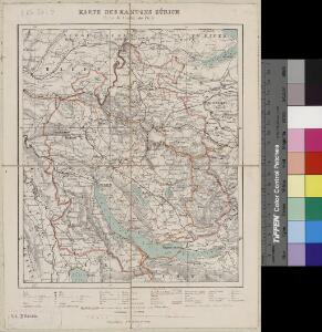
Karte des Kantons Zürich
1 : 250000 1 Karte
Karte des Kantons Zürich
1 : 250000 1 Karte
<<Der>> Canton Zürich
1 : 230000 1 Karte
Carte des Cantons Zürich
1 : 275000 1 Karte gezeichnet und gestochen von J.H. Bachofen ; hrsg. und im Verlag von J.H. Locher
<<Der>> Canton Zürich
1 : 230000 1 Karte H. Keller del. ; J.J. Scheurmann sc.
[Geologische Karte des Kantons Zürich]
1 : 250000 1 Karte
Canton de Zurich
1 : 291000 1 Karte dressé par Th. Duvotenay ; gravé par C. Dyonnet ; Bénard sc.
Bodenverbesserungen im Kanton Zürich
1 : 280000 1 Karte zusammengestellt von J. Girsberger
<<Der>> Canton Zürich
1 : 230000 1 Karte H. Keller del. ; J. J. Scheurmann sc.
<<Der>> Canton Zürich
1 : 230000 1 Karte
Kanton Zürich: Trigonometrisches Netz
1 : 100000 Auftraggebung: Eidgenössisches Topographisches Büro, in Bern Jacky, W., Ingenieur; Pfändler, L., Ingenieur
Canton Zürich sive illustris Helvetiorum respublica Tigurina cum subditis suis et confinibus
1 : 275000 1 Karte [Gabriel Walser?]
Karte des Kantons Zürich
1 : 125000 1 Karte J.M. Ziegler ; gestochen von R. Leuzinger ; Schrift von P. Steiner
<<Der>> Kanton Zürich
1 : 200000 1 Karte [gez. v. Beust]
[Karte des Kantons Zürich]
1 : 250000 1 Karte
<<Der>> Canton Zürich
1 : 230000 1 Karte H. Keller del. ; J.J. Scheurmann sc.
Atlas novus Reipublicae Helveticae
1 Atlas ([40] Bl., 97 S.) bey Orell, Gessner und Compagnie, Zürich
Canton Zürich
1 : 240000 1 Karte gezeichnet und herausgegeben von Hch. Keller
Karte des Kantons Zürich
1 : 125000 1 Karte J.M. Ziegler ; gestochen von R. Leuzinger ; Schrift von P. Steiner
Karte des Kantons Zürich
1 : 200000 1 Karte gez. v. Beust
<<Der>> Kanton Zürich
1 : 200000 1 Karte [gez. v. Beust]
[Karte des Kantons Zürich]
1 : 250000 1 Karte
Canton Zürich sive illustris Helvetiorum respublica Tigurina cum subditis suis et confinibus
1 : 275000 1 Karte [Gabriel Walser?]
Canton Zürich
1 : 230000 1 Karte gezeichnet und herausgegeben von Hch. Keller ; gest. v. J. Scheurmann
Karte des Kantons Zürich
1 : 200000 1 Karte [gez. v. Beust]
<<[Der>> Canton Zürich mit seinen nähern Angränzungen]
1 : 118000 1 Karte [gezeichnet und herausgegeben von Heinrich Keller ; gest. v. J. Scheurmann]