Maps of Region Engiadina Bassa/Val Müstair

Topographische Karte der Schweiz
1 : 100000 25 Karten vermessen und hrsg. auf Befehl der Eidgenössischen Behörden ; aufgenommen unter der Aufsicht des Generals G.H. Dufour Eidg. Topographisches Bureau, [Genève], [später: Bern]
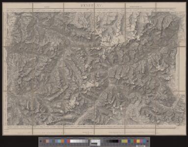
Davos, Martinsbruck
1 : 100000 1 Karte geologische Aufnahmen von G. Theobald [Wurster & Randegger], [Winterthur]
Blatt XV: Davos, Martinsbruck, uit: Topographische Karte der Schweiz / vermessen und hrsg. ... unter Aufsicht des Generals G.H. Dufour
1 : 100000 Annotatie: Met plaatsnamenregister (bl. V), bladwijzer (bl. XXI) en hoogteregister (bl. XXV); Voor aanwezige bladen zie overzichtsblad Dufour, G. H. [Bern : Eidg. Topogr. Bureau]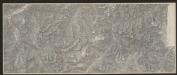
Engadin-Orientbahn
1 : 100000 1:100 000 Schweiz Eidgenössisches Topographisches Bureau Eidg. Topographisches Bureau
Ober Engadin
1 Vogelschaukarte Orell Füssli, Zürich
Geologische Karte des Unter-Engadin
1 : 150000 Theobald, Gottfried Ludwig Topogr. Anstalt v. Wurster, Randegger & Co.
Reduzirte Karte des Unter-Engadin
1 : 150000 1 Karte Topogr. Anstalt v. Wurster, Randegger & Cie., Winterthur
Karte des Unter-Engadins
1 : 50000 1 Karte auf 2 Blättern bearbeitet von J.M. Ziegler ; Stich & Druck der Topogr. Anstalt v. Wurster, Randegger & Co. Topogr. Anstalt v. Wurster, Randegger & Co., Winterthur
Karte des Unter-Engadins
1 : 50000 1 Karte auf 2 Blättern bearbeitet von J.M. Ziegler ; Stich & Druck der Topogr. Anstalt v. Wurster, Randegger & Co. Topogr. Anstalt v. Wurster, Randegger & Co., Winterthur
Rhätische Bahn
1 : 100000 Kümmerly & Frey Geographischer Verlag (Bern) Hitz (Auslieferung)
Uebersichtsplan der projectirten Schmalspurbahn Landquart - Davos
1 : 100000 Wetzel, C. [s.n.]
Topographischer Atlas der Schweiz: Albula

[Kaart], uit: Albula
1 : 50000 Bern : Eidgenössische Landestopographie
Rheni posterioris et Muesae prima stamina et progressus
1 Karte : Kupferdruck ; 46 x 60 cm Scheuchzer apud I. Cóvens et C. Mortier
Karte des Unter-Engadins
1 : 50000 Nord-Blatt Ziegler, Jakob Melchior Topogr. Anstalt v. Wurster, Randegger & Co.
Silvretta Gruppe
1 : 75000 k.k. Militärgeograph. Inst.
Ill Urspring.; Spezialkarte der osterreichisch-ungarischen Monarchie.
from Spezialkarte der osterreichisch-ungarischen Monarchie. Austro-Hungarian Monarchy. Militärgeographisches Institut.,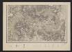
Karte des Unter-Engadins
1 : 50000 Süd-Blatt Ziegler, Jakob Melchior Topogr. Anstalt v. Wurster, Randegger & Co.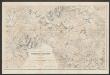
Ofenpassgruppe
1 : 50000 Schweiz Eidgenössisches Topographisches Bureau [Verlag der Expedition des Jahrbuches des S.A.C.]
Albulae fluvii prima stamina et progressus
1 : 130000 1 Karte [von Johann Jakob Scheuchzer] excudit Petrus van der Aa, Lugd. Bat [Leiden]
<<Die>> Silvretta-Gebirgsgruppe nach eidgenössischen Aufnahmen
1 : 50000 1 Karte Stich u. Druck der topogr. Anstalt von Wurster, Randegger & Co. in Winterthur [Verlag der Expedition des Jahrbuches des S.A.C.], [Bern]
II. Skikarte der Mittel-Silvretta
1 : 50000 Alpy švýcarské (pohoří) Rudolf Rother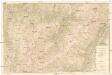
Touristenkarte von Arosa
1 : 25000 Arosa (Švýcarsko) Kur- & Verkehrsverein
Karte über das Auftreten des grauen Lärchenwicklers (Steganoptycha pinicolana Zll.) in den Waldungen des oberen Engadins 1878,79 & 80 & 1886,87 & 88
1 : 50000 Coaz, Johann Wilhelm Fortunat Schweiz. Industrie- und Landwirtschaftsdepartement
Ski-Karte des Inneren Montafon und Paznaun
1 : 50000 Tyrolské Alpy (Rakousko : pohoří) Kartographisches, früher Militärgeographisches Institut
III. Skikarte der West-Silvretta und des Ost-Rätikon
1 : 50000 Alpy rakouské (pohoří) Rudolf Rother
Manöverkarte für die Uebungen der VIII. Armeedivision im September 1884
1 : 50000 Eidg. topographisches Bureau
Manöverkarte für die Übungen der VIII. Armeedivision im September 1884
1 : 50000 Eidg. topograph. Büreau