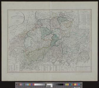
Maps of Switzerland

Charte von Helvetien und Wallis
1 : 600000 1 Karte nach den neuesten und vorzüglichsten Hülfsmitteln neu entworfen von F. Götze im Verlage des Landes Industrie Comptoirs, Weimar
Helvetia cum finitimis regionibus confoederatis
1 : 800000 1 Karte describebat Gerard' Mercator et excudebat Guiljelmus Blaeu [apud Iohannem et Cornelium Blaeu], [Amsterdami]
<<Die>> katholische und reformierte Schweiz seit der Reformation
1 : 2000000 1 Karte [bearb. nach Urkunden und den vorzüglichsten Werken Schweizerischer Geschichte von E. Scheuermann] [Scheuermann], [Aarau]
<<La>> Suisse
1 : 1500000 1 Karte [Verlag nicht ermittelbar], [Erscheinungsort nicht ermittelbar]
<<Die>> XIII Cantone der Schweiz
1 : 2000000 1 Karte [bearb. nach Urkunden und den vorzüglichsten Werken Schweizerischer Geschichte von E. Scheuermann] bei E. Scheuermann, Aarau
<<Die>> Schweiz
1 : 930000 1 Karte entw. u. gez. v. A. St. 1820 ; Carl Jättnig sculp. [Perthes], [Gotha]
Uebersichts-Karte der Schweiz
1 : 1050000 1 Karte gezeichnet von Rudolph Gross ; gestochen von Rixinger u. Graf J. Heuberger's Verlag, Bern
Charte von der Schweiz nach ihrer jezigen Eintheilung
1 : 880000 1 Karte [Joseph Dirwaldt] Mollo, Wien
Charte von Helvetien und Wallis
1 : 600000 1 Karte nach dem neuesten und vorzüglichsten Hülfsmitteln neu entworfen von F. Götze im Verlage des Geograph. Instituts, Weimar
Officielle Uebersichtskarte der Schweiz. Eisenbahnen vom Monat Mai 1881
1 : 700000 1 Karte R. Leuzinger Schweiz. Post- & Eisenbahndepartement, [Bern]
Nova Helvetiae tabula
1 : 780000 1 Karte ex officina Iudoci Hondij F., Amstelodami
<<Die>> Schweiz
1 : 930000 1 Karte entw. u. gez. v. A. St. 1820 ; Carl Jättnig sculp. [Perthes], [Gotha]
XI, 253 S.
von Torsten Kirstges
Oldenbourg, München

<<La>> Suisse
1 : 1300000 1 Karte chez R. & J. Wetstein et Guil. Smith, Amsterdam
Nova totius Helvetiae cum suis subditis ac sociis tab. geogr
1 : 1400000 1 Karte studio manu ac sumtibus Matth. Seutter ; Tob. Conr. Lotter sc. anjezo im Verlag bey Tob Conr. Lotter, Augsburg
Petite carte de la Suisse pour les écoles
1 : 800000 1 Karte gezeichnet und hrsg. von Heinrich Keller Keller, Zürich
Johnson's Switzerland
1 : 970000 1 Karte by Johnson and Ward Johnson and Ward, New York
Exactissima Helvetiae, Rhaetiae, Valesiae caeterorumq. confoederatorum ut et finitimorum populorum regionum tabula
1 : 800000 1 Karte edita primum per Nicolaum Visscher, Amst. David Funck, Norimbergae
<<La>> Suisse
1 Karte par P. Du Val ; Somer sculp. et l'Alleman chez l'autheur, Paris
<<Die>> VIII alten Orte zu Ende der Burgundischen Kriege
1 : 2000000 1 Karte [bearb. nach Urkunden und den vorzüglichsten Werken Schweizerischer Geschichte von E. Scheuermann] [Scheuermann], [Aarau]
<<Die>> Schweiz
1 : 1470000 1 Karte G. Heck dirt. ; R. Schmidt et J. Maedel III sculp. [F.A. Brockhaus], [Leipzig]
Nova totius Helvetiae cum suis subditis ac sociis tab. geogr
1 : 790000 1 Karte studio manu ac sumtibus Matth. Seut. anjezo in Verlag bey Ioh. Mich. Probst, Augsp.
<<Les>> Suisses, leurs alliez, avec les sujets des Suisses et des alliéz
1 Karte selon les mémoires de Sjmler, de Gyger, et de plusieurs autres autheurs, par le Sr. Tillemon chez I.B. Nolin sur le Quay de l'Horloge du palais proche la Rue de Harlay à l'enseigne de la Place des Victoires, Paris
Johnson's Switzerland
1 : 970000 1 Karte by Johnson and Ward Johnson and Ward, New York
<<Die>> Schweiz oder helvetische Eidgenossenschaft
1 : 600000 1 Karte entworfen und gezeichnet von C.F. Weiland im Verlage des Geograph. Instituts, Weimar
<<Die>> schweiz. Abstimmung vom 12. Mai 1872
1 : 1250000 1 Karte [Verlag nicht ermittelbar], [Erscheinungsort nicht ermittelbar]
Mappa geogr. Helvetiae, eller, Geogr. charta öfwer Schweitz
1 : 2100000 1 Karte af A. Åkerman ; Eric Österberg sc. [Verlag nicht ermittelbar], [Upsala]
Novissima foederatorum Helvetiorum tabula
1 : 2000000 1 Karte [Weigel], [Nürnberg]
Helvetia cum finitimis regionibus confoederatis
1 Karte Per Gerardum Mercatorem cum privilegio [Jodocus Hondius], [Amsterodami]