Maps of Swabia
[Bodensee oder Kostnitzersee] : XVIII
Schrämbl, Franz Anton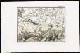
[Lac de Constance]
Tardieu, Ambroise
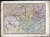
Alemannia sive Svevia svperior
1 Karte : Kupferdruck ; 36 x 48 cm Hurter Blaeu
[Zürich-Innsbruck]
1 : 576000 Bodamské jezero-oblast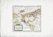
Die in und um Schwaben gelegenen östreichischen Antheile in der ämtlichen Sprache Vorderöstreich
1 Karte : Kupferdruck ; 22 x 24 cm Reilly F. J. J. von Reilly
VI, uit: General-Karte des oesterreichischen Kaiserstaates mit einem grossen Theile der angrenzenden Länder / durch Josef Scheda ... bearb. und hrsg
1 : 576000 Annotatie geografische gegevens: Maatstokken: oesterreichische Meilen, geografische oder deutsche Meilen, preussische Meilen, türkische Berri, französische Lieues, russische Werste; Maatstok per blad: wiener Klafter, öster. Meilen; Blad XIX: statistische en taalkundige informatie; Blad XIX: legenda [Wien : K.K. Militärisch-Geografisches Institut]
Sheet VI: Karte Des Oesterreichischen Kaiserstaates.
1 : 576000 Scheda, Josef
Sect. 26: Augsburg, uit: Geologische Karte des Deutschen Reichs in 27 Blaettern / [von] Richard Lepsius ; Red. von C. Vogel
1 : 500000 Annotatie: Blad 18 ontbreekt; Een aantal bladen op linnen; Een aantal bladen gereviseerd 1913-1914; Annotatie geografische gegevens: Met schaalstokken o.a. in kilometers; Legenda Carl Vogel 1828-1897 Gotha : Justus Perthes
Nova Alemanniæ sive Sveviæ svperioris tabvla
1 Karte : Kupferdruck ; 36 x 48 cm Janssonius apud Ioannem Ianssonium
Neue Schweizerkarte von 1847
1 : 300000 1 Karte auf 4 Bl. als Wand- und Reliefkarte topisch und politisch dargestellt von Eduard Winckelmann Tobias Dannheimer, Kempten
Nova Alemanniæ sive Sveviæ svperioris tabvla
1 Karte : Kupferdruck ; 36 x 47 cm Hondius apud Henricum Hondium
Kanton Zürich: Staats-, Gemeinde- und Genossenschaftswaldungen: Übersichtsplan mit Blatteinteilung
1 : 50000 Ohne Erstellungsdatumsangabe. Ausgangskarte: Ausschnitt aus der Übersicht der Blätter des Topographischen Atlasses der Schweiz (Siegfried-Karte). Hartmann, Karl, Forstadjunkt im Zürcher Oberforstamt, von Aarau, in Unterstrass
Circvli Sveviae Mappa
1 : 470000 Mollova mapová sbírka Hase, Johann Matthias Homann, Johann Baptista - dědici
Circvli Sveviae mappa
1 : 490000 Švábsko (Německo) Hase, Johann Matthias Michaliani editum opera Homan[n]ianorum Heredum
Circvli Sveviae mappa
1 : 490000 Švábsko (Německo) Hase, Johann Matthias Michaliani editum opera Homan[n]ianorum Heredum
Circvli Sveviae mappa
1 : 490000 Švábsko (Německo) Hase, Johann Matthias editum opera Homan[n]ianorum Heredum
Circvli Sveviae mappa
1 : 490000 Švábsko (Německo) Hase, Johann Matthias Michaliani editum opera Homan[n]ianorum Heredum
Nouvelle carte géographique de la Suisse
1 : 600000 1 Karte auf 4 Bl. dressé par Jacq. Scheuchzer chez R. & J. Wetstein et Guil. Smith, Amsterdam
[Übersichtskarte von Engadiner Alpen]
1 : 575000 Engadin (Švýcarsko)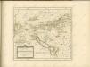

Circuli Sveviae
1 : 477000 Švábsko (Německo) Hase, Johann Matthias Homan[n]ianorum Heredum
Die in und um Schwaben gelegenen Östreichischen Antheile in der ämtlichen Sprache Vorderöstreich : Nro. 58
Reilly, Franz Johann Joseph von
Circulus Suevicus in quo ducatus Wirtenbergensis cum reliquis statibus et provinciis curate designatus propomtur
1 : 640000 Württembersko (Německo) Lotter, Tobias Conrad studio et caelo Tobiae Conradi Lotter
Postkarte der schweizerischen Eidgenossenschaft
1 : 300000 1 Karte in 4 Teilen unter Aufsicht des General Dufour nach den gegenwürtig vorhandenen Materialien des eidgenössischen Atlasses und den besten Karten gezeichnet von J.R. Stengel u. E. Mohr Wurster, Winterthur
Totius s.r.i. circuli Suevici tabula chorographica, 4
1 Blatt : R. et J. Ottens
[Reisekarte der Schweiz]
1 : 500000 1 Karte auf 6 Bl. gezeichnet v. H. Keller ; gest. v. J.J. Scheurmann [Füssli & Comp.], [Zürich]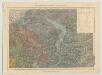
Carte du phénomène erratique et des anciens glaciers du versant nord des Alpes Suisses et de la chaîne du Mont-Blanc
1 : 250000 Nordost-Blatt Favre, Alphonse Imp. par l'Etabl. topogr. de Wurster, Randegger et Cie.
Officielle Eisenbahn-Karte der Schweiz
1 : 250000 Nordost-Blatt [s.n.]
<<Les>> Suisses, leurs alliés et leurs sujets
1 : 230000 1 Karte auf 4 Bl. par A.H. Iaillot, 1703 chez l'auteur joignant les grands Augustins aux deux globes, Paris
![[Bodensee oder Kostnitzersee] : XVIII](https://images-2.georeferencer.com/images/iiif/735182188780/full/,300/0/native.jpg)

