Maps of Aalst

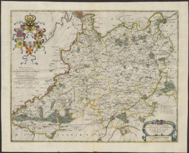
NOVA ET ACCVRATA | COMITATVS ET DITIONIS | ALOSTANÆ | in Flandria Imperiali | TABVLA
[Amsterdam : Joan Blaeu]
NOVA ET ACCVRATA | COMITATVS ET DITIONIS | ALOSTANÆ | in Flandria Imperiali | TABVLA
[Amsterdam : Joan Blaeu]
Carte Particuliere des Environs de Bruxelles avec le Bois Soigne et d'une Partie de la Flandre jusques Agand
1 : 250000 Mollova mapová sbírka Seutter, Matthäus Lotter, Tobias Conrad Seutter, Matthäus
Carte Particuliere des environs de Bruxelles, avec le Bois de Soigne, et d'un partie de la Flandre jusques a Gand
1 : 116600 Mollova mapová sbírka Fricx, Eugène Henry Covens, Johannes I
Carte Particuliere des environs de Bruxelles avec le Bois de Soigne et d'une partie de la Flandre jusques agand
1 : 116600 Mollova mapová sbírka Fricx, Eugène Henry Harrewyn, Jacques Fricx, Eugené Henry
CASTELLANIA | ALDENARDENSIS
[Amsterdam : Joan Blaeu]
Plan du champ de bataille, prés d'Oudenaerde l'11. Juillet 1708
1 : 30000 G. Schouten f.
Plan de la bataille d'Oudenaerde du jj juillet 1708
1 : 2400 Mosburger, G. L. Doesborgh, Thomas par Doesburgh
Plan parcellaire de la commune de Nazareth : avec les mutations
1 : 5000 Royal Library of Belgium Map Room Popp, Philippe Christian (1805-1879) Popp, Philippe Christian (1805-1879)
Carte Particuliere des environs de Menin, Courtray, Ypre, Dixmude, et Deynse
1 : 116600 Mollova mapová sbírka Fricx, Eugène Henry Covens, Johannes I
Plan parcellaire de la commune de Cruyshautem : avec les mutations
1 : 5000 Royal Library of Belgium Map Room Popp, Philippe Christian (1805-1879) Popp, Philippe Christian (1805-1879)
Plan parcellaire de la commune de Wetteren : avec les mutations
1 : 5000 Royal Library of Belgium Map Room Popp, Philippe Christian (1805-1879) Popp, Philippe Christian (1805-1879)
Plan parcellaire de la commune de Huysse : avec les mutations
1 : 5000 Royal Library of Belgium Map Room Popp, Philippe Christian (1805-1879) Popp, Philippe Christian (1805-1879)
Plan parcellaire de la ville de Renaix : avec les mutations
1 : 5000 Royal Library of Belgium Map Room Popp, Philippe Christian (1805-1879) Popp, Philippe Christian (1805-1879)
Développement de la ville de Alost : avec les mutations
1 : 1250 Royal Library of Belgium Map Room Popp, Philippe Christian (1805-1879) Popp, Philippe Christian (1805-1879)
Plan parcellaire de la commune de Melle : avec les mutations
1 : 5000 Royal Library of Belgium Map Room Popp, Philippe Christian (1805-1879) Popp, Philippe Christian (1805-1879)
Plan parcellaire de la commune de Flobecq : avec les mutations
1 : 5000 Royal Library of Belgium Map Room Popp, Philippe Christian (1805-1879) Popp, Philippe Christian (1805-1879)
Plan parcellaire de la commune de Berchem (lez Audenarde) : avec les mutations
1 : 5000 Royal Library of Belgium Map Room Popp, Philippe Christian (1805-1879) Popp, Philippe Christian (1805-1879)
Plan parcellaire de la commune de Denderwindeke : avec les mutations
1 : 5000 Royal Library of Belgium Map Room Popp, Philippe Christian (1805-1879) Popp, Philippe Christian (1805-1879)
Plan parcellaire de la commune de Wichelen : avec les mutations
1 : 5000 Royal Library of Belgium Map Room Popp, Philippe Christian (1805-1879) Popp, Philippe Christian (1805-1879)
Plan parcellaire de la commune de Worteghem : avec les mutations
1 : 5000 Royal Library of Belgium Map Room Popp, Philippe Christian (1805-1879) Popp, Philippe Christian (1805-1879)
Plan parcellaire de la commune de Thollembeek : avec les mutations
1 : 5000 Royal Library of Belgium Map Room Popp, Philippe Christian (1805-1879) Popp, Philippe Christian (1805-1879)
Plan parcellaire de la commune de Meirelbeke : avec les mutations
1 : 5000 Royal Library of Belgium Map Room Popp, Philippe Christian (1805-1879) Popp, Philippe Christian (1805-1879)
Plan parcellaire de la commune de Machelen lez-Deynze : avec les mutations
1 : 5000 Royal Library of Belgium Map Room Popp, Philippe Christian (1805-1879) Popp, Philippe Christian (1805-1879)
Plan parcellaire de la commune de Etichove : avec les mutations
1 : 5000 Royal Library of Belgium Map Room Popp, Philippe Christian (1805-1879) Popp, Philippe Christian (1805-1879)
Plan parcellaire de la commune de Oultre : avec les mutations
1 : 5000 Royal Library of Belgium Map Room Popp, Philippe Christian (1805-1879) Popp, Philippe Christian (1805-1879)
Plan parcellaire de la commune de Schelde-Windeke : avec les mutations
1 : 5000 Royal Library of Belgium Map Room Popp, Philippe Christian (1805-1879) Popp, Philippe Christian (1805-1879)
Plan parcellaire de la commune de Schoorisse : avec les mutations
1 : 5000 Royal Library of Belgium Map Room Popp, Philippe Christian (1805-1879) Popp, Philippe Christian (1805-1879)
Plan parcellaire de la commune de Peteghem : avec les mutations
1 : 5000 Royal Library of Belgium Map Room Popp, Philippe Christian (1805-1879) Popp, Philippe Christian (1805-1879)