Maps of India

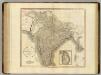
MAGNI | MOGOLIS | IMPERIVM.
[Amsterdam : Joan Blaeu]

Magni Mogolis Imperium [Karte], in: Theatrum orbis terrarum, sive, Atlas novus, Bd. 2, S. 253.
1 Karte aus Atlas Blaeu, Joan Blaeu, Willem Janszoon
Magni Mogolis Imperium [Karte], in: Novus Atlas, das ist, Weltbeschreibung, Bd. 2, S. 266.
1 Karte aus Atlas Blaeu, Joan Blaeu, Willem Janszoon
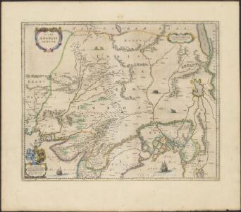
Magni Mogolis imperivm
1 : 6900000 Annotatie: Met opdracht door Joh. en Corn. Blaeu aan Johannes Huydekoper; Origineel is Blad 187 in atlas factice; Annotatie geografische gegevens: Met schaalstok: 45 Milliaria Germanica communia (=5 cm) Joan Blaeu 1597/98-1673; Cornelis Blaeu ca. 1610-1645 [Amsterdam : J. en C. Blaeu]
Magni Mogolis Imperium. [Karte], in: Novus atlas absolutissimus, Bd. 6, S. 147.
1 Karte aus Atlas Janssonius Offizin
Tabula Asiae X. [Karte], in: Geographia universalis vetus et nova complectens Claudii Ptolemaei Alexandrini enarrationis libros VIII, S. 293.
1 Karte aus Atlas Münster, Sebastian [und Ptolemaeus, Claudius]
India North.
1 : 5448960 Stanford, Edward
134-135. India, Pakistan, Ceylon, Nepal, Political. The World Atlas.
1 : 7500000 USSR (Union of Soviet Socialist Republics).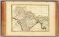
Indes I.
1 : 10000000 Bonne, Rigobert, 1727-1794
Magni Mogol infeniutus / J.F.V.E.
1 : 5000000 Essen, J. F. van [Antwerpen : J.F.V.E.]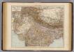
India North.
1 : 6000000 Andree, Richard; Times (London, England)
Imperii magni Mogolis sive Indici Padschach, juxta recentißimas navigationes accurata delineatio geographica
Indie Seutter, Matthäus Seutter, Albrecht Carl sumtibus Matth. Seutteri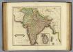
Hindostan.
1 : 8500000 Lizars, Daniel
Map of High Asia
Hindoostan, Ceylon.
1 : 6900000 Cary, John, ca. 1754-1835
Nord-Indien
1 : 4000000 Indie severní War Office
Hindoostan or India.
1 : 20000000 Seaman, James V.
India.
1 : 9000000 Colton, G.W.
Hindoostan or British India.
1 : 9000000 Colton, G.W.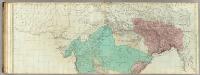
The East Indies, with the roads (northern section).
1 : 2600000 Jefferys, Thomas
Hindoostan.
1 : 12672000 Lucas, Fielding Jr.
Hindoostan.
1 : 15000000 Arrowsmith, Aaron
Hindoostan.
1 : 15000000 Arrowsmith, Aaron
Hindoostan.
1 : 7100000 Thomson, John
Hindoostan or British India.
1 : 9000000 Colton, G.W.
Vorder-Indien
Atlas der evangelischen Missions-Gesellschaft zu Basel Locher; Gross, Rudolf Im Verlag des Comptoires der evangelischen Missions-Gesellschaft
Hindostan Or British India.
1 : 9000000 Colton, G.W.
Vorder Indien
Bhútán Steinhauser, Anton Artaria