Maps of Renfrewshire

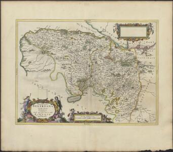
PRÆFECTURA | RENFROANA | Vulgo dicta | BARONIA | THE BARONIE OF | RENFROW
Timotheus Pont Auctor. [Amsterdam : Joan Blaeu]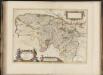
Praefectura Renfroana, vulgo, dicta Baronia. The Baronie of Renfrow / Timotheus Pont Auctor.
Pont, Timothy, 1560?-1614? Blaeu, Joan, 1596-1673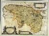
Præfectura Renfroana vulgo dicta Baronia
1 Karte : Kupferdruck ; 38 x 52 cm Blaeu; Pont Joan Blaeu
Glasgow (72) - OS One-Inch map
1 : 63360 Topographic maps Ordnance Survey Ordnance Survey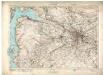
Glasgow (72) - OS One-Inch map
1 : 63360 Topographic maps Ordnance Survey Ordnance Survey
Renfrew Shire.
Thomson, John, 1777- ca. 1840
Map of the County of Renfrew.
Ainslie, John, 1745-1828
Map of the County of Renfrew.
Ainslie, John, 1745-1828
Cvninghamia
1 Karte : Kupferdruck ; 41 x 54 cm Blaeu; Pont Joan Blaeu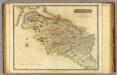
Renfrew-Shire.
1 : 73000 Thomson, John
The Shire of Renfrew with Cuningham [i.e. Cunningham]. The North Part of Air [i.e. Ayr] / by H. Moll.
Moll, Herman, d. 1732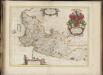
Cuninghamia / ex schedis Timotheo Pont ; Ioannis Blaeu excudebat. Cunningham.
Pont, Timothy, 1560?-1614? Blaeu, Joan, 1596-1673
Glasgow - OS One-Inch map
1 : 63360 Topographic maps Ordnance Survey Ordnance Survey
Glasgow - OS One-Inch map
1 : 63360 Topographic maps Ordnance Survey Ordnance Survey
Glasgow - OS One-Inch map
1 : 63360 Topographic maps Ordnance Survey Ordnance Survey
Volume 1: Sheet 30 - Glasgow
1 : 63360 Farquharson, J.
Map of the town of Glasgow & country seven miles around.
Richardson, Thomas, fl. 1772-1829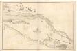
River Clyde from Dumbarton to Glasgow.
Great Britain. Hydrographic Office
Plan of Glasgow - Bartholomew's 'Survey Atlas of Scotland'
1 : 25000 Topographic maps John Bartholomew & Son, Ltd John Bartholomew & Son, Ltd
NS26 - OS 1:25,000 Provisional Series Map
1 : 25000 Topographic maps Ordnance Survey Ordnance Survey
NS25 - OS 1:25,000 Provisional Series Map
1 : 25000 Topographic maps Ordnance Survey Ordnance Survey
NS36 - OS 1:25,000 Provisional Series Map
1 : 25000 Topographic maps Ordnance Survey Ordnance Survey
NS35 - OS 1:25,000 Provisional Series Map
1 : 25000 Topographic maps Ordnance Survey Ordnance Survey
NS46 - OS 1:25,000 Provisional Series Map
1 : 25000 Topographic maps Ordnance Survey Ordnance Survey
NS45 - OS 1:25,000 Provisional Series Map
1 : 25000 Topographic maps Ordnance Survey Ordnance Survey
NS56 - OS 1:25,000 Provisional Series Map
1 : 25000 Topographic maps Ordnance Survey Ordnance Survey
NS55 - OS 1:25,000 Provisional Series Map
1 : 25000 Topographic maps Ordnance Survey Ordnance Survey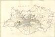
Glasgow
Great Britain. Parliament. House of Commons.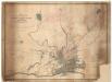
Map shewing...estate of Milton.
Kyle, Thomas, 1827?-1864
Map of the ten parishes within the Royalty... of Glasgow.
Cleland, James, 1770-1840 Smith, David, ca. 1803/4-1854
This map of the ten parishes within the Royalty and the parishes of Gorbals Barony of Glasgow.
Smith, David, fl. 1803-1854 Cleland, James, 1770-1840 Wood, John, ca. 1780-1847
Map of the City of Glasgow and suburbs.
Fleming, Peter, 1783-ca.1851
Map of the City of Glasgow and suburbs.
Fleming, Peter, 1783-ca.1851
Map of the City of Glasgow and suburbs.
Fleming, Peter, 1783-ca.1851
Map of the City of Glasgow and suburbs.
Fleming, Peter, 1783-ca.1851
Map of the City of Glasgow and suburbs.
Fleming, Peter, 1783-ca.1851