Maps of Ayr

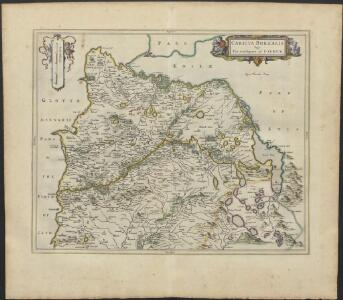
CARICTA BOREALIS | Vulgo | The northpart of CARRICK.
Opus Timothei Pont. [Amsterdam : Joan Blaeu]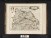
Caricta Borealis, vulgo, The northpart of Carrick / Opus Timothei Pont.
Pont, Timothy, 1560?-1614? Blaeu, Joan, 1596-1673
Caricta borealis vulgo the northpart of Carrick
1 Karte : Kupferdruck ; 41 x 51 cm Blaeu; Pont Joan Blaeu
Loch Doon (83) - OS One-Inch map
1 : 63360 Topographic maps Ordnance Survey Ordnance Survey
Loch Doon (83) - OS One-Inch map
1 : 63360 Topographic maps Ordnance Survey Ordnance Survey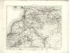
Ayr - OS One-Inch map
1 : 63360 Topographic maps Ordnance Survey Ordnance Survey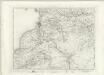
Ayr - OS One-Inch map
1 : 63360 Topographic maps Ordnance Survey Ordnance Survey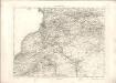
Ayr - OS One-Inch map
1 : 63360 Topographic maps Ordnance Survey Ordnance Survey
NS21 - OS 1:25,000 Provisional Series Map
1 : 25000 Topographic maps Ordnance Survey Ordnance Survey
NS20 & Parts of NS10 - OS 1:25,000 Provisional Series Map
1 : 25000 Topographic maps Ordnance Survey Ordnance Survey
NS31 - OS 1:25,000 Provisional Series Map
1 : 25000 Topographic maps Ordnance Survey Ordnance Survey
NX29 - OS 1:25,000 Provisional Series Map
1 : 25000 Topographic maps Ordnance Survey Ordnance Survey
NS30 - OS 1:25,000 Provisional Series Map
1 : 25000 Topographic maps Ordnance Survey Ordnance Survey
NS41 - OS 1:25,000 Provisional Series Map
1 : 25000 Topographic maps Ordnance Survey Ordnance Survey
NX39 - OS 1:25,000 Provisional Series Map
1 : 25000 Topographic maps Ordnance Survey Ordnance Survey
NS40 - OS 1:25,000 Provisional Series Map
1 : 25000 Topographic maps Ordnance Survey Ordnance Survey
NX49 - OS 1:25,000 Provisional Series Map
1 : 25000 Topographic maps Ordnance Survey Ordnance Survey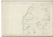
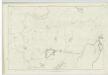
Ayrshire, Sheet XXXVIII - OS 6 Inch map
1 : 10560 Topographic maps Ordnance Survey Ordnance Survey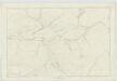
Ayrshire, Sheet LVII - OS 6 Inch map
1 : 10560 Topographic maps Ordnance Survey Ordnance Survey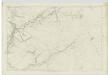
Ayrshire, Sheet LXII - OS 6 Inch map
1 : 10560 Topographic maps Ordnance Survey Ordnance Survey
Kirkcudbrightshire, Sheet 1 - OS 6 Inch map
1 : 10560 Topographic maps Ordnance Survey Ordnance Survey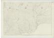
Ayrshire, Sheet LXIII - OS 6 Inch map
1 : 10560 Topographic maps Ordnance Survey Ordnance Survey
Kirkcudbrightshire, Sheet 7 - OS 6 Inch map
1 : 10560 Topographic maps Ordnance Survey Ordnance Survey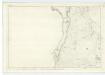
Kirkcudbrightshire, Sheet 4 - OS 6 Inch map
1 : 10560 Topographic maps Ordnance Survey Ordnance Survey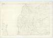
Kirkcudbrightshire, Sheet 8 - OS 6 Inch map
1 : 10560 Topographic maps Ordnance Survey Ordnance Survey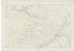
Ayrshire, Sheet LVI - OS 6 Inch map
1 : 10560 Topographic maps Ordnance Survey Ordnance Survey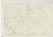
Ayrshire, Sheet XL - OS 6 Inch map
1 : 10560 Topographic maps Ordnance Survey Ordnance Survey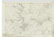
Ayrshire, Sheet XXXIX - OS 6 Inch map
1 : 10560 Topographic maps Ordnance Survey Ordnance Survey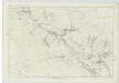
Ayrshire, Sheet XLVI - OS 6 Inch map
1 : 10560 Topographic maps Ordnance Survey Ordnance Survey