Maps of Uckermark

Maps of Uckermark

$title$

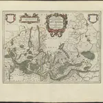
MARCHIONATUS | BRANDENBURGICI | PARTES DUÆ, | NOVA MARCHIA | et | UCKERANA

Auctore | OLAO JOANNIS GOTHO | Gustaui Magni Cosmographo. [Amsterdam : Joan Blaeu]
$title$

Mapa Wojewodztwa Szczecinskiego

$title$

Marchia nova Vulgo New Marck in March: Brandenburg

1 : 470000 Mollova mapová sbírka Schenk, Pieter Schenk, Peter I
$title$

Marchionatus Brandenburgici Partes Duae Nova Marchia et Uckerana

1 : 420000 Mollova mapová sbírka Örnehufvud, Olof Hansson Covens, Johannes I
$title$

$title$

Theatrum belli in Pomerania Citeriori

1 : 140000 Mollova mapová sbírka
$title$

$title$

$title$

$title$

Abbildung der sehr grossen und blutigen Feldschlacht, welche am 25. August 1758 bei Zorndorf, ohnweit Cüstrin, zwischen der König. Preussischen Armée, unter Se. Königl. Maj. Höchsteigener Anführung, und der Russischen, unter Commando des Generals von Fermor, vorgefallen. bei welcher Se. König. Maj. abermal einen vollkommenen Sieg erfochten, ohnerachtet der grossen Überlegenheit der Feinde, sowol an Mannschaft als Geschütze, und der vorteilhaften Stellung, welche sie zwischen Wäldern und Morästen genommen

$title$

$title$

Der Soldinsche Creis

1 : 296000 Myślibórz (Polsko) Sotzmann, Daniel Friedrich Glassbach, Carl Christian
$title$

$title$

$title$

Der Arenswaldische Creis

1 : 290000 Sotzmann, Daniel Friedrich
$title$

Insulae Et Principatus Rugiae cum vicinis Pomeraniae Littoribus Nova Tabula

1 : 210000 Mollova mapová sbírka Homann, Johann Baptista - dědici
$title$

Eigentliche Abbildung der Pomerischen Insul Rügen : Auf welcher die Dänen und Allűrte, von den Schweden auß Stralsund unversehens überfallen, eine gäntzliche Niederlag erlitten, und dadurch die ganze Insul den Schweden wieder raumen müssen. Geschehen Dienstag den 8. 18. Januarÿ Anno 1678

1 : 185000 Mollova mapová sbírka
$title$

Der Nieder-Barnimsche Creis

1 : 302000 Braniborsko (Německo) Oesfeld, Karl Ludwig von Glassbach, Carl Christian
$title$

Der Dramburgsche Creis

1 : 296000 Drawsko Pomorskie (Polsko) Sotzmann, Daniel Friedrich
$title$

Der Ober Barnimsche Creis

1 : 292000 Braniborsko (Německo) Oesfeld, Karl Ludwig von Jättnig, Karl
$title$

Composite: 217. Schwedt. (Germany)

1 : 100000 Reichsamt fur Landesaufnahme
$title$

Composite: 155. Politz. (Germany)

1 : 100000 Reichsamt fur Landesaufnahme
$title$

Composite: 156. Naugard. (Germany)

1 : 100000 Reichsamt fur Landesaufnahme
$title$

Composite: 154. Pasewalk. (Germany)

1 : 100000 Reichsamt fur Landesaufnahme
$title$

218. Gartz a. d. O. (Germany)

1 : 100000 Reichsamt fur Landesaufnahme
$title$

Composite: 245. Freienwalde.

1 : 100000 Reichsamt fur Landesaufnahme
$title$

188. Stargard a. d. Ihna. (Germany)

1 : 100000 Reichsamt fur Landesaufnahme
$title$

157. Labes. (Germany)

1 : 100000 Reichsamt fur Landesaufnahme
$title$

248. Friedeberg i. d. Neum.

1 : 100000 Reichsamt fur Landesaufnahme
$title$

186. Prenzlau. (Germany)

1 : 100000 Reichsamt fur Landesaufnahme
© MapTiler © OpenStreetMap contributors
How does it work?
These instructions will show you how to find historical maps online.
Getting started
Type the place name in the search box to find the exact location. You can further adjust the search by zooming in and out.
Zoom
Zoom in and out with the buttons or use your mouse or touchpad natively.
Exact Area tool
Click here and draw a rectangle over the map to precisely define the search area.
Set filters
Narrow your search with advanced settings, such as Years (from/to), Fulltext, Publisher, etc.
Results
See the results of your search on the right side. You can scroll down to find more maps of this location.
?

Download OldMapsOnline Mobile