Maps of Africa

[Historisch-geographischer Atlas zu den allgemeinen Geschichtswerken von C. v. Rotteck, Pölitz u. Becker] : Afrika Uebersichtsblatt für die Geschichte und die geographischen Entdeckungen
von Julius Loewenberg Lithographie von B. Herder in Freiburg im Breisgau [Freiburg im Breisgau] : [Herder]
Africa
Afrika Hase, Johann Matthias Dorn, Sebastian impensis Homannianorum Heredum
[Recto], uit: Africae nova tabula / auct. Henr. Hondio 1631
1 : 20000000 Annotatie: Afkomstig uit: Gerardi Mercatoris Atlas ou Representation du monde universel ... - Amsterodami : sumptibus ... Henrici Hondij, 1633, of uit: L'appendice de l'atlas de Gerard Mercator et Iudocus Hondius ... - Amsterdam : Henry Hondius, 1633, of uit een latere editie Hondius, Henricus [Amsterdam : Henr. Hondius]
Africae nova Tabula. [Karte], in: Novus atlas absolutissimus, Bd. 6, S. 156.
1 Karte aus Atlas Janssonius Offizin
Africae nova Tabula. [Karte], in: Gerardi Mercatoris et I. Hondii Newer Atlas, oder, Grosses Weltbuch, Bd. 1, S. 33.
1 Karte aus Atlas Mercator, Gerhard und Hondius, Jodocus Jansson, Jan
Africa
Afrika Hase, Johann Matthias Hauer, Daniel Adam impensis Homannianorum Heredum
Africa
Afrika Hase, Johann Matthias impensis Homannianorum Heredum
Afrika.
1 : 23500000 Stein, Christ. Gottfr. Dan.
Africa
1 : 29000000 Afrika Schmit, J. M. F. Tranquillo Mollo
Afrika
1 : 55500000 Afrika Merklas, Václav
AFRICÆ | nova descriptio
Auct: Guiljelmo Blaeuw [Amsterdam : Joan Blaeu]
Africa.
1 : 50000000 Seaman, James V.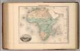
Afrique Physique.
1 : 29500000 Migeon, J.
Africa
1 : 18500000 entw. und gezeichnet von C. F. Weiland Weimar : Verlag des Geograph. Instituts
Africae noviss. cateres tabula
1 : 22200000 auct. J. Bormeester [Amsterdam] : [s.n.]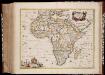
Africæ accurata tabula / ex officina Nic. Visscher
1 : 16000000 Annotatie: Met opdracht aan Gerard Schaep door N. Visscher; Kaart uitg. in de periode ca. 1680-ca. 1690; Origineel is Blad 201 in atlas factice Nicolaes Jansz. Visscher jr. 1649-1702 [Amsterdam : N. Visscher]
Totius Africae accuratissima tabula [...]
1 : 20000000 denuo correcte revisa, multis locis aucta, in partes tam maiores quam minores divisa per F. de Witt Amstel. [Amsterdam] : ex officina Cóvens et Mortier

L'Afrique en 1840.
1 : 40000000 Houze, Antoine Philippe
Afrika
Adolf Stieler's Handatlas über alle Theile der Erde und über das Weltgebäude Stieler, Adolf Justus Perthes
Africae Accurata Tabula [Karte], in: Novus atlas absolutissimus, Bd. 6, S. 159.
1 Karte aus Atlas Janssonius Offizin
[Kaart], uit: Karte von Afrika / entworfen von F. Handtke ; bearbeitet und ergänzt im kartographischen Institut der Verlagshandlung
1 : 14500000 titelvariant: General-Karte von Afrika; Annotatie: Omslagtitel: General-Karte von Afrika; Annotatie geografische gegevens: Schaalstokken; Inzetkrt.: Das Deutsche Reich. - 1.14.500.000; Das mittlere Ost-Afrika. - 1.6.000.000. - Zum Vergleich: [Kgr. Sachsen] (elfde schaal); I. Lüderitz-Land (der südliche Theil von Deutsch-Südwestafrika, II. Das Kamerun-Gebiet, III. Togo-Gebiet und Sklavenküste (alle 1:3.000.000). - [Zum Vergleich:] Das Königr. Sachsen (zelfde schaal) Verlag von Carl Flemming, Glogau. Kartographisches Institut Glogau : Carl Flemming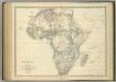
Africa.
1 : 19008000 Johnston, Alexander Keith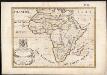
A new map of Africk, shewing its present general divisions chief cities, or towns, rivers, mountain &c.
1 : 25000000 Wells, Edward Sheldonian Theatre
Africa ex Magnae Orbis Terrae Descriptione
Rasciotti, Donato; Mazza, Giovanni Battista
Karte von Afrika nach den neuesten Forschungen : mit Angabe der wichtigsten Entdeckungswege
1 : 14250000 Lange, Henry, 1821-1893 Otto Purfürst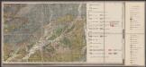
Nova Africae Tabula [Karte], in: Gerardi Mercatoris Atlas, sive, Cosmographicae meditationes de fabrica mundi et fabricati figura, S. 496.
1 Karte aus Atlas Mercator, Gerhard Montanus, Petrus
Afrika
1 : 52860000 Afrika
Africa
1 : 18000000 Afrika Weiland, Karl Ferdinand Mädel Geographisches Institut
![[Historisch-geographischer Atlas zu den allgemeinen Geschichtswerken von C. v. Rotteck, Pölitz u. Becker] : Afrika Uebersichtsblatt für die Geschichte und die geographischen Entdeckungen](https://images-2.georeferencer.com/images/iiif/557791382461/full/,300/0/native.jpg)

