Maps of Germany

[Historisch-geographischer Atlas zu den allgemeinen Geschichtswerken von C. v. Rotteck, Pölitz u. Becker] : Deutschland als Staatenbund seit dem Pariser Frieden 1814
von Julius Loewenberg Lithographie von B. Herder in Freiburg im Breisgau [Freiburg im Breisgau] : [Herder]
[Historisch-geographischer Atlas zu den allgemeinen Geschichtswerken von C. v. Rotteck, Pölitz u. Becker] : Deutschland als Rheinbund während der Napoleonischen Kaiserherrschaft
von Julius Loewenberg Lithographie von B. Herder in Freiburg im Breisgau [Freiburg im Breisgau] : [Herder]
Etats Secondaires de L'Allemagne.
Andriveau-Goujon, J.
Die Ältesten Karten von Deutschland

Duytsland in 9 Kraitzen of Circels Nevens de Keyserlyke Erflanden verdeelt
1 : 6900000 Mollova mapová sbírka Ottens, Reinier Ottens, Josua
Duytsland in 9 Kraitzen of Circels Nevens de Keyserlyke Erflanden verdeelt
1 : 6900000 Mollova mapová sbírka Schenk, Pieter Schenk, Peter II
Charte von Deutschland nach der neuesten Begränzung
Evropa střední J. Riedl's Kunsthandlung
Germany.
1 : 3651000 Fisher, Richard Swainson
L'Alemagne
1 : 2200000 Mollova mapová sbírka Placide de Sainte-Hélène Duval, Pierre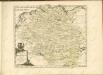

Eisenbahn Karte von Deutschland u. den angrenzenden Ländern
Evropa střední J.B. Hirschfeld
Composite: Germany.
1 : 1000000 John Bartholomew and Son
Germaniae atqve in Ea Locorvm Princip Aliorvm Mappa Critica
1 : 2500000 Mollova mapová sbírka Mayer, Tobias Homann, Johann Baptista - dědici
Carte des Havlte et Basse Allemagne
Evropa střední Langlois, N. N. Langlois
Post- und Eisenbahn- Karte von Deutschland
1 : 3800000 Evropa střední Wagner, Jan Eduard Kohl, Johann Georg Wagner u. Kohl
[Mitteleuropa]
Evropa střední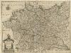
Novissima Germaniae Descriptio
1 : 3300000 Mollova mapová sbírka Le Roy, Henry
Germany.
1 : 6000000 Bowen, Frances
Charte von Teutschland: Nach dem definitiven Indemnisations-Plane vom 8ten October 1802
1 : 4100000 Landes-Industrie-Comptoir
Germany.
1 : 3674880 Johnson, A.J.
Germany.
1 : 7200000 Seaman, James V.
Kriegsschauplatz im Jahre 1813
Evropa střední Kunst und Industrie Comptoir
Carte de l'Empire d'Alemagne
1 : 2900000 Mollova mapová sbírka Duval, Pierre Duval, Pierre
Rheinbund 10. Januar 1810
Deutschland Rheinbund Kunz, Andreas ; Moeschl, Joachim Robert
Charte von Deutschland nach den besten Hülfsmitteln gezeichnet, dem Pariser Frieden erweitert und gemäss der Beschlüsse des Wiener Congresses begränzt
1 : 1750000 von Friedr. Wilh. Streit Nürnberg : Friedrich Campe
Deutschland u. Italien im früheren Mittelalter
Evropa střední R. Gaertner
Empire of Germany and the 13 Cantons of Switzerland.
1 : 2700000 Carey, Mathew
Empire of Germany with the 13 Cantons of Switzerland.
1 : 2700000 Carey, Mathew
Empire of Germany with the 13 Cantons of Switzerland.
1 : 2700000 Carey, Mathew
![[Historisch-geographischer Atlas zu den allgemeinen Geschichtswerken von C. v. Rotteck, Pölitz u. Becker] : Deutschland als Staatenbund seit dem Pariser Frieden 1814](https://images-2.georeferencer.com/images/iiif/818336326360/full/,300/0/native.jpg)

