Maps of Germany

[Neuer Atlas der ganzen Erde nach den neuesten Bestimmungen ... : XIV.] Gebirgs- und Gewaesser-Charte von Teutschland, oder der Teutsche Staaten-Bund
Entworfen und gezeichnet von Dr. F.W. Streit H. Leutemann sc. Leipzig : J.C. Hinrichs'sche Buchhandlung
Oro-hydrographische Charte von Deutschland und der Schweiz
1 : 2890000 Evropa střední Weiland, Karl Ferdinand
Deutschland
Geographischer Atlas über alle Theile der Erde Ziegler, Jakob Melchior Verlag von Dietrich Reimer
Deutschland.
1 : 2400000 Ziegler, J. M.
Germany.
1 : 3170000 Mitchell, Samuel Augustus
Germany.
1 : 3170000 Mitchell, Samuel Augustus
Germany.
1 : 3170000 Tanner, Henry S.
Oro-hydrographische Charte von Deutschland und der Schweiz : insbesondere zur Uebersicht der grossen topographisch-militairischen Charten von Deutschland in 217 und von der Schweiz in 24 Blättern
1 : 3000000 entworfen von C.F. Weiland Weimar : im Verlage des Geograph. Instituts
Deutschland
Geographischer Atlas über alle Theile der Erde Ziegler, Jakob Melchior Verlag von Joh. Wurster um Comp.
Neueste Karte von Deutschland, der Schweiz und Ober-Italien in 4 Blättern
1 : 1700000 Ravenstein, Ludwig Bibliographisches Institut
Karte von Deutschland
Grosser Hand-Atlas über alle Theile der Erde in 170 Karten Meyer, J. Verlag des Bibliographischen Instituts
Norddeutsche Bundesstaaten, Süddeutsche Bundesstaaten
Evropa střední
Germany Divided into Circles
1 : 6400000 Mollova mapová sbírka Moll, Herman Moll, Hermann
Deutschland.
1 : 3400000 Radefeld, Carl Christian Franz, 1788-1874
Carte de l'Empire d'Alemagne
1 : 2900000 Mollova mapová sbírka Duval, Pierre Duval, Pierre
Deutschland
1 : 2350000 Evropa střední Weiland, Karl Ferdinand Geographisches Institut
Deutschland
1 : 2350000 Evropa střední Weiland, Karl Ferdinand Geographisches Institut
Deutschland
1 : 2350000 Evropa střední Weiland, Karl Ferdinand Geographisches Institut
Germany, Switzerland, N. Italy.
1 : 5300000 Mitchell, Samuel Augustus
Neuste Post Karte von Deutschland und dessen angrenzenden Laender
Evropa střední Walch, Johann bey Ioh. Walch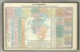
Tableau l'historie de la Confederation Germanique.
1 : 6200000 Duval, Henri
[Historisch-geographischer Atlas zu den allgemeinen Geschichtswerken von C. v. Rotteck, Pölitz u. Becker] : Deutschland zur Uebersicht nach seiner Kreiseintheilung
von Julius Loewenberg Lithographie von B. Herder in Freiburg im Breisgau 1839 [Freiburg im Breisgau] : [Herder]
Germany.
1 : 2429000 Johnson, A.J.

Deutschland, Niederlande, Belgien, Schweiz.
1 : 10000000 Brudin, J. L.; Stieler, Adolf
[Atlas zur Geschichte von Bayern] : Va. Die Besitzungen der Wittelsbacher im XIVt. Jahrhundert. Vb. Das Churfürstenthum Pfalz am Rheine und das Herzogthum Zweybrücken
K. v. Spruner W. Hase jun. sc. [Gotha : Perthes]

Deutschland.
1 : 2300000 Weiland, C. F. (Carl Ferdinand), d. 1847
Germany.
1 : 3674880 Johnson, A.J.
![[Neuer Atlas der ganzen Erde nach den neuesten Bestimmungen ... : XIV.] Gebirgs- und Gewaesser-Charte von Teutschland, oder der Teutsche Staaten-Bund](https://images-2.georeferencer.com/images/iiif/105412385266/full/,300/0/native.jpg)

