Maps of British Isles

Maps of British Isles

$title$

[Neuer Atlas der ganzen Erde nach den neuesten Bestimmungen ... : XI.] Die Britischen Inseln
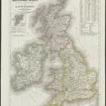
Entworfen und gezeichnet von Dr. F.W. Streit H. Leutemann sc. Leipzig : J.C. Hinrichs'sche Buchhandlung
$title$

British Isles (Political).

1 : 1900000 Johnston, W. & A.K.
$title$

$title$

Les Britannique.

1 : 2850000 Migeon, J.
$title$

Die Britischen Inseln oder die Vereinigten Königreiche

1 : 1850000 Normanské ostrovy Kiepert, Heinrich Gräf, C. Geographisches Institut
$title$

British Islands.

1 : 2300000 Morse, Jedidiah; Morse, Sidney E. (Sidney Edwards), 1794-1871
$title$

Brittannicae Insule ex Aevi Romani Monumentis. (1826)

1 : 3900000 Tanner, Henry S.
$title$

Novissima prae caeteris aliis accuratissima regnorum Angliae, Scotiae Hiberniaeq[ue] tabula

1 : 1850000 Irsko Wit, Frederick de F de Wit
$title$

Stereographical map, British Isles.

1 : 1600000 Stanford, Edward
$title$

Rainfall, temperature, British Isles.

1 : 6950000 Stanford, Edward
$title$

[Ethnographic Map of Great Britain and Ireland]

The physical atlas Johnston, Alexander Keith William Blackwood & Sons
$title$

British Islands.

1 : 4000000 Schonberg & Co.
$title$

British Isles.

1 : 3651000 Fisher, Richard Swainson
$title$

Iles Britanniques ou Royaume Uni de la Grand Bretagne et la l'Irland.

1 : 3300000 Monin, C.V.
$title$

Welká Britanie a Iry

$title$

Britische Inseln

Neuer Handatlas über alle Theile der Erde Kiepert, Heinrich Verlag von Dietrich Reimer
$title$

Charte der vereinigten Königreiche Grossbritanien und Irland

1 : 2900000 Irsko Kipferling, Karl Joseph Kunst ind Industrie Comptoir
$title$

Tabula novissima accuratissima regnorum Angliae, Scotiae Hiberniae

1 : 1850000 Irsko Seutter, Matthäus Mattheo Seutter
$title$

Iles Britanniques.

1 : 2500000 Brue, Adrien Hubert, 1786-1832
$title$

British Islands.

1 : 3400000 Greenleaf, Jeremiah
$title$

British Islands.

1 : 3484800 Greenleaf, Jeremiah
$title$

Iles Britanniques.

Andriveau-Goujon, J.
$title$

Welká Britanie a Iry

1 : 3400000 Irsko Merklas, Václav W. Merklas
$title$

Welká Británie a Iry

1 : 3360000 Irsko Merklas, Václav
$title$

British Empire.

1 : 3200000 Lavoisne, M.
$title$

The British Isles. (with) inset map of the Shetland Islands.

1 : 3801600 Tallis, J. & F.
$title$

Great Britain, Ireland.

1 : 5500000 Huntington, Nathaniel G. (Nathaniel Gilbert), 1785-1848
$title$

British Isles.

1 : 6200000 Worcester, Joseph E.
$title$

Tabula novissima accuratissima regnorum Angliæ, Scotiæ Hiberniæ

1 Karte : Kupferdruck ; 56 x 48 cm Lotter Tobias Konrad Lotter
$title$

Tabula novissima accuratissima regnorum Angliæ, Scotiæ Hiberniæ

1 Karte : Kupferdruck ; 57 x 48 cm Seutter Matthäus Seutter
$title$

Carte du gouvernement militaire d'Angleterre

1 Karte : Kupferdruck ; 16 x 15 cm, Bildgrösse 35 x 46 cm Châtelain s.n.
$title$

Nouvelle carte pour introduire a la geographie et a la genealogie des rois d'Angleterre et d'Ecosse

4 Karten auf 2 Blättern : Kupferdruck ; Bildgrösse 38 x 92 cm Châtelain s.n.
$title$

Insvlarvm britannicarvm acurata delineatio

1 Karte : Kupferdruck ; 37 x 49 cm Ortelius; Janssonius; Keere apud Ioannem Ianssonium
© MapTiler © OpenStreetMap contributors
How does it work?
These instructions will show you how to find historical maps online.
Getting started
Type the place name in the search box to find the exact location. You can further adjust the search by zooming in and out.
Zoom
Zoom in and out with the buttons or use your mouse or touchpad natively.
Exact Area tool
Click here and draw a rectangle over the map to precisely define the search area.
Set filters
Narrow your search with advanced settings, such as Years (from/to), Fulltext, Publisher, etc.
Results
See the results of your search on the right side. You can scroll down to find more maps of this location.
?

Download OldMapsOnline Mobile