Maps of Europe

[Geschichtlich-geographischer Atlas von Europa :] XIII. Karte von Europa in seinem jetzigen Zustande am Ende des Jahres 1832
entworfen und gezeichnet durch Ferd. Aug. v. Witzleben bei K. Kolbe gest. v. A. Heimburger [Berlin etc.] : [Mittler]
[Geschichtlich-geographischer Atlas von Europa :] VI. Karte von Europa beim Ende der Regierung Otto des Grossen im Jahre 973
entworfen und gezeichnet durch Ferd. Aug. v. Witzleben Gestochen bei K. Kolbe von August Heimburger [Berlin etc.] : [Mittler]
Europae [Karte], in: Theatrum orbis terrarum, S. 22.
1 Karte aus Atlas Ortelius, Abraham
Carte pittoresque & maritime de l'Europe : indiquant la division des Etats, les routes et chemins de fer ... / par A.M. Perrot ; revue et augm. par A. Vuillemin
1 : 5700000 Annotatie: Met afb. van de belangrijkste Europese steden en diverse kostuumfiguren; Annotatie geografische gegevens: Grenzen gekleurd Perrot, A. M.; Vuillemin, A. Paris : Fatout
Europa 1964
Europa Kunz, Andreas ; Moeschl, Joachim Robert
Europa gegen Ende von Justinians Regierung (um 560 n. Ch. G.)
1 : 15000000 Europa, Mittelmeerraum, Justinian I., Byzantinisches Reich, Kaiser
Europa 2003 [Blattschnitt bis zum Ural]
Europa Kunz, Andreas ; Moeschl, Joachim Robert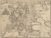
Europae [Karte], in: Theatrum orbis terrarum, S. 52.
1 Karte aus Atlas Ortelius, Abraham Vrients, Jan Baptista
Europa
1 : 10000000 entworfen und gezeichnet von C. F. Weiland Weimar : Verlag des Geograph. Instituts
[Geschichtlich-geographischer Atlas von Europa :] XII. Karte von Europa zur Zeit der grössten Ausdehnung des französischen Kaiserreichs im Jahre 1812
entworfen und gezeichnet durch Ferd. Aug. v. Witzleben bei K. Kolbe gest. v. A. Heimburger [Berlin etc.] : [Mittler]
Politický přehled Evropy

Europa während des Zeitraums der Reformation und der Übermacht des Hauses Habsburg 1492 - 1618
1 : 15000000 Europa

Eisenbahn- und Dampfschiffrouten-Karte von Europa
1 : 3000000 Franz, J. Druck und Verlag von Carl Flemming
Nieuwe kaart van Europa na de alderlaatste ondekking int licht gebracht, te Amsterdam by Isaak Tirion
1 : 18000000 Europa Tirion, Isaak, http://d-nb.info/gnd/1031543473
Europa im 18. Jahrhundert
Europa
Europa
Plastischer Schul-Atlas über alle Theile der Erde : in 24 Karten Woldermann, G Verlag von P. Eckerlein
Europa 1908
Europa Kunz, Andreas ; Röss, Wolf ; Moeschl, Joachim Robert
[Geschichtlich-geographischer Atlas von Europa :] VII. Karte von Europa beim Ende der Regierung Friedrichs des Rothbarts im Jahre 1190
entworfen und gezeichnet durch Ferd. Aug. v. Witzleben Gestochen bei K. Kolbe von August Heimburger [Berlin etc.] : [Mittler]
Europa beim Beginn der französischen Revolution. 1789
Europa Französische Revolution
Europa um 1740
1 : 15000000 Europa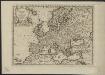
L'Europe, suivant les nouvelles observations de Messrs. de l'Academie Royale des Sciences, etc.
1 : 5100000 augmentées de nouveau Leyde : chez Pierre van der Aa
Accuratissima Europæ tabula
1 Karte : Kupferdruck ; 48 x 56 cm Danckerts Danckerts
Nova et accurata totius Europæ descriptio
1 Karte : Kupferdruck ; 47 x 56 cm Danckerts Danckerts
Accuratissima Europae tabula
1 : 10000000 1 Karte : Kupferdruck ; 48 x 56 cm Danckerts, Justus [Danckerts]
Carte générale orographique et hydrographique de l'Europe, qui montre les principales ramifications des montagnes, fleuves et chemins avec les principales villes
1 : 4600000 dressée d'aprés les meilleures cartes des auteurs les plus acredités par le Général Baron Sorriot de L'Host gravée par Joseph List. Vienne, [s.n.]
[Geschichtlich-geographischer Atlas von Europa :] VIII. Karte von Europa zur Zeit der Gelangung der Valois auf den Thron Frankreichs im Jahre 1328
entworfen und gezeichnet durch Ferd. Aug. v. Witzleben Gestochen bei K. Kolbe von Her. Herzberg [Berlin etc.] : [Mittler]
Kaart van oud Europa tot verstand van XXIste boek van den Geest der wetten [door den heere baron de Montesquieu]
1 : 8250000 J. C. de Roeder fec. et delin. J. van Jagen sculp. Amsterdam : bij Holtrop
[Europa]
Evropa
![[Geschichtlich-geographischer Atlas von Europa :] XIII. Karte von Europa in seinem jetzigen Zustande am Ende des Jahres 1832](https://images-2.georeferencer.com/images/iiif/950991901395/full/,300/0/native.jpg)

