Maps of Iran

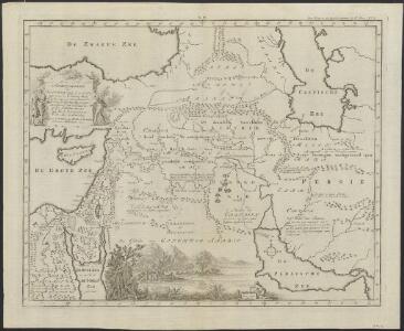
Afbeeldinge der Oostersche landen waar in, zoo de X stammen Israëls, als de II overige van Juda; gedurende den tyd hunner ballingschap verkeert hebben : tot opheldering van dit gedeelte der gewyde geschiedenis
1 : 6000000 ontworpen door W.A. Bachiene J. van Jagen mapp. sculpsit, et figur. apposit. sculpturam curavit ; S. Fokke fec. Uitgegeven te Gorinchem : by Nicolaas Goetzee
Tableau historique des Empires d'Assyrie, de Babylone.
1 : 23500000 Duval, Henri
L'Empire des Perses.
1 : 13000000 Houze, Antoine Philippe
Vorderasien, Persien.
1 : 10000000 Andree, Richard
Mappa dispersus filiorum Noemi
1 : 10670000 Malá Asie Bonne, Rigobert André
Greece, Turkey, Persia, India.
Cornell, S. S. (Sarah S.)
Asia Minor, Persia.
1 : 10000000 Andree, Richard; Times (London, England)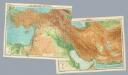
Composite: Near East.
1 : 4000000 John Bartholomew and Son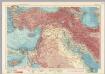
Middle East. Pergamon World Atlas.
1 : 5000000 Polish Army Topography Service
Tabula Asiae IIII. [Karte], in: Claud. Ptolemaeus. Geographia lat. cum mappis [...], S. 305.
1 Karte aus Atlas Münster, Sebastian [und Ptolemaeus, Claudius]
Asia occidental I
1 mapa. Datat al s.XIX. 0 Gras y compañia, editores. Madrid
Regna Lydium, Medicum, Babylonium etc.
Mesopotamien Antike
Tableau historique de l'Histore Sacree.
1 : 13800000 Duval, Henri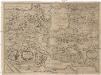
Nova delineato Persiae et confiniorvm
perská říše Olearius, Adam Rothgiesser, Christian Lorenzen

Tabula Asiae IIII. [Karte], in: Geographia universalis vetus et nova complectens Claudii Ptolemaei Alexandrini enarrationis libros VIII, S. 275.
1 Karte aus Atlas Münster, Sebastian [und Ptolemaeus, Claudius]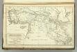
Countries Situated between Shiraz and Constantinople.
1 : 6000000 Melish, John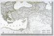
Carte d'Europe ou sont tracées les limites des empires, royaumes, et etats souverains, feuille 6
1 Blatt : 63 x 93 cm Semen etc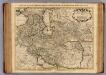
Carte de Perse.
1 : 5300000 L'Isle, Guillaume de, 1675-1726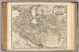
Carte de Perse.
1 : 5300000 L'Isle, Guillaume de, 1675-1726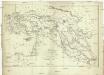
Carte de l'Asie Mineure, de l'Armenie et du Kourdistan
1 : 4000000 Arménie Kinneir, John Makdonald Aubert
Tercia Asie Tabula [Karte], in: [Clavdii Ptholomei Cosmographi ...], S. 305.
1 Karte aus Atlas Nicolaus Germanus [und Ptolemaeus, Claudius]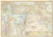
Lands of the bible today

Asie Anterieure.
1 : 5000000 Vivien St Martin, L.
Persis, Parthia, Armenia, etc.
1 : 14700000 Fenner, Rest.
Persis, Parthia, Armenia.
1 : 14600000 Fenner, Rest.
Vorderasien 600 v. Ch
Asie západní
Bible Lands and the cradle of western civilization
1 : 3000000 Jeruzalém National Geographic Society
Carte generale de toute l'Europe, 6
1 Blatt : 56 x 48 cm J.M. Will