Maps of Seven Seas (Open Ocean)
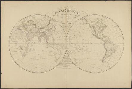
Mappemonde en deux hémisphères où sont tracées les lignes de faîte des grands bassins qui partagent la surface du globe
1 : 44000000 par L. Vivien gravé par Desbuisson [...] ; écrit par Arnoul Paris : Hachette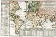
Carte des lieux où les differentes longueurs du pendule à secondes ont été observées
1 Karte : Kupferdruck ; 24 x 37 cm, Blattgrösse 46 x 61 cm Buache Philippe Buache
Objevy zemí na hranici středního a nového věku

Ocean Atlantique et Ocean Indien.
1 : 50000000 Vivien St Martin, L.
Orbis Terrarum Veteribus Cogniti Typus Geographicus. [Karte], in: Novus atlas absolutissimus, Bd. 10, S. 8.
1 Karte aus Atlas Janssonius Offizin
Mappe-Monde = Geo-Hydrographique, ou Descritption Generale Du Globe Terrestre Et Aquatique En Deux-Plans-Hemispheres. [Karte], in: Atlas nouveau, contenant toutes les parties du monde [...], Bd. 1, S. 32.
1 Karte aus Atlas Sanson, Nicolas Jaillot, Alexis Hubert und Mortier, Pieter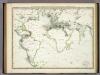
Die Vulkanischen Erscheinungen Der Atlen Welt.
1 : 65000000 Berghaus, Heinrich
Longueurs du pendule.
1 : 75000000 L'Isle, Guillaume de, 1675-1726

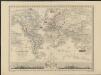
Inhabited World.
1 : 93000000 Woodbridge, William C.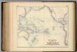
Oceania, or Islands in the Pacific Ocean.
1 : 41000000 Fullarton, A. & Co.
Atlas über die Entwicklung von Industrie und Handel der Schweiz in dem Zeitraume vom Jahr 1770 bis zum Jahr 1870
1 : 45000000 1 Atlas ([3], VIII Bl.) im Auftrage der schweizerischen Commission für die additionellen Ausstellungen in Wien, bearbeitet von Dr. Hermann Wartmann Wurster Randegger & Co., Winterthur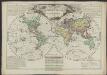
Mappemonde philosophique et politique, où sont tracés les voyages de Cook et de La Pérouse
1 : 62000000 par L. Brion, père [...] Paris : chez l’auteur
Pacific Ocean.
1 : 50000000 Letts, Son & Co.
Isothermal chart.
1 : 95000000 Woodbridge, William C.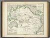
Karte vom Grossen Ocean, (Mare Pacifico).
1 : 90000000 Berghaus, Heinrich
Animals - World.
Woodbridge, William C.
Vorstellvng der in der Nacht zwischen den 8. u. 9. Aug; 1748
Mollova mapová sbírka Mayer, Tobias Homann, Johann Baptista - dědici
Die verfinsterte Erdkugel :
Mollova mapová sbírka Lowitz, Georg Moriz Schneider, Ruprecht Adam Homann, Johann Baptista - dědici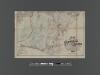
[Pocket] Map of the Borough of Queens, New York City.
From Queens
Westliche Halbkugel
Neuester Schul-Atlas Walch, Johann im Verlag bei Joh. Walch
Isothermal chart, productions.
1 : 80000000 Woodbridge, William C.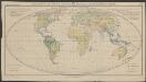
Verbreitung der wichtigsten Formationstypen der Erde
1 : 80000000 Schimper, Andreas Franz Wilhelm Gustav Fischer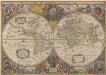
Nova Totius Terrarum Orbis Geographica Ac Hydrographica Tabula. [Karte], in: Novus atlas absolutissimus, Bd. 1, S. 14.
1 Karte aus Atlas Janssonius Offizin
Nova totius terrarum orbis tabula
1 : 80000000 auctore F. de Wit. t' Amsterdam : bij Frederick de Wit
Nova Totius Terrarum Orbis Gepgraphica Ac Hydrographica Tabula. [Karte], in: Gerardi Mercatoris et I. Hondii Newer Atlas, oder, Grosses Weltbuch, Bd. 1, S. 25.
1 Karte aus Atlas Mercator, Gerhard und Hondius, Jodocus Jansson, Jan
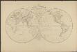
Planisphère terrestre
1 : 70000000 écrit par P. Rousset. Paris : J. Andriveau-Goujon, Éditeur, Rue du Bac, 21
Kaart der ontdekkingen gedaan door kapitein James Cook op zijne drie reistogten, met aanwijzing der koers van de schepen welke onder zijn bevel stonden
1 : 80000000 Van Baersel en Tuyn del. lithografie van R. de Vries Jr. ; naar het ontwerp van den Engelschen Luitenant ter Zee, H. Roberts [S.l.] : [s.n.]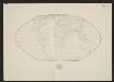
Umriszhandkarte der Erde in Eckerts flächentreuer Projektion
1 : 90000000 Wagner, H. Verlag von H. Wagner u. E. Debes