Maps of Arctic Ocean

Maps of Arctic Ocean

$title$

Nieuwe pascaart inhoudende 't noorder deel van Europa sijnde seer dienstigh voor de Groenlandse en Moskovise scheepvaart
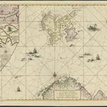
1 : 3500000 nieuwelijkx opgestelt door G. v. Keulen t'Amsterdam : bij Johannes van Keulen, Zeekaard Verkooper en Graad-boog maker Aande Oost Zijde vande Nieuwen Brugh Inde Gekroonde Lootsman
$title$

Nouvelle carte des isles de Spizbergue et des environs

1 Karte : Kupferdruck ; 40 x 55 cm Engel; Holzhalb Franz Samuel Fetscherin
$title$

Museumskart 150: Nieuwe zee-kaart van het noorder gedeelte van Europa

1 : 1000000 Johannes van Keulen
$title$

Museumskart 175: Kystkart over Nord-Norge, Russland og Spitsbergen

1 : 500000 Theunis Jacobsz | Pieter Goos
$title$

Pascaart vande Zee-Custen Van Finmarcken, Laplant, Ruslant, Nova Zembla en Spitsbergen [...] [Karte], in: Het vijfde Deel Des Grooten Atlas : Vervatende De Water-Weereld, S. 119.

1 Karte aus Atlas Jansson, Jan Jansson, Jan
$title$

Pascaart van de zee-custen van Ruslant, Laplant, Finmarcken, Spitsbergen en Nova-zemla

1 Karte : Kupferdruck ; 43 x 53 cm Doncker bÿ Hendrick Doncker inde Nieubrug steegh in't Stuurmans gereedtschap
$title$

Pascaart Vande Zee-Custen van Finnmarcken, Laplant, Ruslant, Nova Zembla en Spitzsbergen [...] Tabula Hydrographica [...] [Karte], in: Novus atlas absolutissimus, Bd. 9, S. 160.

1 Karte aus Atlas Janssonius Offizin
$title$

Nova Zembla, Waygats, Fretum Naßovicum, et Terra Samoiedum [...] [Karte], in: Het vijfde Deel Des Grooten Atlas : Vervatende De Water-Weereld, S. 126.

1 Karte aus Atlas Jansson, Jan Jansson, Jan
$title$

Spesielle kart nr 117-3: Geistlig inndelingskart over Norge

1 : 1000
$title$

Carte d'Europe ou sont tracées les limites des empires, royaumes, et etats souverains, feuille 1

1 Blatt : 63 x 96 cm Semen etc
$title$

The Chart of FINMARCK from Sanien to North-Kyn or North point

from The sea-atlas : containing an hydrographical description of most of the sea-coasts of the known parts of the world.
$title$

[127][130] Finmarchiae et Laplandiae Maritima ..., uit: Atlas sive Descriptio terrarum orbis

Annotatie: Gedigitaliseerde versie. Amsterdam. Heiloo : Picturae (vervaardiger), 2015. tiff-bestand. Gedigitaliseerd: 07-01-2015; Origineel: Universiteitsbibliotheek Vrije Universiteit (XL.05127.-) ; Netherlands; Titelpagina ontbreekt Wit, Frederik de Amsterdam : Frederick de Wit
$title$

Museumskart 178: Sjøkart over Norskehavet

1 : 1000000
$title$

Finmarchiæ et Laplandiæ maritima

1 Karte : Kupferdruck ; 49 x 55 cm Renard Louis Renard
$title$

Nova Zemla : Waygats, Fretum Nassovicum, et Terra Samoiedum singula omnium emendatissimè descripta

1 : 2000000 Annotatie: Paskaart; Origineel is Blad 150 in atlas factice; Annotatie geografische gegevens: [Glijdende] schaalvermelding op kaart: 28 Milliaria Germanica, pro latitudinis gradu [66o-78o]=4,2-7,5 cm [Amstelodamum] : [Apud Ioannem Ianßonium]
$title$

Russia 1.

1 : 4435200 Letts, Son & Co.
$title$

Feuille 5 (E I), uit: Carte géologique internationale de l'Europe : la carte, votée au congrès géologique international de Bologne en 1881, est exécutée conformément aux décisions d'une commission internationale, avec le concours des gouvernements, sous le dir. de M.M. Beyrich et Hauchecorne

Annotatie: Blad 48 gamme des couleurs; blad 49: bladwijzer en titelblad Heinrich Ernst Beyrich 1815-1896; Wi. Hauchecorne Berlin : Reimer / (Berlin: Institut lithographique)
$title$

Spesielle kart nr 67: Norges Inndeling i Lægedistrikter

1 : 1600000 Det private Opmaalingskontor
$title$

Nördliches Eismeer Häfen in der Barentsee

Barentsovo moře Reichs-Marine-Amt
$title$

Spesielle kart nr 70b: Norges arktiske Gebet

1 : 1500000 Norges Geografiske Opmaaling
$title$

[III], uit: Geognostische Karte des Oesterreichischen Kaiserstaates mit einem grossen Theile Deutschland's u. Italien / hauptsachlich nach ... Haidinger's geognostischer Karte dieses Staates bearb. von Josef Scheda

1 : 3000000 titelvariant: General-Karte von Europa in 25 Blättern; Annotatie: Bijlage bij: General-Karte von Europa in 25 Blättern. - 1:2.592.000. - 1845-1847 Scheda, Joseph Wien : K.K. Militär. Geografisch. Institut
$title$

Spesielle kart nr 70c: Norges arktiske Gebet

1 : 1500000 Norges Geografiske Opmaaling
$title$

Finnmarchiae et Laplandiae Maritima

$title$

Spesielle kart 83: Spitzbergen og Jan Mayen, Swedisch ekspedition

A. E. Nordenskiöld | N. Dunèr
$title$

Statistikk kart 1-3: C. W. Bergs Folkemængdekart over Norge. Nordlige del

1 : 1600000 H. Krug | Broch | C. W. Berg
$title$

Geologisk kart 51- Berggrunnskart over Norge

1 : 1000000 Johannes A. Dons | O. Holtedahl Norges geologiske undersøkelse
$title$

Spesielle kart nr 70d: Norges arktiske Gebet

1 : 1500000
$title$

Spesielle kart 173b: Oversiktskart over Nivellementer i Nord-Norge

1 : 100000
$title$

Feuille 4 (D I), uit: Carte géologique internationale de l'Europe : la carte, votée au congrès géologique international de Bologne en 1881, est exécutée conformément aux décisions d'une commission internationale, avec le concours des gouvernements, sous le dir. de M.M. Beyrich et Hauchecorne

Annotatie: Blad 48 gamme des couleurs; blad 49: bladwijzer en titelblad Heinrich Ernst Beyrich 1815-1896; Wi. Hauchecorne Berlin : Reimer / (Berlin: Institut lithographique)
$title$

Spesielle kart nr 70a: Plantegeografisk kart over Norges arktiske Gebet

1 : 1500000 Nordmann Norges Geografiske Opmaaling
© MapTiler © OpenStreetMap contributors
How does it work?
These instructions will show you how to find historical maps online.
Getting started
Type the place name in the search box to find the exact location. You can further adjust the search by zooming in and out.
Zoom
Zoom in and out with the buttons or use your mouse or touchpad natively.
Exact Area tool
Click here and draw a rectangle over the map to precisely define the search area.
Set filters
Narrow your search with advanced settings, such as Years (from/to), Fulltext, Publisher, etc.
Results
See the results of your search on the right side. You can scroll down to find more maps of this location.
?

Download OldMapsOnline Mobile