Maps of Uttarakhand
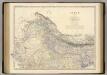
Spezial-Karte vom Himalaya in Kumaon, Gurhwal, Simur &c. &c.
1 : 600000 entworfen nach den astronomischen-trigonometrischen Vermessungen von W. S. Webb, J. A. Hodgson & J. D. Herbert [...] von H. Berghaus gest. von C. F. Wolff Gotha : Perthes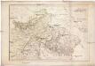
Spezial-Karte vom HIMALAYA in KUMAON, GURHWAL, SIRMUR &C. &C
1 : 600000 Himálaj (pohoří) Berghaus, Heinrich Karl Wilhelm Herbert, J. D. Justus Perthes
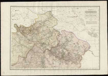
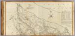
[Suharunpoor]
Indie Surveyor general's office
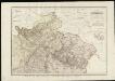
India 11.
1 : 2217600 Letts, Son & Co.
India XI.
1 : 2200000 Society for the Diffusion of Useful Knowledge (Great Britain)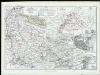
Die Missionsgebiete der Nordwest-Provinzen
(Delhi, Agrah, Oude, Ellahabad north)
1 : 750000 Dury, Andrew; Kitchin, Thomas; Rennell, James, 1742-1830; Robert Laurie & James Whittle
Uebersicht des gegenwärtigen Kriegsschauplatzes in Indien
1 : 1200000 [S.l.] : [s.n.]
Manasarowar
1 : 2500000 United States. Army Map Service. Army Map Service
Southern Asia series
1 : 2000000 Asie jižní Survey of India offices
Sheet B [Central & North India], uit: Road map of India
1 : 2027520 titelvariant: North West India; Central & North India; North East India; South India; Annotatie geografische gegevens: De bladen overlappen elkaar gedeeltelijk; Elk blad met bladoverzicht van de hele serie [S.l. : India Tyre & Rubber Company]
North-Western Provinces, Oudh, and Nepal.
1 : 3990000 W. & A.K. Johnston Limited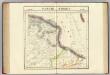
Partie du Thibet. Asie 68.
1 : 1641836 Vandermaelen, Philippe, 1795-1869
Central India.
1 : 3380000 Sharpe, J.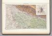
139. Upper Ganga (Ganges) Valley. Delhi. The World Atlas.
1 : 2500000 USSR (Union of Soviet Socialist Republics).
Der Sikh-Staat.
1 : 2200000 Flemming, Carl
India 9.
1 : 2217600 Letts, Son & Co.
India IX.
1 : 2200000 Society for the Diffusion of Useful Knowledge (Great Britain)
India 10.
1 : 2217600 Letts, Son & Co.
India X.
1 : 2200000 Society for the Diffusion of Useful Knowledge (Great Britain)
Composite: Delhi, Agrah, Oude, Ellahabad.
1 : 750000 Robert Laurie & James Whittle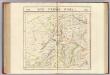
Pays d'Ajemeer, d'Agra. Asie 82.
1 : 1641836 Vandermaelen, Philippe, 1795-1869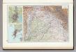
136. Punjab. Calcutta. Bombay. The World Atlas.
1 : 2500000 USSR (Union of Soviet Socialist Republics).
Charte von Süd Carolina
Jižní Karolína Rafn, Carl Christian Drayton, John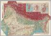
India - North. Pergamon World Atlas.
1 : 5000000 Polish Army Topography Service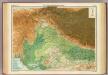
India - north-western section.
1 : 4000000 John Bartholomew & Co.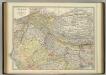
India (northern sheet).
1 : 4457000 Johnston, W. & A.K.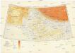
Karte von Europa und Westasien
1 : 4000000 Asie západní Ravensteins Geographische Verlagsanstalt und Druckerei
N. Hindostan.
1 : 4400000 Thomson, John