Maps of Siberia

Maps of Siberia

$title$

Tartarie septentrionale et orientale suivant Monsr. Witsen et les meilleures relations
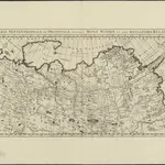
1 : 10000000 A Amsterdam : chez Jean Fred. Bernard
$title$

Atlas für Industrie- und Handelsgeographie: Für commercielle und technische Lehranstalten, für Kaufleute und Industrielle

$title$

An accurate map of the Russian empire both in Europe and Asia / Engraved for Guthries new System of

1 : 19000000 1 Karte : Kupferdruck ; 32 x 40 cm Dilly, Charles Published as the Act directs by C. Dilly & G. Robinson
$title$

Carte de la Sibérie et des pays voisins / par le Sr. Bellin Ing. de la Marine

1 : 14500000 1 Karte : Kupferdruck ; 27 x 44 cm Bellin, Jacques Nicolas [Bellin]
$title$

Carte de la Sibérie et des pays voisins / par le Sr. Bellin Ing. de la Marine

1 : 14500000 1 Karte : Kupferdruck ; 27 x 44 cm Bellin, Jacques Nicolas [Bellin]
$title$

Carte de la Sibérie et des pays voisins / par le Sr. Bellin Ing. de la Marine

1 : 14500000 1 Karte : Kupferdruck ; 27 x 44 cm Bellin, Jacques Nicolas [Bellin]
$title$

Carte generale des etats du Czar empereur de Moscovie, ou l'on voit ce que ce prince possede en Euro

1 : 9500000 1 Karte auf 2 Blatt : Kupferdruck ; 36 x 62 cm Châtelain, Zacharias L'Honore et Châtelain
$title$

Imperium Russicum

1 : 7600000 Rusko Doetsch, Johann Anton Hartl, Sebastian apud Sebastianum Hartl
$title$

Carte géographique contenant le royaume de Siberie

1 : 13000000 Asie střední Lotter, Matthäus Albrecht publiée par Tobie Conrad Lotter
$title$

A generall mapp of the Kingdome of Tartaria / designed by Monsieur Sanson, Geographer to the French

1 : 16000000 1 Karte : Kupferdruck ; 25 x 38 cm Sanson, Guillaume [Richard Blome]
$title$

Ethnographische Karte des Asiatischen Russlands

Russland Russland / Asiatischer Teil Ethnische Gruppe
$title$

Great Tartary.

1 : 26000000 Moll, Herman, d. 1732
$title$

CHARTE vom ASIATISCHEN RUSSLAND

Rusko východní
$title$

Charte vom Asiatischen Russland

Rusko východní
$title$

Asiatisches Rusland

Russland Russland / Asiatischer Teil
$title$

Uebersichts-Karte der ethnographischen Verhältnisse von Asien und von den angrenzenden Theilen Europa'sbearbeitet und herausgegeben mit Unterstützung der kaiserlichen Akademie der Wissenschaften in Wien von Vinzenz v. Haardt

Hartenthurn, Vincenz
$title$

General'naja karta azijatskoj časti Rossijskoj imperii

1 : 26000000 Rusko východní Korsakov, P.
$title$

Les états du czar ou empereur des russes en Europe et en Asie, avec les routes qu'on tient ordinair

1 : 9000000 1 Karte : Kupferdruck ; 42 x 65 cm Fer, Nicolas de chez I.F. Benard, gendre du S. de Fer
$title$

Tartaria sive Magni Chami imperivm

1 : 13000000 1 Karte : Kupferdruck ; 38 x 50 cm [Blaeu]
$title$

Tartaria sive Magni Chami imperiorum

1 : 14000000 1 Karte : Kupferdruck ; 25 x 33 cm Blaeu, Joan [Merian]
$title$

Tartaria sive Magni Chami imperiorum

1 : 14000000 1 Karte : Kupferdruck ; 25 x 33 cm Blaeu, Joan [Merian]
$title$

Nouvelle carte de Moscovie où sont representés les diferents etats de Sa Maiesté Czarienne en Eur

1 : 13000000 1 Karte : Kupferdruck ; 40 x 56 cm Châtelain, Zacharias [Verlag nicht ermittelbar]
$title$

Nouvelle carte de Moscovie où sont representés les diferents etats de Sa Maiesté Czarienne en Eur

1 : 13000000 1 Karte : Kupferdruck ; 40 x 56 cm Châtelain, Zacharias [Verlag nicht ermittelbar]
$title$

Carte de Tartarie / dressée sur les relations de plusieurs voyageurs de differentes nations et sur

1 : 11100000 1 Karte : Kupferdruck ; 47 x 60 cm L'Isle, Guillaume de chez I. Cóvens et C. Mortier
$title$

Carte de Tartarie / dressée sur les relations de plusieurs voyageurs de differentes nations et sur

1 : 11100000 1 Karte : Kupferdruck ; 47 x 60 cm L'Isle, Guillaume de chez I. Cóvens et C. Mortier
$title$

Russia asiatica

1 : 13000000 1 Karte : Kupferdruck ; 42 x 30 cm presso Antonio Zatta, e figli
$title$

Azijatskaja Rossija

1 : 10500000 Rusko východní
$title$

Russia alba, sive Moscovia / cura Gerardi et Leonardi Valk

1 : 6500000 1 Karte : Kupferdruck ; 46 x 58 cm Valck, Gerard [Valck]
$title$

$title$

Tartaria sive Magni Chami Imperium. [Karte], in: Theatrum orbis terrarum, sive, Atlas novus, Bd. 2, S. 264.

1 Karte aus Atlas Blaeu, Joan Blaeu, Willem Janszoon
© MapTiler © OpenStreetMap contributors
How does it work?
These instructions will show you how to find historical maps online.
Getting started
Type the place name in the search box to find the exact location. You can further adjust the search by zooming in and out.
Zoom
Zoom in and out with the buttons or use your mouse or touchpad natively.
Exact Area tool
Click here and draw a rectangle over the map to precisely define the search area.
Set filters
Narrow your search with advanced settings, such as Years (from/to), Fulltext, Publisher, etc.
Results
See the results of your search on the right side. You can scroll down to find more maps of this location.
?

Download OldMapsOnline Mobile