Maps of Como
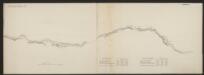
Larii Lacus vulgo Comensis descriptio : excurrit Larius a Meridie in Septentrionem, pronior tamen in Oriente
1 : 150000 auct. Paulo Jovio [S.l.] : [s.n.]
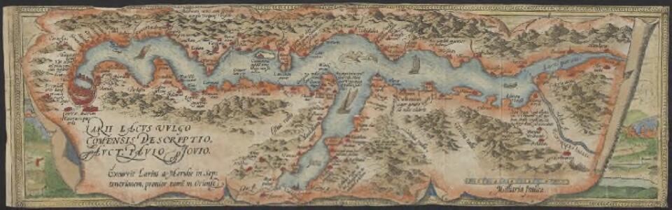
Larii Lacus Vulgo Comensis Descriptio [Karte], in: Theatrum orbis terrarum, S. 85.
1 Karte aus Atlas Ortelius, Abraham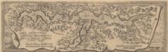
Larii Lacus Culgo Comensis Descirptio [Karte], in: Theatrum orbis terrarum, S. 309.
1 Karte aus Atlas Ortelius, Abraham Vrients, Jan Baptista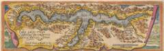
Larii Lacus Culgo Comensis Descirptio [Karte], in: Theatrum orbis terrarum, S. 214.
1 Karte aus Atlas Ortelius, Abraham
Parte alpeste dello stato di Milano
Mollova mapová sbírka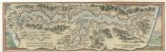
Larii Lacvs Uvlgo Comensis Descriptio
Mollova mapová sbírka Giovio, Paolo Coppens van Diest, Gillis
[Comer See und Umgebung]
1 : 256000 Alpy italské (pohoří)
Carte delle prealpi di Lecco
1 : 100000 Grassi
Blatt XXIV: Lugano, Como, uit: Topographische Karte der Schweiz / vermessen und hrsg. ... unter Aufsicht des Generals G.H. Dufour
1 : 100000 Annotatie: Met plaatsnamenregister (bl. V), bladwijzer (bl. XXI) en hoogteregister (bl. XXV); Voor aanwezige bladen zie overzichtsblad Dufour, G. H. [Bern : Eidg. Topogr. Bureau]
Topographische Karte der Schweiz
1 : 100000 25 Karten vermessen und hrsg. auf Befehl der Eidgenössischen Behörden ; aufgenommen unter der Aufsicht des Generals G.H. Dufour Eidg. Topographisches Bureau, [Genève], [später: Bern]
Larii lacvs vvlgo Comensis descriptio
3 Karten auf 1 Blatt : Kupferdruck ; zusammen 34 x 49 cm Giovio; Ortelius s.n.
Larii lacvs vvlgo Comensis descriptio
3 Karten auf 1 Blatt : Kupferdruck ; 34 x 49 cm Giovio; Ortelius s.n.
Carte delle valli del Liro e di Livio
1 : 50000 Grassi
Zu Bildner des Heeres Beilage 24
K.k. Schulbücher-Verschleiss-Administration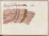
Gotthardbahnstrecke Erstfeld-Castione; geologische Übersichtskarten: Blatt X: Gebiet Claro-Castione
1 : 25000 Auftraggebung: Direktion der Gotthardbahn Stapff, F. M., einst Vorstand der geologisch-montanistischen Abteilung bei der Zentralbauleitung der Gotthardbahn Berliner lithogr. Institut, Berlin Druck: J. F. Starke, Berlin
Carte delle valli di Codera dei Ratti
1 : 50000 Grassi
Carta delle profondità del Ceresio o lago di Lugano
1 : 40000 Lavizzari, Luigi [Tip. e Lit. Cantonale]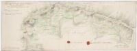
Strittige Grenze zwischen der Schweiz und dem Herzogtum Mailand bei Lugano, Brè, Cadro und Sonvico; Grundriss
1 : 8000 Mit 2 Siegeln. Portigliotti, Gaudenzo, Ingenieur; Caresana, Giuseppe, Ingenieur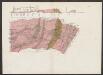
Geologische Uebersichtskarte der Gotthardbahnstrecke
1 : 25000 Blatt 10 Stapff, Friedrich Moritz [s.n.]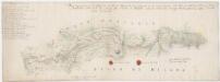
Strittige Grenze zwischen der Schweiz und dem Herzogtum Mailand bei Vacallo, Sagno, Morbio superiore, Caneggio, Bruzella, Schignano, Mezzena, Moltrasio, Rovena, Piazza und Masilianico; Grundriss
1 : 8000 Mit Legende und 2 Siegeln. Portigliotti, Gaudenzo, Ingenieur; Caresana, Giuseppe, Ingenieur
Strittige Grenze zwischen der Schweiz und dem Herzogtum Mailand bei Caprino, Gandria, Castagnola, Lugano, Rogno, Rovio, Rampogno, Lanzo und Sante Fedele; Grundriss
1 : 8000 Mit 2 Siegeln. Ohne Datumsangabe. Portigliotti, Gaudenzo, Ingenieur; Caresana, Giuseppe, Ingenieur
Strittige Grenze zwischen der Schweiz und dem Herzogtum Mailand bei Rovio, Castel San Pietro, Muggio, Cabbio, Bruzella, Caneggio, Sante Fedele, Erbon, Cerano, Casasco und Schignano; Grundriss
1 : 8000 Mit Legende und 2 Siegeln. Portigliotti, Gaudenzo, Ingenieur; Caresana, Giuseppe, Ingenieur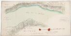
Strittige Grenze zwischen der Schweiz und dem Herzogtum Mailand bei Candria und Lugano; Grundriss
1 : 8000 Mit Legende und 2 Siegeln. Portigliotti, Gaudenzo, Ingenieur; Caresana, Giuseppe, Ingenieur
Strittige Grenze zwischen der Schweiz und dem Herzogtum Mailand bei Ponte Colla, Bogno, Certara, Sonvico, Cavargna und Sighebia; Grundriss
1 : 8000 Mit Legende und 2 Siegeln. Portigliotti, Gaudenzo, Ingenieur; Caresana, Giuseppe, Ingenieur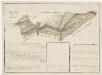
Grenze zwischen der Schweiz und dem Herzogtum Mailand bei Cabbio, Muggio, Cerano und Sante Fedele; Grundriss
1 : 8000 Mit Legende. Caresana, Giuseppe, Ingenieur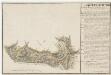
Grenze zwischen der Schweiz und dem Herzogtum Mailand bei Caneggio und Moltrasio; Grundriss
1 : 8000 Mit Legende. Caresana, Giuseppe, Ingenieur
Chiasso TI: Bach Faloppia zwischen Seseglio und Bresciano; Grundriss
Datumsangabe auf der Rückseite. Caresana, Giuseppe, Ingenieur, von Tureglia
Strittige Grenze zwischen der Schweiz und dem Herzogtum Mailand bei Bruzella, Caneggio und Moltrasio; Grundriss
1 : 8000 Mit Legende und 4 Siegeln. Portigliotti, Gaudenzo, Ingenieur; Caresana, Giuseppe, Ingenieur; Cozzi, G., Geom.
Strittige Grenze zwischen der Schweiz und dem Herzogtum Mailand bei Chiasso, Pedrinate, Novazzano, Monte Lompino, Caualasca, Parè, Drezzo und Ronago; Grundriss
1 : 8000 Mit Legende und 2 Siegeln. Portigliotti, Gaudenzo, Ingenieur; Caresana, Giuseppe, Ingenieur