Maps of Germany

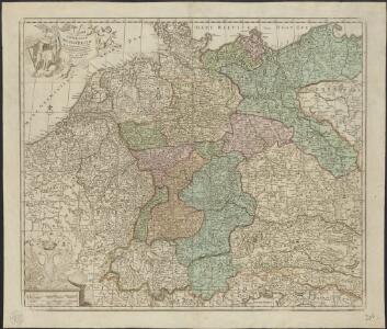
Germaniae vulgo Duitschland, tabula comprehendens accuratam X. circulorum Bohemiae Regni ac Universae Helvetiae descriptionem cum divisione in caeteras partes
1 : 2250000 per Ian Bt. Elwe Amstelodami : Ian Bt. Elwe
Homannův atlas světa
1 : 12500000
L Alemagna
1 : 7100000 Evropa střední Zatta, Antonio Zatta
[Historisch-geographischer Atlas zu den allgemeinen Geschichtswerken von C. v. Rotteck, Pölitz u. Becker] : Deutschland's frühere kirchliche Eintheilung
von J.V. Kutscheit Lithographie der Herderschen Verlags-Handlung zu Freiburg im Breisgau [Freiburg im Breisgau] : [Herder]
Imperium Romano-Germanicum in suos circulos electorat. et status accurate distinctum
1 : 2500000 Evropa střední Homann, Johann Baptist J. B. Homann
IMPERIUM ROMANO-GERMANICUM IN SUOS CIRCULOS DIVISUM Geographice exhibitum
1 : 2450000 Evropa střední Homann, Johann Baptist Hübner, Johann a Ioh. Baptista Homanno
Tabula Geographica Totius Germaniae
1 : 2400000 Homann, Johann Baptist
Neue Postkarte von Deutschland und einem Theile Frankreichs
Německo in Verlage der Schrämblischen Buchdruckerey
Hydrographia Germaniae
1 : 2400000 Mollova mapová sbírka Zollmann, Philipp Heinrich Homann, Johann Baptista - dědici
Hydrographica Germaniae Delineatio qua celebriorum Germaniae Fluvior Scaturigines, cursus et Ostia Oculis proponuntur
1 : 2500000 Mollova mapová sbírka Seutter, Matthäus Lotter, Tobias Conrad Seutter, Matthäus
Germania secundum observationes recentissimas in suos circulos divisa
1 : 2313000 Německo Walch, Johann Ioanes Walch
Germania secundum observationes recentissimas in suos circulos divisa
1 : 2313000 Německo Walch, Johann Ioanes Walch
S[anctum] Imperium Romano-Germanicum oder Teutschland Mit Seinen Angräntzenden Königreichen Und Provincien
Reichelt, Julius; Visscher, Nicolaes; Hogeboom, Andries
Imperii Romano-Germanici
1 : 2400000 Mollova mapová sbírka Schatz, Johann Jakob Homann, Johann Baptista - dědici
Imperii Romano-Germanici
1 : 2400000 Mollova mapová sbírka Schatz, Johann Jakob Homann, Johann Baptista - dědici
Imperium Romano-Germanicum
1 : 2400000 Mollova mapová sbírka Homann, Johann Baptist Homann, Johann Baptista - dědici
Imperium Romano-Germanicum
1 : 2400000 Mollova mapová sbírka Homann, Johann Baptist Homann, Johann Baptista - dědici
Neu vermehrte Post Charte durch gantz Teutschland nach Italien, Franckreich, Niederland, Preußen, Polen, und Ungarn &c.


Germania in Circulos Divisa
1 : 4300000 Mollova mapová sbírka Weigel, Christoph Weigel, Christoph I.
Neue Post-Karte von Teutschland zum altgemeinen Postbuch von Teutschland
1 : 2000000 Diez, Franz Maximilian 1761-1851 Berlin : C. Jack
L'Empire d'Allemagne
1 : 1200000 Mollova mapová sbírka Sanson, Guillaume Covens, Johannes I
[Recto], uit: Post- und Eisenbahn-Karte von Deutschland, den Niederlanden, Belgien und der Schweiz / bearb. nach L. Friedrich's Post-, Eisenbahn- & Reisekarte von Mittel-Europa
1 : 1800000 Annotatie: Ondertitel op omslag: Bis Calais & Paris, Rügen & Königsberg, Krakau & Pesth, Venedig & Grenoble Gotha : Perthes

Germaniae = L’empire d’Allemagne distingué suivant l’étendue de tous les estats, principautés et souverainetés qui passent ou qui ont passé jusque a present sous le nom d’Allemagne
1 : 900000 sur les memoires les plus nouveaux de Mss. Sanson, de L'Isle Iaillot, de Fer, &c. A Amsterdam : par I. Cóvens et C. Mortier

Neu vermehrte Post Charte durch gantz Teutschland nach Italien Franckreich Niederland Preussen Polen und Ungarn etc
1 Karte : Kupferdruck ; 44 x 55 cm Nell von Nellenberg; Homann Homaennische Erben?
Neu-vermehrte Post-Charte durch gantz Teutschland nach Italien, Franckreich, Niederland, Preussen, Polen und Ungarn etc
1 Karte : Kupferdruck ; 45 x 57 cm Nell von Nellenberg; Homann Johann Baptist Homann