Maps of Northern European Plain

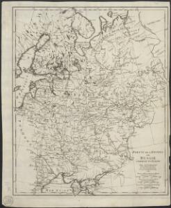
Partie de l'Empire de Russie comprise en Europe
1 : 6500000 par le Sr. d'Anville [S.l.] : [s.n.]
Russia in Europe.
1 : 12000000 Tanner, Henry S.

Russland von der Besiegung der Petschenegen durch die Polowzer und der Erweiterung der Nowgorodischen Republik nach Nordosten, um 1114 bis zur Zerstörung Kiew's durch die Tataren 1240
1 : 12000000 Weliki Nowgorod, Kiewer Reich
Carte de la partie européenne de l'empire de Russie, avec l'indication des chemins de poste, ainsi que des douanes frontières et de la repartition actuelle en gouvernements et districts
1 : 3000000
Ost-Europa
1 : 5000000 Evropa východní Fischer, R. Drei Kegel Verlag
Russia & Poland.
1 : 5639040 Arrowsmith, John
Russie d'Europe.
1 : 11000000 Monin, C.V.
Das Europaeische Russland
Russland / Europäischer Teil
Schematičeskaja karta uězdov evropejskoj Rossīi. Urožaja rži "sam " za 1885 g.
Russland Russland Landwirtschaft Statistik Petrovskij, A.N.
Russia in Europe general map.
1 : 9000000 Society for the Diffusion of Useful Knowledge (Great Britain)
Karte des Europaeischen Russlands
Neuester Schul-Atlas Walch, Johann im Verlag bei Joh. Walch
Ethnographische Übersichtskarte von Osteuropa
1 : 10000000 Russland Ukraine Ethnische Gruppe Kartogr. Anstalt G. Freytag & Berndt, Ges. m. b. H., Wien
Russia.
1 : 7000000 Hall, S. (Sidney)
Russia in Europe.
1 : 8400000 Sharpe, J.
Russland von der Verlegung des Russischen Grossfürstenthums nach Moskau 1328 und der Gründung des Grossfürstenthums Litauen bis zur Vernichtung der Goldenen Horde 1480
1 : 21000000 Moskauer Reich, Großfürstentum Litauen
Composite: Das Russische Reich in Europa.
1 : 4475000 Stein, Christ. Gottfr. Dan.
Das europaeische Russland
1 : 6588000 Rusko západní Weiland, Karl Ferdinand im Verlage des Geogr. Instituts
Russia, Poland.
1 : 5702400 Stanford, Edward
Karta želěznych dorog Rossijskoj imperiji
1 : 1200000 Moskva-oblast (Rusko) izdanije Kartografičeskago zavedenija A. Il'jina
Počtovaja karta rossijskoj imperii
1 : 3000000 Rusko západní Frolov
Schiffbare Flüsse u. Kanäle
Russland / Europäischer Teil Wasserstraße
Charte von dem europaischen Russland
1 : 9400000 Rusko západní Streit, Friedrich Wilhelm
Europäisches Russland
1 : 14500000 Russland / Europäischer Teil
Europäisches Russland

Sovětský svaz v mapách

Russia.
1 : 10000000 Colton, G.W.
[Neuer Atlas der ganzen Erde nach den neuesten Bestimmungen ... : XXII.] Charte von dem Europaeisch-Russischen Reiche
Entworfen u. gezeichnet von Dr. F.W. Streit H. Leutemann sc. Leipzig : J.C. Hinrichssche Buchhandlung
Russland von der Verlegung des Russischen Grossfürstenthums nach Moskau, 1328, und der Gründung des Grossfürstenthums Litthauen bis zur Vernichtung der Goldenen Horde, 1480
1 : 12000000 Großfürstentum Litauen, Moskauer Reich