Maps of Ukraine

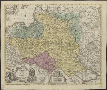
Mappa geographica ex novissimis observationibus repraesentans Regnum Poloniae et Magnum Ducatum Lithuaniae
1 : 2000000 cura et sumptibus Tobiae Conradi Lotter Aug[usta] Vind[elicorum] : sumptibus Tobiae Conradi Lotter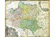
Mappa Geographica Regni Poloniae
Mayer, Tobias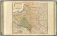
Poland, Prussia.
1 : 2300000 Faden, William, 1750?-1836
Poland: Density
1 : 3000000 Series of maps on various aspects of Poland. Density. Number of inhabitants per square kilometre. War Office
[Geschichtlich-geographische Entwickelung des Zuwachses und der Abnahme des polnischen Reiches vom Jahre 992 bis zum Jahre 1831, dargestellt in fünf Karten] : II. Karte von Polen unter dem Jagellonen, 1386-1572
1 : 4800000 entw. u. gez. durch F.A. von Witzleben [Berlin] : [Reimer]

Poland: Jews
1 : 3000000 Series of maps on various aspects of Poland. Distribution of Jewish minorities. War Office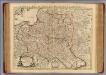
La Pologne.
1 : 2600000 L'Isle, Guillaume de, 1675-1726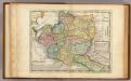
Poland.
1 : 6300000 Moll, Herman, d. 1732
Poland: Language. No.1
1 : 3000000 Series of maps on various aspects of Poland. Languages in 1910-1913. War Office
Poland: Lithuanians, Little Russians and Czechs
1 : 3000000 Series of maps on various aspects of Poland. Distribution of Lithuanians, Little Russians and Czechs, showing minorities. War Office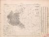
Poland: Poles
1 : 3000000 Series of maps on various aspects of Poland. Distribution of Poles showing minorities. War Office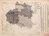
Poland: Language. No.2
1 : 3000000 Series of maps on various aspects of Poland. Distribution of languages according to various authorities. War Office
Nieuwe kaart van Polen
1 : 18000000 te Amsterdam : bij T. Crajenschot
Nieuwe kaart van Polen, Pruissen, Lithauwen, Koerland en Samogitie
1 : 5000000 [S.l.] : [s.n.]
Poland: Poles (excluding Jews)
1 : 3000000 Series of maps on various aspects of Poland. Poles (excluding Jews). Kingdom of Poland (1897) an Galicia (1900). Distribution of Poles, showing minorities. War Office
Mapa rozmieszczenia gleb na ziemiach polskich
1 : 6300000 Polen Geologie Arct, Michał
Mappa geographica regni Poloniae ex novissimis quot quot sunt mappis specialibus composita et ad LL. stereographica projectionis
1 : 2900000 Bělorusko Mayer, Tobias per Homannianos Heredes
Mapa rozmieszczenia bogactw kopalnych na ziemiach polskich
1 : 6300000 Polen Geologie Arct, Michał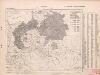
Poland: Germans and White Russians
1 : 3000000 Series of maps on various aspects of Poland. Poland. Germans and White Russians. Distribution of Germans and White Russians, showing minorities War Office
[Geschichtlich-geographische Entwickelung des Zuwachses und der Abnahme des polnischen Reiches vom Jahre 992 bis zum Jahre 1831, dargestellt in fünf Karten] : III. Karte von Polen von dem Aussterben der Jagellonen bis zur ersten Theilung, 1572-1772
1 : 4800000 entw. u. gez. durch F.A. von Witzleben [Berlin] : [Reimer]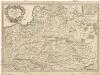
Estats de la couronne de Pologne
1 : 2600000 Evropa východní Sanson, Guillaume Cordier, Louis chez H. Jaillot
Polen nach dem Frieden von Oliva 1660
Polen Oliva / Friede
Bez titulu: soubor map pag. 245

Mappa geographica, ex novissimis observationibus repraesentans regnum Poloniae et magnum ducatum Lithuaniae
1 : 2700000 Bělorusko Lotter, Tobias Conrad
Mappa geographica, ex novissimis observationibus repraesentans regnum Poloniae et magnum ducatum Lithuaniae
1 : 2700000 Bělorusko Lotter, Tobias Conrad sumptibus Tobiae Conradi Lotter
Mappa geographica, ex novissimis observationibus repraesentans regnum Poloniae et magnum ducatum Lithuaniae
1 : 2700000 Bělorusko Lotter, Tobias Conrad sumptibus Tobiae Conradi Lotter
Mappa geographica, ex novissimis observationibus repraesentans regnum Poloniae et magnum ducatum Lithuaniae
1 : 2700000 Bělorusko Lotter, Tobias Conrad sumptibus Tobiae Conradi Lotter
Mappa geographica, ex novissimis observationibus repraesentans regnum Poloniae et magnum ducatum Lithuaniae
1 : 2700000 Bělorusko Lotter, Tobias Conrad sumptibus Tobiae Conradi Lotter