Maps of Lower Saxony

Demarcations-Linie welche Kraft dem am 17. May 1795 zwischen Frankreich und Preussen geschlossenen Vergleich bestimmt : wie weit die Franzosen disseits des Rheins in Deutschland vordringen dürffen
1 : 1300000 Augsburg : Johann Walch
West-Duitschland
1 : 840000 Annotatie: Notities in zwart en rood potlood met betrekking tot geallieerde troepenbewegingen eind 1944, begin 1945 [S.l] : [s.n]
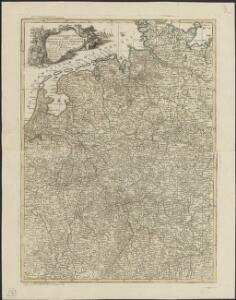
Nova Germaniae
1 : 3420000 Belgie
Royaume des Pays-Bas. Europe 13.
1 : 1641836 Vandermaelen, Philippe, 1795-1869
Westfront
1 : 1100000 [S.l. : s.n.]
Nouvelle carte geographique des postes des Pais Bas, de la Westphalie, & des provinces limitrophes
1 : 1
Die Herzogthuemer Saxonia und Lotharingia inferior; dann Thuringia, Osterland, Massia &c.
1 : 1900000 Spruner von Merz, Karl
Nordwestliches Deutschland, Niederlande und Belgien
1 : 3441000 Belgie Justus Perthes
D.O.M. Carte Generale Des Dixsept Provinces des Pays-Bas avec les Frontieres de France, d'Allemagne et Partie de l'Angleterre Nouvellement dreßée sur plusieur Momoires tirés sur les Lieux pendant les Guerres
1 : 750000 Mollova mapová sbírka Sengre, Henri Misson, François Maximilien
Nord-Westliches Deutschland, Niederlande und Belgien
Handatlas über alle Theile der Erde und über das Weltgebäude Stieler, Adolf Justus Perthes
Nord-Westliches Deutschland, Niederlande und Belgien
Hand-Atlas über alle Theile der Erde und über das Weltgebäude Stieler, Adolf Justus Perthes
Bojište [sic] 1870
Belgie Bedřich Sandtner
Nordwestliches Deutschland, Niederlande und Belgien
Schul-Atlas über alle Theile der Erde nach dem neuesten Zustande, und über das Weltgebäude Stieler, Adolf bei Justus Perthes
Nordwestliches Deutschland, Niederlande und Belgien
Schul-Atlas über alle Theile der Erde nach dem neuesten Zustande, und über das Weltgebäude Stieler, Adolf Justus Perthes
Totius FLUMINIS RHENI Novissima DESCRIPTIO
1 : 910000 Nizozemsko Visscher, Nicolaes Jansz. ex officina N. Visscher
Nord-Westliches Deutschland, Niederlande Und Belgien.
1 : 1850000 Vogel, C.
Nordwestliches Deutschland, Niederlande und Belgien

[Nordwestliches Deutschland, Kgr. der Niederlande, Kgr. Belgien]
Hand-Atlas über alle Theile der Erde nach dem neuesten Zustande und über das Weltgebäude Stieler, Adolf bei Justus Perthes
Allemagne occidentale.
1 : 1850000 Picquet, C.
Tabula generalis totius Belgii
1 : 1000000 Belgie Homann, Johann Baptist á Iohanne Baptista Homanno
TABULA GENERALIS TOTIUS BELGII qua PROVINCIAE XVII. INFER. GERMANIAE olim sub S.R.I. CIRCULO BURGUNDIAE
1 : 1100000 Belgie Homann, Johann Baptist â Iohanne Baptista Homanno
Tabula generalis totius Belgii
1 : 1000000 Belgie Homann, Johann Baptist á Iohanne Baptista Homanno
Tabula generalis totius Belgii
1 : 1000000 Belgie Homann, Johann Baptist â Iohanne Baptista Homanno
Operationen der alliirten und französischen Armee 1759

Nouvelle Carte du Royaume des Pays - Bas et Pays Limithropes...

Special-Karte der west-norddeutschen Bundesstaaten

Atlas für Handel und Industrie: Für Kaufleute, Fabrikante u. Gewerbetreibende, Handlungs- u. Gewerbe-Schulen

German Federal Republic. Pergamon World Atlas.
Polish Army Topography Service
[Nordwestliches Deutschland, Kgr. Der Niederlande, Kgr. Belgien]
Hand-Atlas über alle Theile der Erde nach dem neuesten Zustande und über das Weltgebäude Stieler, Adolf bei Justus Perthes