Maps of Europe
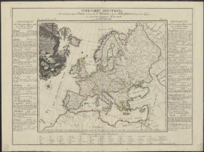
Neue Carte von Europa welche die merkwürdigsten Producte und vornehmsten Handelspläze nebst den Flächen-Inhalt aller Europäischen Länder in deutschen Quadrat-Meilen enthält
1 : 9000000 von A.F.W. Crome T.A. Pingeling sculpsit Hamburg Dessau ; [s.n.]
Europa delineata et recens edita per Nicolaum Visscher. [Karte], in: Novus atlas absolutissimus, Bd. 1, S. 28.
1 Karte aus Atlas Janssonius Offizin
Europa Exactissime Descripta [Karte], in: Novus atlas absolutissimus, Bd. 1, S. 25.
1 Karte aus Atlas Janssonius Offizin
Europa nach seinen kirchlichen Verhältnissen im Mittelalter
1 : 15000000 Europa Kirchengeschichte
Nova et accurate divisa in regna et regiones praecipuas Europae descriptio
1 : 10000000 per F. de Witt Amstelodami [Amsterdam] : ex officina I. Cóvens et C. Mortier
[Recto], uit: Europa exactissime descripta / auctore Henrico Hondio
1 : 11500000 Annotatie: Uit: L'appendice de l'atlas de Gerard Mercator et Iudocus Hondius ... - Amsterdam : Henry Hondius, 1633; Met opdracht aan Lodewijk XIII Hondius, Henricus Amstelodami : sumptibus auctoris
Europa
Neuester Schul-Atlas Walch, Johann im Verlag bei Joh. Walch
Europa Exactissime Descripta [Karte], in: Gerardi Mercatoris et I. Hondii Newer Atlas, oder, Grosses Weltbuch, Bd. 1, S. 30.
1 Karte aus Atlas Mercator, Gerhard und Hondius, Jodocus Jansson, Jan
Nouvelle carte de l'Europe dans son état actuel
Evropa Hérisson, Eustache Desray chez Desray
Nova Europae Descriptio [Karte], in: Gerardi Mercatoris Atlas, sive, Cosmographicae meditationes de fabrica mundi et fabricati figura, S. 64.
1 Karte aus Atlas Mercator, Gerhard Montanus, Petrus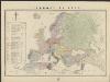
L'Europe en 1860
1 : 7800000 London : Edward Stanford
Carte demonstrative des determinations astronomiques de latitude et d'azimuth
1 : 10000000 Institut topographique militaire
Florenkarte von Europa
Atlas der Pflanzenverbreitung Drude, Oscar Justus Perthes
Europa
Allgemeiner Atlas [Walch, Johannes] im Verlag bei Johannes Walch
Europe : laid down from the observations of the Royal Academy of Sciences & compared with the maps of Sanson, Nolin, Du Fer, De l'Isle, Moll & other modern geographers ... / [John Bowles] ; engrav'd by Emanuel Bowen
1 : 4500000 Annotatie: Met tabel van Europese lengtematen; Met informatie over de verschillende Europese staten Bowles, John; Bowen, Emanuel London : printed for John Bowles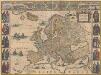
Europa recens descripta [Karte], in: Novus Atlas, das ist, Weltbeschreibung, Bd. 1, S. 22.
1 Karte aus Atlas Blaeu, Joan Blaeu, Willem Janszoon
Europa
Atlas der Pflanzengeographie über alle Theile der Erde Rudolphi, Ludwig Verlag der Nicolaischen Buchhandlung
Europa
1 Karte : Kupferdruck ; 45 x 53 cm Götze im Verlage des Geograph: Instituts
Europa
1 Karte : Kupferdruck ; 45 x 55 cm Götze im Verlage des Geograph. Instituts
Europa
1 Karte : Kupferdruck ; 46 x 54 cm Götze im Verlage des Geograph. Instituts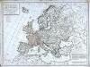
Carte politique de l'Europe
1 Karte : Kupferdruck ; 50 x 68 cm Poirson; Jean; Brion de la Tour chez Jean rue Jean de Beauvais no. 10
Carte politique hydrographique [et] routiere de l'Europe
1 Karte : Kupferdruck ; 48 x 54 cm Champion; Hinrichs chez J. C. Hinrichs libraire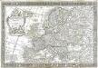
L'Europe
1 Karte : Kupferdruck ; 43 x 66 cm Nolin; Boniselle; Jean chez Jean rue Jean de Beauvais no. 32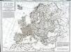
Carte politique de l'Europe
1 Karte : Kupferdruck ; 50 x 68 cm Poirson; Jean; Brion de la Tour chez Jean rue Jean de Beauvais no. 32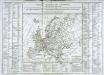
Tableau général de l'Europe
1 Karte : Kupferdruck ; 35 x 44 cm, Bildgrösse: 52 x 73 cm Brion de la Tour; Le Campion; Le Campion chés les Campion freres m.ds d'estampes rue St. Jacques près la f.e S. Severin à la ville de Rouen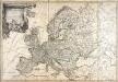
L'Europe
1 Karte : Kupferdruck ; 49 x 73 cm Brion de la Tour; Esnault; Rapilly chez Esnauts et Rapilly rue St. Jacques à la ville de Coutances
General Karte von Europa
1 Karte : Kupferdruck ; 50 x 58 cm von der kön. privileg: Schneider und Weigelschen Kunst und Buchhandlung
L'Europe dans son etat actuel
1 Karte : Kupferdruck ; 47 x 61 cm Hérisson; Desray; Glot; Picquet chez Desray libraire rue Hautefeuille no. 4, chez Picquet géog.he graveur du cab. topographique de S. M. l'empereur et roi et de S. M. le roi de Hollande quai Malaquais no. 15
Europa
E. von Sydow's Schul-Atlas in sechs und dreissig Karten Sydow, Emil von bei Justus Perthes