Maps of Europe

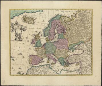
Nova et accurate divisa in regna et regiones praecipuas Europae descriptio
1 : 10000000 per F. de Witt Amstelodami [Amsterdam] : ex officina I. Cóvens et C. Mortier
Europa delineata et recens edita per Nicolaum Visscher. [Karte], in: Novus atlas absolutissimus, Bd. 1, S. 28.
1 Karte aus Atlas Janssonius Offizin
Europa nach seinen kirchlichen Verhältnissen im Mittelalter
1 : 15000000 Europa Kirchengeschichte
Neue Carte von Europa welche die merkwürdigsten Producte und vornehmsten Handelspläze nebst den Flächen-Inhalt aller Europäischen Länder in deutschen Quadrat-Meilen enthält
1 : 9000000 von A.F.W. Crome T.A. Pingeling sculpsit Hamburg Dessau ; [s.n.]
Nova Europae Descriptio [Karte], in: Gerardi Mercatoris Atlas, sive, Cosmographicae meditationes de fabrica mundi et fabricati figura, S. 64.
1 Karte aus Atlas Mercator, Gerhard Montanus, Petrus
Europa
Allgemeiner Atlas [Walch, Johannes] im Verlag bei Johannes Walch
Europa
1 Karte : Kupferdruck ; 45 x 53 cm Götze im Verlage des Geograph: Instituts
Europa
1 Karte : Kupferdruck ; 45 x 55 cm Götze im Verlage des Geograph. Instituts
Europa
1 Karte : Kupferdruck ; 46 x 54 cm Götze im Verlage des Geograph. Instituts
Carte politique de l'Europe
1 Karte : Kupferdruck ; 50 x 68 cm Poirson; Jean; Brion de la Tour chez Jean rue Jean de Beauvais no. 10
Carte politique hydrographique [et] routiere de l'Europe
1 Karte : Kupferdruck ; 48 x 54 cm Champion; Hinrichs chez J. C. Hinrichs libraire
L'Europe
1 Karte : Kupferdruck ; 43 x 66 cm Nolin; Boniselle; Jean chez Jean rue Jean de Beauvais no. 32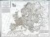
Carte politique de l'Europe
1 Karte : Kupferdruck ; 50 x 68 cm Poirson; Jean; Brion de la Tour chez Jean rue Jean de Beauvais no. 32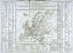
Tableau général de l'Europe
1 Karte : Kupferdruck ; 35 x 44 cm, Bildgrösse: 52 x 73 cm Brion de la Tour; Le Campion; Le Campion chés les Campion freres m.ds d'estampes rue St. Jacques près la f.e S. Severin à la ville de Rouen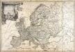
L'Europe
1 Karte : Kupferdruck ; 49 x 73 cm Brion de la Tour; Esnault; Rapilly chez Esnauts et Rapilly rue St. Jacques à la ville de Coutances
Carte demonstrative des determinations astronomiques de latitude et d'azimuth
1 : 10000000 Institut topographique militaire
Europa
Neuester Schul-Atlas Walch, Johann im Verlag bei Joh. Walch
Europa Exactissime Descripta [Karte], in: Novus atlas absolutissimus, Bd. 1, S. 25.
1 Karte aus Atlas Janssonius Offizin
General Karte von Europa
1 Karte : Kupferdruck ; 50 x 58 cm von der kön. privileg: Schneider und Weigelschen Kunst und Buchhandlung
L'Europe dans son etat actuel
1 Karte : Kupferdruck ; 47 x 61 cm Hérisson; Desray; Glot; Picquet chez Desray libraire rue Hautefeuille no. 4, chez Picquet géog.he graveur du cab. topographique de S. M. l'empereur et roi et de S. M. le roi de Hollande quai Malaquais no. 15
Karte von Europa und dem Mittelländischen Meere
1 : 4300000 Evropa Stülpnagel, Friedrich von Bär, Johann Christoph Justus Perthes
Karte von Europa und dem Mittelländischen Meere
1 : 4300000 Evropa Stülpnagel, Friedrich von Bär, Johann Christoph Justus Perthes
Europa
1 : 12000000 Evropa Kiepert, Heinrich Bishoff, C. Geographische Verlagshandlung Dietrich Reimer
Accuratissima Europæ tabula
1 Karte : Kupferdruck ; 49 x 58 cm Allard ex officina I. Cóvens et C. Mortier
Nova et accurate divisa in regna et regiones præcipuas Europæ descriptio
1 Karte : Kupferdruck ; 43 x 53 cm Wit ex officina I. Cóvens et C. Mortier
Europa excultissima
1 Karte : Kupferdruck ; 48 x 57 cm Schenk Pieter Schenk
Accuratissima Europæ tabula
1 Karte : Kupferdruck ; 48 x 57 cm Allard Carel Allard
Europa Exactissime Descripta [Karte], in: Gerardi Mercatoris et I. Hondii Newer Atlas, oder, Grosses Weltbuch, Bd. 1, S. 30.
1 Karte aus Atlas Mercator, Gerhard und Hondius, Jodocus Jansson, Jan
[Evropa]
Evropa