Maps of Bangka-Belitung Islands
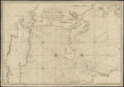
New chart of the straits of Sunda, Banca, Gaspar and Billiton
1 : 110000 drawn from the best authorities, by J. W. Norie, Hydrographer, &c. J. Stephenson, engraver London : Norie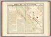
Partie, Sumatra. Oceanique no. 19.
1 : 1641836 Vandermaelen, Philippe, 1795-1869
[Kaart van Straat van Sunda]
[S.l. : s.n.
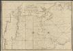
Palembang / Survey of India
Survey of India [S.l.] : Survey of India
Batavia / Topografische Inrichting
Topografische Dienst Batavia Batavia : Topografische Inrichting
Palembang / samengesteld en gedrukt bij den Topografischen Dienst
Topografische Dienst Batavia Batavia : Topografische Dienst
Batavia / Survey of India
Survey of India [S.l.] : Survey of India
[Geologische kaart van West-Java]
1 : 3500000 Annotatie: Concept voor atlas van C. Lekkerkerker?; Met doorsnede van de hoogste bergtoppen [S.l. : s.n.]
Banca and Gaspar straits (1958)
Banca and Gaspar Straits. Mintok Bay, etc. [Admiralty Chart]
West-Java : bijgewerkt tot 1 November 1935 / Reproductiebedrijf Topografische Dienst
Topografische Dienst Batavia Batavia : Topografische Dienst
Kaart van Straat Soenda : overgenomen van de Zeekaart van 1870 / get[ekend door] J.G. de Groot
Bruxelles : Institut National de Géographie
West-Java / Topografische Dienst
Topografische Dienst Batavia Batavia : Reproductiebedrijf Topografische Dienst
West-Java : met aanwijzing van de bevolkingsdichtheid per district volgens de uitkomsten der volkstelling in 1930
Topografische Dienst Batavia [Batavia : Topografische Dienst]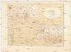
Kaart van Het Gedeelte Java en Sumatra
1 : 500000 Jáva (Indonésie) Eckstein, G. A. Gebroeders Van Cleef
Kaart van het Rijk van Bantam, Jacatra & Cheribon op het eiland Java / door Js. van den Bosch ; gegraveerd door C. van Baarsel en Zoon
C. van Baarsel en Zoon s-Gravenhage ; Amsterdam : Gebroeders van Cleef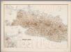
3. West Java, uit: Atlas van Nederlandsch Oost-Indië / samengest. door Topographisch Bureau te Batavia van 1897-1904
Annotatie: Omgewerkte versie van: Atlas der Nederlandsche bezittingen in Oost-Indië / naar de nieuste bronnen samengest. door J.W. Stemfoort en J.J. ten Siethoff. - 's-Gravenhage : Topographische Inrichting, [ca. 1885] Topographisch Bureau, Batavia 's-Gravenhage : Topographische Inrichting
Kaart van West-Java : Eerste militaire afdeeling / [door J.W Stemfoort en J.J. ten Siethoff ; gereproduceerd op last van het Departement van Koloniën, aan de Topographische Inrichting te 's-Gravenhage, onder leiding van den Directeur C.A. Eckstein]
Ministerie van Koloniën Den Haag s-Gravenhage : Departement van Koloniën
Geologische overzichtskaart van Bangka en Billiton
Amsterdam : Joh. G. Stemler
To Captain Krusenstern, of the Imperial Russian Navy, as a tribute for his laudable exertions to benefit navigation and maritime science
1 : 443750 this chart of the Strait of Sunda is inscribed by [...] James Horsburgh [London] : by James Horsburgh, hydrographer to the Hon.ble East India Co.
Djawa Barat
Bandung : 'Hovic' Visser
Pangkal Pinang / Survey of India
Survey of India [S.l.] : Survey of India
Belinjoe / Survey of India
Survey of India [S.l.] : Survey of India
Teloekbetoeng / Survey of India
Survey of India [S.l.] : Survey of India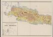
Geologische overzichtskaart van Java en Madoera
1 : 500000 West-Blatt Verbeek, R. D. M. Joh. G. Stemler Cz.
Kaart van den Archipel van Riouw, Singapore en Lingga [and] Kaart van de eilanden Bangka en Blitong
D. Heyse, graveur lith. te 's Hage ; gedr. bij P. Blommers te 's Hage te 's Hage : uitgave van K. Fuhri
A map of the island of Banca
1 : 200000 by M. H. Court R. Baily sculpt. London : Black, Kingsbury, Parbury & Allen
Overzichtskaart van de Residentie Lampoengsche Districten / Topografische Dienst
Topografische Dienst Weltevreden Weltevreden (Batavia) : Reproductiebedrijf Topografische Dienst
Marga-indeeling Residentie Lampongsche Districten
[S.l. : s.n.]
Kaart van den Riouw- en Lingga-Archipel / [J.W. Stemfoort en J.J. ten Siethoff ; gereproduceerd op last van het Departement van Koloniën, aan de Topographische Inrichting te 's-Gravenhage, onder leiding van den Directeur C.A. Eckstein]
Ministerie van Koloniën Den Haag s-Gravenhage : Departement van Koloniën