Maps of Netherlands

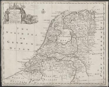
A new and correct map of the seven provinces : drawn from the most approved maps and charts : the whole being regulated by astronomical observations
1 : 920000 by Eman Bowen. [London] : Tyndal

Provinces Vnies de Pays Bas
1 : 861000 Nizozemsko

Belgii pars septentrionalis communi nomine vulgo Hollandia ... = Land caerte van ’t Verenigde Nederland met ’t gene daer onderhoort, verdeelt in syn provincien en minder verdelingen
1 : 800000 naaukeurig aangewesen en uyt de beste aantekeninge opgestelt. Ultrajecti : Cornelius Kribber
La republica Battava
1 : 2400000 Nizozemsko Zatta, Antonio Zatta
Belgii pars septentrionalis communi nomine vulgo Hollandia ...
1 : 640000 edente Petro Schenkio Amstelaedami : Petrus Schenkius
Provinces unies des Pays-Bas avec leurs acquisitions dans la Flandre, le Brabant, le Limbourg, et le Lyege et les places qu'elles tiennent sur le Rhin dans le Duché de Cleves, et dans l'Archevesché et Eslectorat de Cologne
1 : 700000 par G. Valck. À Amsterdam : chez G. Valck
Belgii Foederati Nova Descriptio. [Karte], in: Novus atlas absolutissimus, Bd. 3, S. 28.
1 Karte aus Atlas Janssonius Offizin
The Seven United Provinces of Holland, Groningen, Gelders, Friesland, Overyssel, Utrecht, and Zealand.
1 : 1180000 Melish, John
Descriptio veteris Agri Batavi et Frisi omnisque regionis quae hodie est in dicione VII. Foederatorvm cis et ultra Rhenvm
1 : 1100000 Mollova mapová sbírka Alting, Menso
Foederatae Belgicae tabvla
1 : 728000 Limburg (Belgie) Wit, Frederick de F. de Wit
Belgica foederata complectens septem provincias, ducatum Geldriae, comitatus Hollandiae et Zelandiae, dioeceses Trajectum, Transisulaniam, Groningam et Frisiam et circumjacentes provincias.
1 : 650000 Amsterdam : venalis habent Ger. et Leon Valk
Provinces-Unies des Pays-Bas avec leurs Acquisitions dans la Flandre, le Brabant, le Limbourg et le Lyege
1 : 770000 Mollova mapová sbírka Sanson, Guillaume Cordier, Louis Jaillot, Alexis Hubert
Provincie unite de Paesi Bassi
1 : 870000 descritte da Nicolo Sansone d'Abbeville ... e novamente intagliate da Gio. Batt.a Falda. Roma : Gio. Giacomo Rossi
Niederland u. Belgien.
1 : 1000000 Ziegler, J. M.
Belgium Foederatum mendatè auctum et novissimè editum [Karte], in: Novus atlas absolutissimus, Bd. 3, S. 165.
1 Karte aus Atlas Janssonius Offizin
Holland, Friesland, Groningen, Overyssel, Gelders, Utrecht and Zealand.
1 : 2471040 Carey, Mathew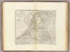
The Seven United Provinces of Holland, Groningen, Gelders, Friesland, Overyssel, Utrecht and Zealand.
1 : 2407680 Carey, Mathew
The Seven United Provinces of Holland, Groningen, Gelders, Friesland, Overyssel, Utrecht and Zealand.
1 : 2407680 Carey, Mathew
Republik der Vereinigten Niederlande Innerer Aufbau 1648
Niederlande Verwaltungsgliederung Kunz, Andreas ; Moeschl, Joachim Robert
Les Dix-Sept Provinces Des Pays-Bas
1 : 760000 Mollova mapová sbírka Sanson, Guillaume Sanson, Guillaume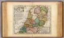
The United Provinces or Netherlands and Arx Britannica.
1 : 1450000 Moll, Herman, d. 1732
Provinces-Unies des Pays-Bas : avec leurs acquisitions dans la Flandre, le Brabant, le Limbourg et le Lyege
1 : 700000 par le Sr. Sanson, Géographe ordinaire du Roy Cordier, sculp. Paris : H. Jaillot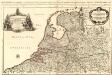
Provinces-Unies des Pays-Bas
1 : 625000 Mollova mapová sbírka Sanson, Guillaume Jaillot, Alexis Hubert

Holland.
1 : 1048000 Hughes, William
BELGICA | FOEDERATA
[Amsterdam : Joan Blaeu]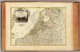
Pays Bas septentrionale.
1 : 1130000 Janvier, Jean