Maps of Sturgeon Bay
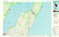
Sturgeon Bay
1 : 100000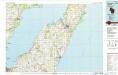
Sturgeon Bay
1 : 100000
Algoma
1 : 62500
Algoma
1 : 62500
New Franken
1 : 62500
New Franken
1 : 62500
Casco
1 : 62500
Casco
1 : 62500
Jacksonport
1 : 62500
Little Sturgeon
1 : 62500
Sturgeon Bay
1 : 62500
Oconto
1 : 62500
Oconto
1 : 62500
Green Bay East
1 : 24000
Algoma
1 : 24000
New Franken
1 : 24000
New Franken
1 : 24000
Algoma NE
1 : 24000
Forestville
1 : 24000
Namur
1 : 24000
Namur
1 : 24000
Little Tail Point
1 : 24000
Little Sturgeon SW
1 : 24000
Little Sturgeon
1 : 24000
Jacksonport SW
1 : 24000
Sturgeon Bay East
1 : 24000
Sturgeon Bay West
1 : 24000
Sturgeon Bay East
1 : 24000
Pensaukee
1 : 24000

