Maps of Rice County
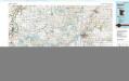
Faribault
1 : 100000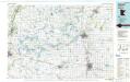
Faribault
1 : 100000
Map of Rice County, Minn.
1 : 126720 Andreas, A. T. (Alfred Theodore), 1839-1900
Map of Le Sueur County, Minn.
1 : 126720 Andreas, A. T. (Alfred Theodore), 1839-1900
Mankato East
1 : 62500
Mankato East
1 : 62500
Mankato East
1 : 62500
Mankato East
1 : 62500
Map of Steele County.
1 : 100000 Andreas, A. T. (Alfred Theodore), 1839-1900
Meriden
1 : 24000
Waseca
1 : 24000
Saco
1 : 24000
Beauford
1 : 24000
St Clair
1 : 24000
Janesville
1 : 24000
Waseca
1 : 24000
Waseca
1 : 24000
Saco
1 : 24000
Owatonna
1 : 24000
Owatonna SE
1 : 24000
Mankato East
1 : 24000
Mankato East
1 : 24000
Elysian
1 : 24000
Elysian
1 : 24000
Waterville
1 : 24000
Waterville
1 : 24000
Morristown
1 : 24000
Medford West
1 : 24000
Medford East
1 : 24000
Moland
1 : 24000

