Maps of Potter County

Conrad
1 : 62500
Conrad
1 : 62500
Conrad
1 : 62500
Conrad
1 : 62500
Conrad
1 : 24000
Short Run
1 : 24000
Conrad
1 : 24000
Short Run
1 : 24000
Conrad
1 : 24000
Short Run
1 : 24000
Conrad
1 : 24000
Conrad
1 : 24000
Short Run
1 : 24000
Conrad
1 : 24000
Conrad
1 : 24000
Cherry Springs
1 : 24000
Ayers Hill
1 : 24000
Ayers Hill
1 : 24000
Cherry Springs
1 : 24000
Cherry Springs
1 : 24000
Ayers Hill
1 : 24000
Ayers Hill
1 : 24000
Ayers Hill
1 : 24000
Cherry Springs
1 : 24000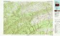
Wellsboro
1 : 100000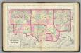
Warren, McKean, Potter, Forest, Elk, Cameron counties.
1 : 300000 Gray, Ormando Willis; Walling, H. F.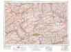
Williamsport
1 : 250000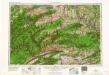
Williamsport
1 : 250000
Williamsport
1 : 250000
Williamsport
1 : 250000
Williamsport
1 : 250000
Williamsport
1 : 250000
Williamsport
1 : 250000
Williamsport
1 : 250000

