Mappa catalogata
Fort Morgan


Titolo completo:Fort Morgan
Anno di illustrazione:1942
Dimensione fisica:20 x 30 cm
Scala della mappa:1:62 500
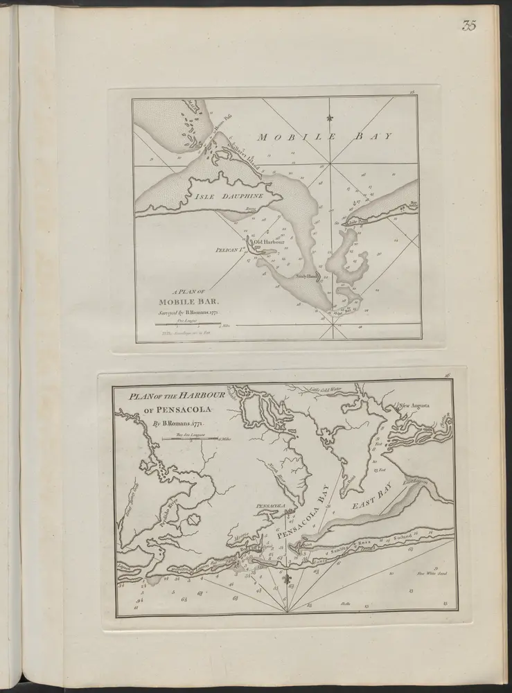
A plan of Mobile Bar
1802
Thomas Jefferys (-1771)
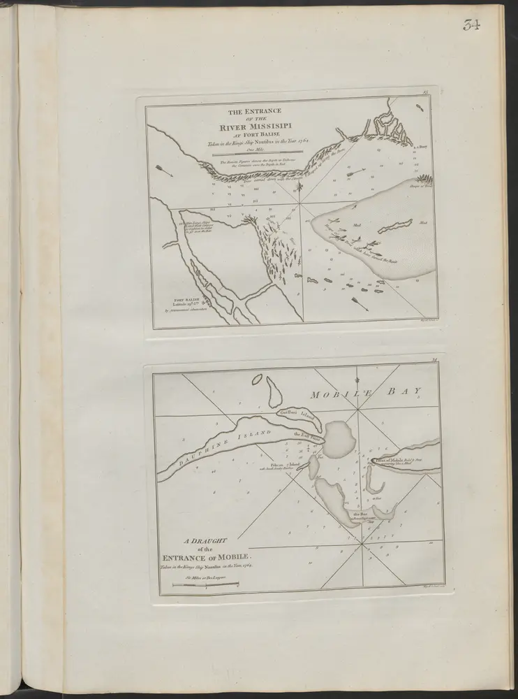
A Draught of the entrance of Mobile
1802
Thomas Jefferys (-1771)
Heron Bay
1958
1:24k
Heron Bay
1958
1:24k
Heron Bay
1958
1:24k
Fort Morgan NW
1958
1:24k
Fort Morgan NW
1958
1:24k
Isle Aux Herbes
1958
1:24k
Isle Aux Herbes
1958
1:24k
Petit Bois Pass
1958
1:24k
Petit Bois Pass
1958
1:24k